
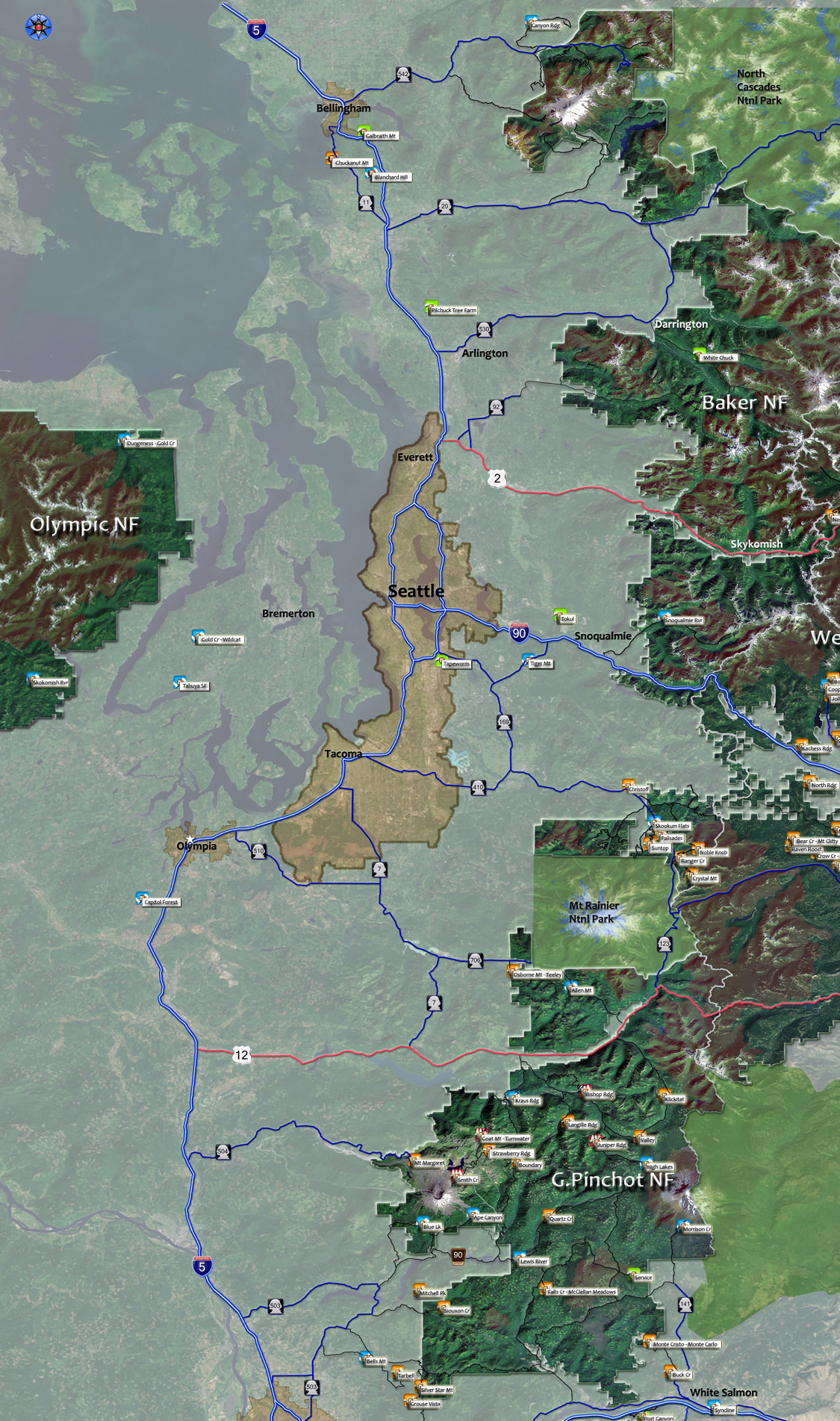
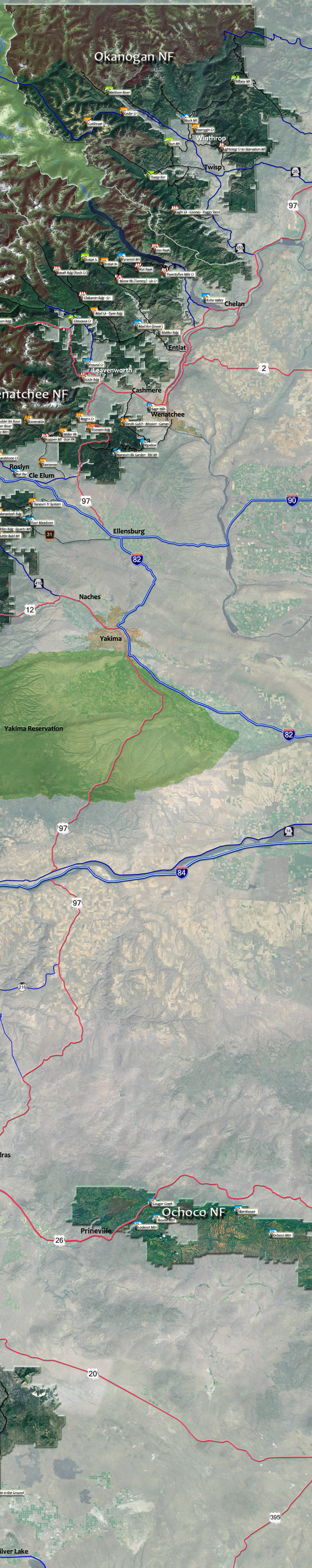
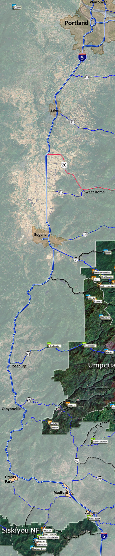
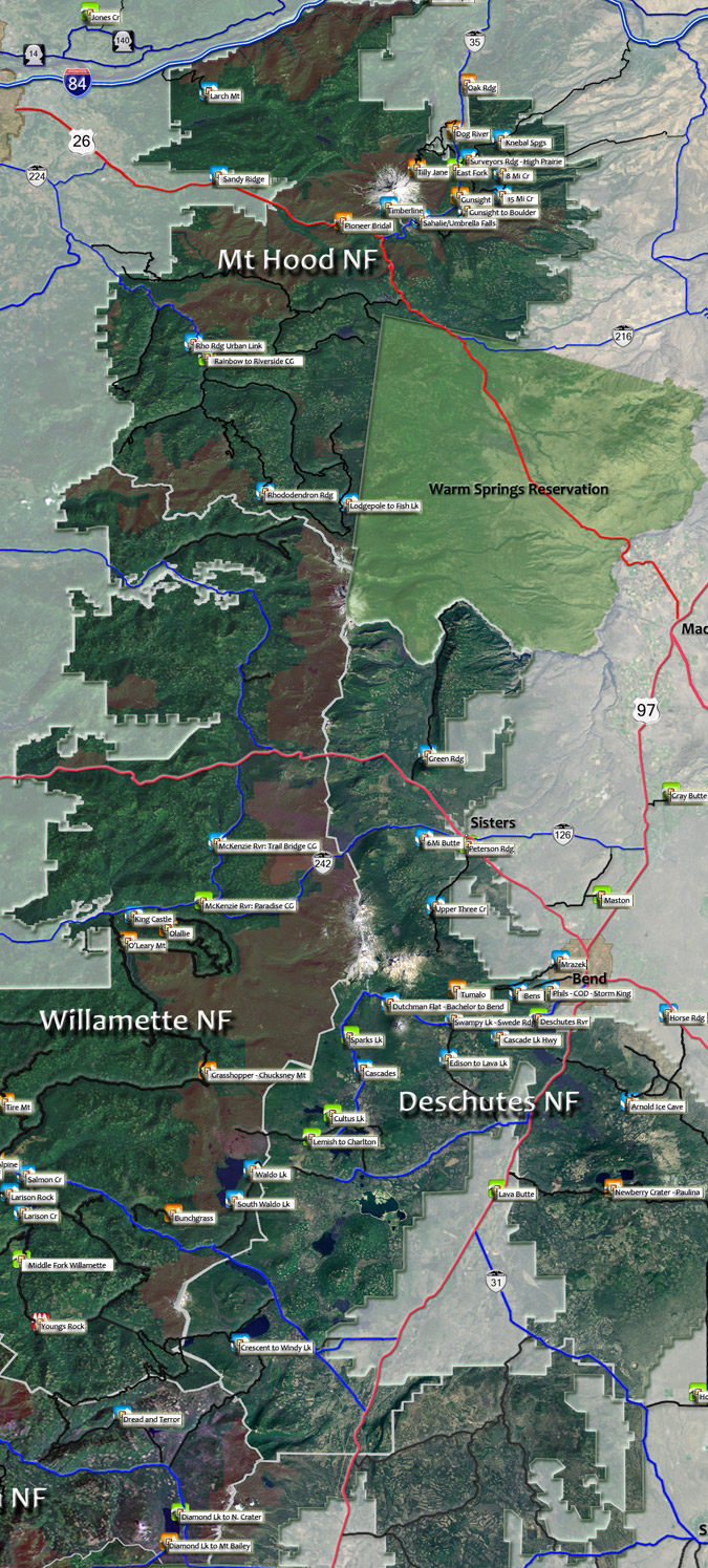
Cascade Range Trails
The interactive map below contains all of the listed trails, although they will show up on local maps prior to showing up on this map.
Select a trail, or select a ranger district and navigate from there.
The trail names are kind of...tiny, so mouse over the trail name and it will appear on the screen.
When exploring new areas, be sure to locate the ranger station nearest the trail, and call or stop by to talk to them about trail conditions, camping and other information. See the Pacific NW NF Site for active closures.
Interactive map: Select a National Forest area or a trail. Use the TrailFinder to search by trail name or some other attribute.
Draggable map: Map window adjusts to screen size and will respond to touch control. Use scrollbar for mouse control.
No Map? Browser settings and some browser extensions can prevent the maps from appearing. Please see Site Tech

Trail Rankings
Ranking consistently applied to all of the listed trails.
- Overall Rating: Ride quality and challenge
- Aerobic: Ascent challenge
- Technical Difficulty: Terrain challenge
- Steepness: Average incline
- Flow: Uninterrupted riding
- Elevation Change: Total elevation gain
- Ride Difficulty: Terrain challenge
Ascent
Elevation and Incline
Easy

Moderate

Intense

Mtn Goat

Google Search
