Boundary Tr1: Norway Pass to Elk Pass

Overall: 7
Aerobic: 6
Technical: 6
Steepness: 6
Flow: 6
Singletrack: 100%
Boundary Tr1 defines the upper boundary of the Saint Helens National Volcanic Monument and extends from Coldwater Lake to Council Bluff (near Mount Adams).
Type
OAB
Length
Avg: 19mi
Ascent
Intense
Elevation Change
TH:3800'
Avg Ascent:4400'
Ascent Incline
10%
Duration
Avg: 4hr
Weather
Forecast
NOAA
popup
USFS
Trail
Review

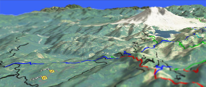
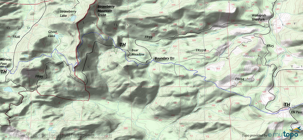
The terrain is steep and somewhat exposed between FR25 Norway Pass and FR26 Elk Pass, and Boundary Tr1 crosses Strawberry Ridge Tr220 along the way, winding in and out of the 1980 blast zone.
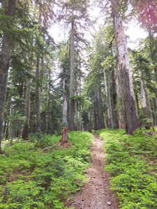
The section between Bear Meadow and Elk Pass is open to motorcycles, with the steep sections rutted out and generally loose pumice gravel conditions over most of that section, which would otherwise be classic Northwest singletrack.
A small bridge is out on the section which parallels FR99, near Bear Meadow Viewpoint. That section appears unused and slowly returning to nature, so consider a road ascent to the viewpoint.
The eastern approach is from Council Bluffs, at the eastern end of Boundary Tr1, covered on the High Lakes Tr116 page.
The western section of Boundary Tr1 is covered on the Mt Margaret Tr230 page.
Boundary Tr1 crosses FR29, 2.5mi to Dark Meadows, to the junction with Tr5, then 5.5mi to Summit Prairie and 7.9mi to Table Mt and 1.5mi to Council Lake.
Directions:See Map. Go to Norway Pass on FR26, or Elk Pass on FR25. View Larger Map. No Map?.


OAB Directions
ready to climb?
- TH: Easy 1.5mi ride past Bismark Mountain, to Ghost Lake, then ascend a 10% grade for 2mi prior to descending to the Bear Meadows Viewpoint.
- 4.3mi: Pass the Strawberry Mt Tr220 intersection, then continue descending for 1.5mi.
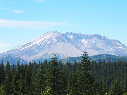
- 5.8mi: At the Bear Meadow viewpoint, descend FR99 about a mile to the next Boundary TH. The last 4mi consists of undulating ridgeline terrain, with little elevation change.
Trail Index
This Ride
Boundary Trail 1
Area
Coldwater Peak Trail 1G, Coldwater Trail 230, Goat Creek Trail 205, Goat Mountain Trail 217, Green River Trail 213, Kraus Ridge Trail 275, Langille Ridge Trail 259, McCoy Peak Trail 259A, Rough Trail 283, Smith Creek Trail 225, Strawberry Mtn Trail 220, Tumwater Trail 218, Vanson Peak Trail 217A, Vanson Ridge Trail 213A, Yellowjacket Trail 1A
Hiking
Bear Meadow Viewpoint Trail, Ghost Lake Trail 1H
Trail Rankings
Ranking consistently applied to all of the listed trails.
- Overall Rating: Ride quality and challenge
- Aerobic: Ascent challenge
- Technical Difficulty: Terrain challenge
- Steepness: Average incline
- Flow: Uninterrupted riding
- Elevation Change: Total elevation gain
- Ride Difficulty: Terrain challenge


