Da-Ku-Be-Te-De Tr940 - Payette Tr970
Twitter Search
#applegatelake

Overall: 5
Aerobic: 4
Technical: 3
Steepness: 1
Flow: 8
Singletrack: 98%
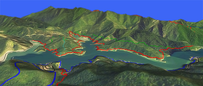
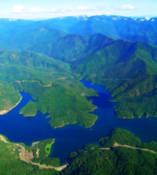
The Applegate Lake Oregon Da-Ku-Be-Te-De Tr940 to Payette Tr970 is a popular shoreline ride which is not as flat as the water it surrounds...just enough terrain to keep it interesting.
Type
Loop
Length
Avg: 16.5mi
Ascent
Easy
Elevation Change
TH:2050'
Avg Ascent:4600'
Ascent Incline
1%
Duration
Avg: 2.5hr
Weather
Forecast
NOAA
popup
USFS

The elevation profile looks scary/wrong until the scale is considered. The trail traverses just above the high water mark of Applegate reservoir, passing through mixed conifer, vine maple, black oak, and Madrone forest.
The most significant ascent is about 450' at a 1% incline, although the entire trail is a typical shoreline ride, with repeated small climbs.
The brief 50' climbs add up to a 4600' ascent but most of it does not disrupt the flow of the ride.
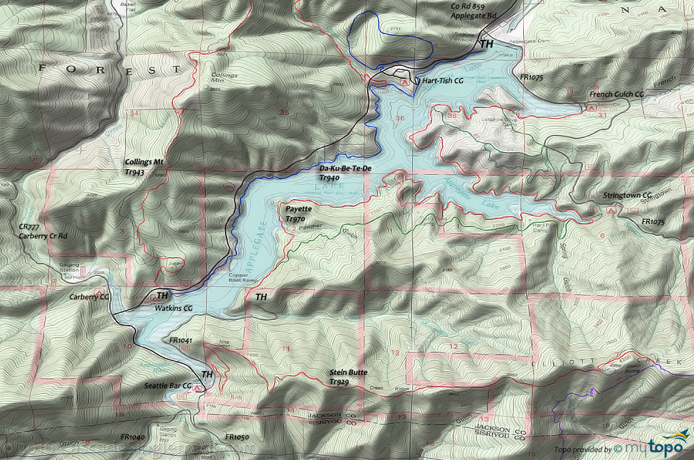
Collings Mtn Tr943 and Stein Butte Tr929 both have lakeside trailheads and Little Grayback Tr921 is not far away, making Applegate Lake a great mountainbike camping destination.
Directions: See Map. View Larger Map. No Map?.

Loop Directions
turn uphill if underwater
- TH: From the Swayne Viewpoint TH, ride Da-Ku-Be-Te-De Tr940 along the shoreline, crossing Grouse Creek at 1mi and joining County Road 859 at 4.2mi to cross the Carberry Creek inlet.
- 4.6mi: After crossing the bridge, go left onto County Road 777, crossing the Elliot Creek inlet bridge. Go left at the intersection with FR1041, near the Seattle Bar campground at the south end of Applegate Lake. Pass the Stein Butte Tr929 TH at 5.8mi.
- 6.7mi: The last .5mi of the FR1041 section climbs 450' up the Manzanita Creek drainage
- 7.4mi: Go left onto Payette Tr970 at the sharp right hand FR1041 curve. Pass a trail intersection near Panther Gulch (7.9mi), one of several lakeside trail options.
- 10mi: After several creek crossings, pass the Tipsu Tyee campground, followed by the Harr Point campground at 11.3mi.
- 11.6mi: Trail merges with FR100 for .4mi, near the Stringtown campground, then resumes the shoreline path with several intersections leading to interconnected hillside trails.
- 15mi: Pass the Latgawa Cove campground, then go left at the FR1075 intersection, near the French Gulch campground, crossing the Applegate Dam to return to the TH.
Trail Index
This Ride
Da-Ku-Be-Te-De Trail 940, Payette Trail 970
Area
Hiking
Calsh Trail 971, Harr Ridge Trail 947, Osprey Trail 973, Prospectors Loop Trail 974, Sinns Bar Trail 972
Campgrounds
Carberry Campground, Flumet Flat Campground, French Gulch Campground, Harr Point Campground, Hart-Tish Campground, Jackson Campground, Latgawa Cove Campground, Seattle Bar Campground, Squaw Lakes Campground, Tipsu Tyee Campground, Watkins Campground
Trail Rankings
Ranking consistently applied to all of the listed trails.
- Overall Rating: Ride quality and challenge
- Aerobic: Ascent challenge
- Technical Difficulty: Terrain challenge
- Steepness: Average incline
- Flow: Uninterrupted riding
- Elevation Change: Total elevation gain
- Ride Difficulty: Terrain challenge


