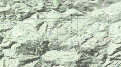
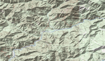
Gales Creek, Storey Burn, Browns Camp Trails
Twitter Search
#galescreektrail
Overall: 4
Aerobic: 5
Technical: 4
Steepness: 5
Flow: 6
Singletrack: 100%
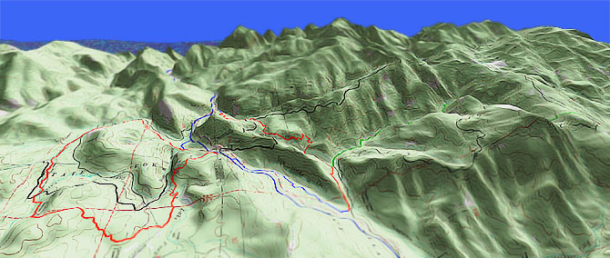
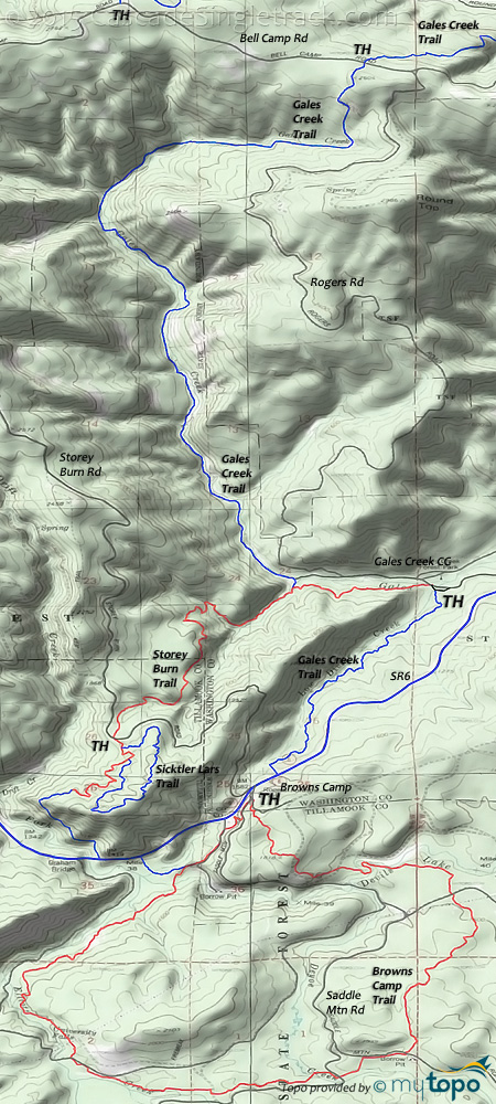
The Oregon Tillamook State Forest Storey Burn trail starts at the Gales Creek campground and ascends to Storey Burn road, a tight hillside climb over moderate terrain.
Type
OAB
Length
Avg: 8mi
Ascent
Moderate
Elevation Change
TH:950'
Avg Ascent:1650'
Ascent Incline
7%
Duration
Avg: 2hr
Weather
Forecast
NOAA
popup
TSF
Trail
Review
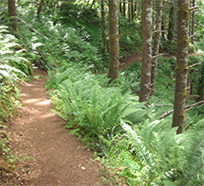
Not a destination trail, but the climb is pleasant and the winding, hillside descent is a hoot.
Although the trail dries out quickly, expect very wet conditions in the early Spring and after a heavy rain.
The northern Gales Creek trail section (which follows Gales Creek to Bell Mountain Rd) was washed out several years ago, and is now reopened for biking and regains it's ranking as the best singletrack in the area.
The washed-out section has been rerouted uphill and some other damaged sections have been reworked to help make the trail more sustainable under constant use.
The 7mi (2000' ascent) Storey Burn to Gales Creek loop option consists of riding to SR6, then riding 1mi (passing the Browns Camp entrance) to the singletrack trail which follows Low Divide Creek to the Gales Creek campground.
Gales Creek is often combined with the Browns Camp loop into a figure eight ride, but in that case consider riding the Browns Camp section CCW.
Browns Camp is a 7.7mi (1700' ascent) loop on some non-Orv singletrack, usually ridden CW but which could be ridden CCW as well.
This ORV area gets a lot of summertime use, but the singletrack is usually far enough away from the doubletrack to prevent user conflicts.
The Elliot Creek trail section, from University Falls back to the Browns Camp trailhead, is not very interesting and ends in a steep gravel road climb, making a University Falls OAB or a return on Saddle Mountain road (or the other gravel road drawn on the topo) suggested alternatives.
Ravens Ridge DH
Ravens Ridge is a popular local downhill (one-way) route.
Directions: See Map. View Larger Map. No Map?.
OAB Directions
slopeside ride
- TH: From the trailhead parking area, located just prior to the campground bridge, ascend Gales Creek trail alongside Gales Creek.
- .7mi: Cross the footbridge, then ride around the knoll to the second footbridge and the Storey Burn trail intersection. Go left on Storey Burn trail and ascend the winding, hillside trail to Storey Burn Road, crossing a small Gales Creek tributary at 1.3mi.
- 2.9mi: Go on the singletrack from the Storey Burn Road parking area. This section of the trail is part of a unidirectional loop, so either complete the loop or (if no one is around) just climb 1mi then turn back. The loop is not drawn on the topo map.
Wilson River Trail
The Wilson River trail traverses steep, rugged canyons alongside SR6.
The 500' elevation change from the upper to lower TH includes several significant hillside traverses, as the trail crosses the headwaters of Lester and Ryan creeks.
Elk Mountain and (especially) Kings Mountain trail offer strong hikers the opportunity to explore the rugged terrain of a basalt ridgeline, with scenic valley views.
Mosquitoes are ferocious in this area until August. Feel free to try the natural repellents, and avoid drinking carbonated drinks prior to riding, but Deet 100 may be the only protection from 'the swarm'. Expect some trailside poison oak and prepare as needed. Try using Tecnu before the ride.
Trail Index
This Ride
Gales Creek Trail, Storey Burn Trail
Area
Browns Camp University Falls Trail, Ravens Ridge DH Trail, Wilson River Trail
Hiking
Elk Mountain Trail, Kings Mountain Trail
Equestrian
Step Creek Trail, Triple C Trail
Campgrounds
Elk Creek Campground, Gales Creek Campground, Jones Creek Campground, Keenig Creek Campground, Reehers Horse Camp
Trail Rankings
Ranking consistently applied to all of the listed trails.
- Overall Rating: Ride quality and challenge
- Aerobic: Ascent challenge
- Technical Difficulty: Terrain challenge
- Steepness: Average incline
- Flow: Uninterrupted riding
- Elevation Change: Total elevation gain
- Ride Difficulty: Terrain challenge


