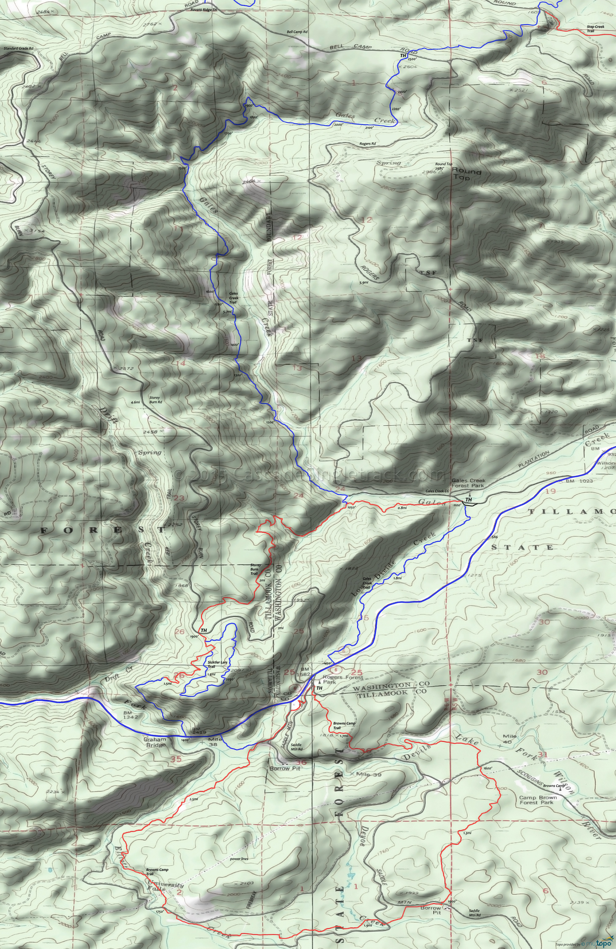
Gales Creek and Browns Camp Trails Mountain Biking and Hiking Topo Map
Map Includes: Browns Camp Trail, Gales Creek Trail, Storey Burn Trail and Sicktler Lars Trail
The 7mi (2000' ascent) Storey Burn to Gales Creek loop option consists of riding to SR6, then riding 1mi (passing the Browns Camp entrance) to the singletrack trail which follows Low Divide Creek to the Gales Creek campground.
TH: From the trailhead parking area, located just prior to the campground bridge, ascend Gales Creek trail alongside Gales Creek.
.7mi: Cross the footbridge, then ride around the knoll to the second footbridge and the Storey Burn trail intersection. Go left on Storey Burn trail and ascend the winding, hillside trail to Storey Burn Road, crossing a small Gales Creek tributary at 1.3mi.
2.9mi: Go on the singletrack from the Storey Burn Road parking area. This section of the trail is part of a unidirectional loop, so either complete the loop or (if no one is around) just climb 1mi then turn back. The loop is not drawn on the topo map.
Gales Creek is often combined with the Browns Camp loop into a figure eight ride, but in that case consider riding the Browns Camp section CCW.
Browns Camp is a 7.7mi (1700' ascent) loop on some non-Orv singletrack, usually ridden CW but which could be ridden CCW as well.
This ORV area gets a lot of summertime use, but the singletrack is usually far enough away from the doubletrack to prevent user conflicts.
Draggable map: Map window adjusts to screen size and will respond to touch control. Use scrollbar for mouse control.
No Map? Browser settings and some browser extensions can prevent the maps from appearing. Please see Site Tech


