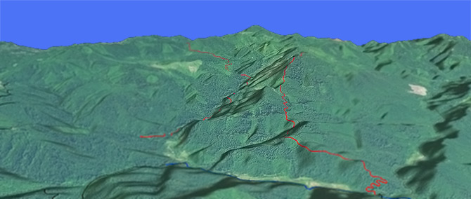
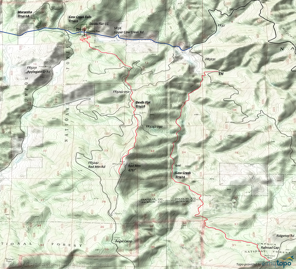
Devils Flat Tr1428

Overall: 4
Aerobic: 6
Technical: 5
Steepness: 5
Flow: 4
Singletrack: 100%
A 4mi climb from the Devils Flat CG, across several logging roads and harvested areas, with a steep final ascent to the Red Mountain summit. FR230 leads to the fire lookout.
Type
OAB
Length
Avg: 9mi
Ascent
Moderate
Elevation Change
TH:2200'
Avg Ascent:2800'
Ascent Incline
12%
Duration
Avg: 3hr
Weather
Forecast
NOAA
popup
USFS
The trail starts from the Azalea Oregon Devils Flat Guard Station Day Use Area, and was used by mule teams to deliver supplies to the lookout.
A nice hike from the CG, the 1.5mi Maranatha Tr1422A connects to Cow Creek Falls Tr1422 and parallels Cow Creek before ascending the hillside north of CR36.
Elk Skull Bluff Tr1428A ascends through a madrone and Douglas fir forest before entering a dry, rocky meadow. Views of the upper Cow Creek drainage and Red Mountain.
The three-campsite Devils Flat CG is situated under a bluff and surrounded by a forest of cedar, pine, and madrone. The Gaurd Station is located on the south side of the CG.
Cow Creek Falls Tr1422 is a short hike form the CG, with views of Cow Creek’s cascading pools and the unique geology of Cow Creek Gorge.
Devil's Flat Tr1428 could be combined with Cow Creek Trail 1424 and the connecting forest roads, with more time spent on the road than trail.
Directions: I-5 Azalea Exit #88 then go east on County Road #36 for 17mi to Devil's Flat Guard Station and Campground. View Larger Map. No Map?.

OAB Directions
tiki
- TH: Ride from the Devils Flat Guard Station Day Use Area, through 0.5mi of switchback to the first knoll at 2800', continuing the ascent to FR051 crossing.
- 1.7mi: Cross FR051 and parallel FR055 to the FR050 intersection.
- 2.2mi: Cross FR050 and traverse the hillside just below FR050 to a quarry and FR090 crossing.
- 2.9mi: Cross FR090 and begin the steep 1.5mi ascent to the summit, with a traverse near the end of the climb.
- 4.4mi: Reach FR230. Go left on the road for 0.2mi to reach the former lookout, then return.
Trail Index
This Ride
Devils Flat Trail 1428
Area
Hiking
Cow Creek Falls Trail 1422, Elk Skull Bluff Trail 1428A, Maranatha Trail 1422A
Campgrounds
Angel Camp, Devils Flat Campground
Trail Rankings
Ranking consistently applied to all of the listed trails.
- Overall Rating: Ride quality and challenge
- Aerobic: Ascent challenge
- Technical Difficulty: Terrain challenge
- Steepness: Average incline
- Flow: Uninterrupted riding
- Elevation Change: Total elevation gain
- Ride Difficulty: Terrain challenge


