Chuckanut Mountain: Larrabee State Park Trails
Twitter Search
#chuckanuts
#wmbcmtb

Overall: 6
Aerobic: 7
Technical: 7
Steepness: 7
Flow: 5
Singletrack: 100%
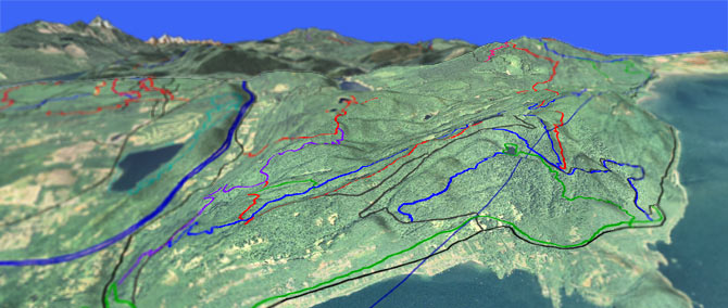
The Bellingham Washington Chuckanut Mountain offers a collection of DNR trails covering Larrabee State Park, with several challenging figure-eight loops which cover most of the terrain.
Type
Loop
Length
Avg: 12mi
Ascent
Intense
Elevation Change
TH:150'
Avg Ascent:3400'
Ascent Incline
13%
Duration
Avg: 3hr
Weather
Forecast
NOAA
popup
DNR
Those seeking something more epic could consider using Lost Lizard Lake trail as a north-south Chuckanut Mtn connector trail to the Blanchard Hill trails.

California and Cleator Roads help ease some of the climbing, as the terrain drops sharply on the sides of this dome shaped mountain.
These roads create several good shuttle opportunities as well.
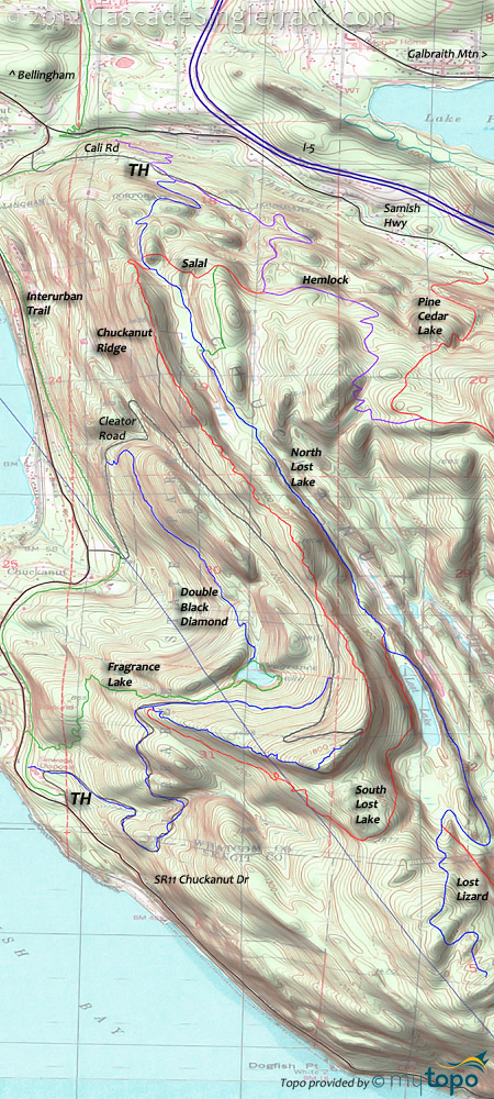
The North and South Lost Lake trails combine into a nice loop, described below, with a section of Double Black Diamond, Hemlock and Salal added to create a figure-eight loop for those seeking something more aggressive.
Interurban can also be used, to start on Cleator Rd and end up at California Road.
Double Black Diamond (don't try this on skis) is a natural figure eight loop, with Cleator Road perfectly positioned for shuttling.
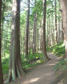
Hiking: The SR11 (Chuckanut Dr) Fragrance Lake TH is for hiking, crossing the Interurban trail before switchbacking the steep, mature, mossy Doug Fir and Cedar slope to Fragrance Lake.
Directions: Ride from Arroyo Park or California Rd, near the Interurban trail. WA Discover Pass required to park at TH. See Map. View Larger Map. No Map?.

Loop Directions
chuckanut
- TH: Ascend from Arroyo Park or California Rd, using Hemlock Tr to reach North Lost Lake Tr at .5mi.
- 1.6mi: After passing the Chuckanut Ridge/Salal Tr intersection at 1.4mi, reach the first plateau, then ride the ridgeline to South Lost Lake Tr.
- 3.7mi: Go right onto South Lost Lake Tr, ascending to the peak at 4.7mi then descending sharply to Double Black Diamond Tr at 5.9mi.
- 5.9mi: Go right then right again, to steeply ascend Double Black Diamond Tr to Cleator Rd.
- 7mi: At the sharp curve, go right onto Chuckanut Ridge Tr and descend to the Lost Lake Tr intersection.
- 9.8mi: Cross Lost Lake Tr and ride Salal Tr to Hemlock Tr.
- 10.4mi: Go left onto Hemlock Tr and ride back to Arroyo Park.
Trail Index
This Ride
Chuckanut Ridge Trail, Double Black Diamond Trail, Fragrance Lake Trail, Hemlock Trail, Interurban Trail, Madrone Crest Trail, North Lost Lake Trail, Pine Cedar Lakes Trail, Salal Trail
Blanchard Trails
Galbraith Mountain
911 Trail, Bob's Trail, Brick Stick Trail, Cedar Dust Trail, Connector Trail, Dans Trail, Electric Avenue Trail, Evolution Trail, Flying Squirrel Trail, Jaws Trail, Kaiser Trail, Kung Fu Trail, Luge Trail, Meth Lab Trail, Mullet Trail, Naughty Nellie Trail, Scorpion Trail, Not Shawn's Trail, SST Trail, Sht Trail, Three Little Pigs Trail, Timing Trail, Tower Trail, Wonderland Trail, Whoopsie Woodle Trail
Trail Rankings
Ranking consistently applied to all of the listed trails.
- Overall Rating: Ride quality and challenge
- Aerobic: Ascent challenge
- Technical Difficulty: Terrain challenge
- Steepness: Average incline
- Flow: Uninterrupted riding
- Elevation Change: Total elevation gain
- Ride Difficulty: Terrain challenge


