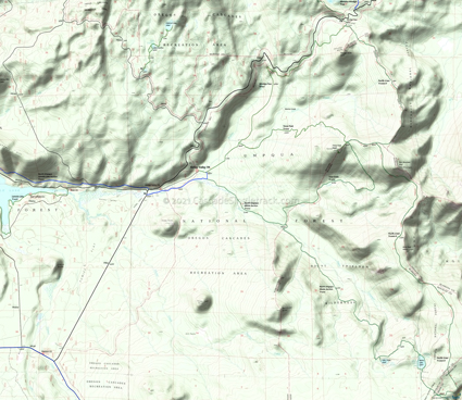
North Umpqua River Trail: Dread and Terror Tr1414
Twitter Search
#northumpquatrail
Overall: 10
Aerobic: 7
Technical: 7
Steepness: 7
Flow: 7
Singletrack: 100%
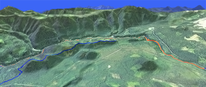
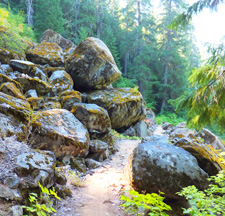
The Clearwater Oregon Dread and Terror section of North Umpqua River Tr1414 offers enough cliff exposure, rough terrain and technical singletrack to challenge intermediate riders and keep advanced riders interested as well.
Type
OAB
Length
Avg:31.5 mi
Ascent
Moderate
Elevation Change
TH:2400'
Avg Ascent:6300'
Ascent Incline
7%
Duration
Avg: 6hr
Weather
Forecast
NOAA
popup
USFS
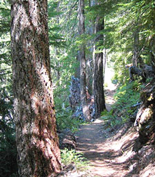
The name was coined by some apparently botanophobic forest service rangers, who named the nearby ridgeline 'Dread and Terror' due to the presence of white thorn bush in the area. The bush is not actually found on Dread and Terror Tr1461..go figure.
Aside from shuttling from Lemolo Lake, the OAB ride typically starts from the Toketee Lake campground, just north of Clearwater on FR34. A full OAB ride requires strong climbing abilities but intermediate riders should be able to manage the lower half.
The ride can be shortened six uneventful miles by starting at the FR3401 Umpqua Hot Springs TH. The trail section on the north side of the river up to FR3401 is not well suited for biking, making the FR3401 Umpqua Hot Springs TH the better starting point.
To extend the ride, the challenging 6.5mi Deer Leap segment can be added, starting from the FR4775 TH.
Shuttle riders will often start at Lemolo Lake White Mule TH, and ride the Dread and Terror, Deer Leap and Jesse Wright segments (29mi), ending at the Marsters bridge.
The actual Dread and Terror trail (#1461) is a short ridgeline ride which does not link up well with North Umpqua Tr1414, and is best ridden as a shuttle or OAB from FR701 to the first switchback.
Because the Dread and Terror section of North Umpqua Tr1414 passes through a narrow valley, expect wet conditions in the Spring and for several days after it has rained. The river valley Thorn Prairie section remains wet year round.
There is an access road for the nearby Lemolo Canal, but don't expect any traffic and there are few access points to that road from the trail, limiting bailout opportunities. Over most of the ride, accessing the canal road would be more life threatening than simply walking out on the trail, so extreme caution is advised.
Be sure to keep a full tank of gas, and get other provisions before the ride, as the Lemolo Lake and Clearwater shops are not 24/7 and the nearest gas station is in Glide.
Ask the Diamond Lake Ranger Station about trail closures before traveling to the area.
Directions: See Map. NW Forest Pass required right at the TH. View Larger Map. No Map?.

OAB Directions
not dreadful
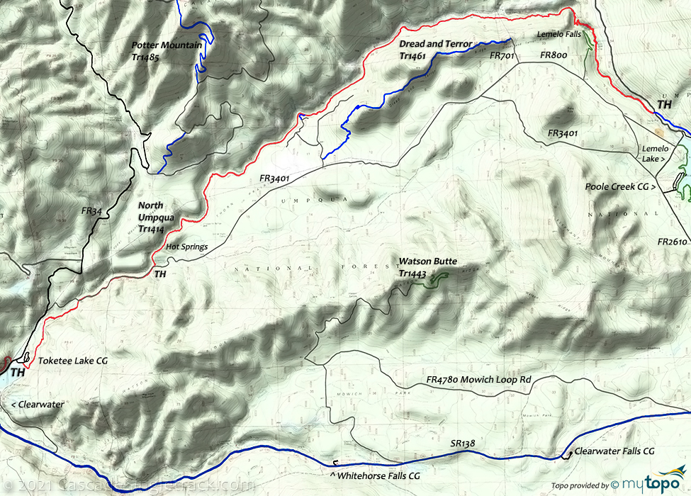
Dread and Terror Area Topo Map
- TH: From the south end of the Toketee Lake campground, cross the bridge then go left on North Umpqua Tr1414. The trail splits at .5mi, then merges with FR100 at 1.2mi. Go right onto FR100 and ride to FR3401.
- 1.7mi: Go left on FR3401, cross the bridge, then go right onto the trail. From FR3401, Tr1414 splits, then eventually merges into a single trail. Cross Deer Cr. at 2.8mi.
- 3.4mi: Pass Tr1444 on the left then briefly merge with FR3401 at Umpqua Hot Springs trailhead parking area. Pass Surprise Falls and cross Loafer Cr. at 4.1mi.
- 9.1mi: Brief intense climb near Bergman Bluff. Pass the Lemolo Power Plant #1 at 12.1mi.
- 13.4mi: As the ascent intensifies, cross North Umpqua and begin the 1mi steep ascent/hike-a-bike to Lemolo Falls. Pass FR673 on the left at 14.7mi.
- 15.7mi: Turnaround at the White Mule FR2610 trailhead, or continue on to Lemolo Lake prior to returning to the TH.
Mount Thielsen Wilderness Hiking
The first mile of trail from Kelsay Valley Trailhead follows the river as it meanders through a broad, grassy flat.
At 2.7 miles, near the Tolo Creek Tr1466 junction, the trail enters Mount Thielsen Wilderness. Ascend toward Lake Lucile and Maidu Lake, over 7700 year old pumice deposits from the eruption of Mt. Mazama, which created Crater Lake.
From Maidu Lake, the Digit Point TH is 4.75 miles to the east at Miller Lake in Fremont-Winema National Forest.
The Pacific Crest National Scenic Tr2000-D junction with North Umpqua Trail is about 1 mile southeast of Maidu Lake.
Both Lake Lucile and Maidu Lake are stocked with fingerling trout. Lake Lucile covers 9 acres and averages a depth of 15 feet. Maidu Lake, the source of the North Umpqua River, averages a depth of 12 feet and covers 20 acres.
Tolo Creek Tr1466 ascends through stands of lodgepole pine and true fir. Several intermittent streams are crossed. The trees become more widely spaced, allowing occasional views of Lemolo Lake, Mt. Bailey and Tenas Peak.
Mosquitoes are ferocious in this area until August. Feel free to try the natural repellents, and avoid drinking carbonated drinks prior to riding, but Deet 100 may be the only protection from 'the swarm'. Expect some trailside poison oak and prepare as needed. Try using Tecnu before the ride.
Trail Index
This Ride
North Umpqua Trail 1414 Dread and Terror Segment
Area
Cougar Creek Trail 1507, Dread and Terror Trail 1461, Mayflower Loop Trail 1559, McDonald Trail 1515, Potter Mountain Trail 1485, Riverview Trail 1530, North Umpqua Trail 1414 Marsters to Toketee Segment, North Umpqua Trail 1414 Panther to Marsters Segment, North Umpqua Trail 1414 Swiftwater to Steamboat Segment
Hiking
Calamut Lake Trail 1494, Lemolo Falls Trail 1468, Maidu Lake Trail 1414, Pacific Crest Trail 2000-D, Tenas Peak Trail 1445, Tolo Creek Trail 1466, Watson Butte Trail 1443, Windigo Pass Trail 1412
Campgrounds
Bunker Hill Campground, Clearwater Falls Campground, East Lemelo Campground, Inlet Campground, Kelsay Valley Campground, Lemelo Two Campground, Poole Creek Campground, Thielsen Campground, Toketee Lake Campground, Whitehorse Falls Campground
Trail Rankings
Ranking consistently applied to all of the listed trails.
- Overall Rating: Ride quality and challenge
- Aerobic: Ascent challenge
- Technical Difficulty: Terrain challenge
- Steepness: Average incline
- Flow: Uninterrupted riding
- Elevation Change: Total elevation gain
- Ride Difficulty: Terrain challenge


