
Bens, Kents, MTB, Sector 16 and Skyliners Trails
Twitter Search
#philstrail
#bendtrails

Overall: 10
Aerobic: 6
Technical: 6
Steepness: 5
Flow: 10
Singletrack: 100%
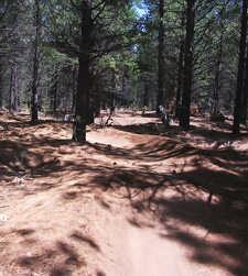
The Bend Oregon Bens Tr50 is the northern trail in the Deschutes National Forest Skyliners Drive trail system, with Kents Tr43, MTB Tr51 and Sector 16 Tr27 as connectors to surrounding trails.
Type
Loop
Length
Avg: 16mi
Ascent
Moderate
Elevation Change
TH:3900'
Avg Ascent:1300'
Ascent Incline
6%
Duration
Avg: 3hr
Weather
Forecast
NOAA
popup
USFS

Nowhere else in the Cascade Range is there such an extensive system of interconnected trails. Taneum is the only other trail system which comes close, covering much more challenging terrain.
With a total elevation change across the system of about 1000', the Skyliners Drive trail system area is fast and fun. No pain, all gain.
Bens Tr50 and Kents Tr43 share the Phils Tr42 FR4606 TH, with Storm King Tr48 as a north-south connector to COD Tr71 and Sector 16 Tr27 connecting to the Tumalo Tr25 trail system.
The trail stats are based on a Kents Tr43 to Bens-Whoops Tr50 CW Loop, and is typical of most of the loops in this system.
Note: Bens Whoops Tr50 is only be ridden downhill. A doubletrack section is used for the uphill return.
Directions: Go West on Skyliners Rd. 2.5mi from town, turn left onto FR4606 or continue to any of the other Bens trailheads along Skyliners Rd. View Larger Map. No Map?.

Loop Directions
Kents - Whoops

- TH: Start this 16mi, 1300' ascent ride on Phils Tr42, crossing a doubletrack at .8mi and passing the KGB Tr72 'flaming chicken (swan? vulture?)' at 1.9mi, going straight through the 5-way #7 intersection. The incline increases some as the trail winds up a drainage to FR4615 Big Burn Rd, running parallel to Voodoo Tr46 over most of the ascent.
- 3.7mi: Cross FR4615 Big Burn Rd then pass the Kents Tr43 #18 intersection on the right at 4.5mi, bearing left at the fork intersection. Pass through the Voodoo Tr46 #19 intersection at 4.8mi, then cross a doubletrack at 4.9mi and FR300 at 5.9mi. Dogleg to the left on FR300 then rejoin Phils Tr42 on the right.
- 7.4mi: Pass the 'helipad' rock garden and go right at the Storm King Tr48 #28 intersection at 7.9mi.
- 8mi: After a fast descent, go right at the Bens Whoops Tr50 #29 intersection (near the sign), ready for some big bumps and banked curves. The trail directly ahead is for ascending back to the start of the Whoops section.
- 10mi: Just after crossing FR300, pass the Whoops parking area. Cross doubletrack two times before reaching the Voodoo Tr46 #17 intersection at 11.2mi. Go right onto Voodoo Tr46, then go left onto Kents Tr43 at 11.9mi at #19 intersection. Ride back to the TH.


Sector 16: Loop Directions
- TH: Start this 17mi (2300' ascent) ride at the FR300 Whoops TH, using the uphill section of Bens Whoops Tr50 to ascend to the #29 intersection.
- 2mi: At the #29 intersection, go west on Bens Tr50 and ascending for 2.3mi over a 6% grade to Sector 16 Tr27.
- 4.3mi: Sector 16 Tr27 descends briefly then moderately ascends to the Swede Ridge Tr52 intersection with FR100.
- 7.2mi: At the intersection with Swede Ridge Tr52, bear to the right onto FR100 (towards the Swede Ridge shelter).
- 9.1mi: Go right onto the second doubletrack on the right, then go then right onto Tumalo Ridge Tr25.2. Ride to the edge of the ridge, then descend the steep ridgeside.
- 11.8mi: At the Tumalo TH, continue on Skyliners Tr28, circumnavigating the ridgeline over moderate terrain.
- 15.1mi: Go left at the Bens Whoops Tr50 #29 intersection and ride the wild trail back to the TH.

Trail Index
This Ride
Bens Trail 50, Phils Trail 42, Kents Trail 43, MTB Trail 51, Sector 16 Trail 27, Skyliners Trail 28, Storm King Trail 48
Area
COD Trail 71, Deschutes River Trail 2.3, Elfin Magic Trail 45, Farewell Trail 26, Flagline Trail 41, Flagline Access Trail 40.1, Flagline Tie Trail 41.1, Funner, Grand Slam Trail 44, KGB Trail 72, Mrazek Trail 32, North Fork Trail 24.2, South Fork Trail 25, Swampy Lake Trail 23, Swampy Loop Trail 23.2, Swampy-Dutchman Trail 40, Swede Ridge Trail 52, Tiddlywinks, Tumalo Creek Trail 25.1, Tumalo Ridge Trail 25.2, Voodoo Trail 46
Trail Rankings
Ranking consistently applied to all of the listed trails.
- Overall Rating: Ride quality and challenge
- Aerobic: Ascent challenge
- Technical Difficulty: Terrain challenge
- Steepness: Average incline
- Flow: Uninterrupted riding
- Elevation Change: Total elevation gain
- Ride Difficulty: Terrain challenge
