North Umpqua River Trail: Marsters to Toketee Tr1414
Twitter Search
#northumpquatrail

Overall: 7
Aerobic: 5
Technical: 5
Steepness: 6
Flow: 7
Singletrack: 95%
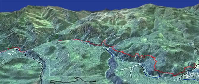
The Clearwater Oregon North Umpqua Tr1414: Marsters to Toketee Lake ride includes the Jessie Wright and Deer Leap sections. As rugged and challenging as the Dread and Terror ride, the trail tends to be less wet and technical.
Type
Loop
Length
Avg: 26.5mi
Ascent
Moderate
Elevation Change
TH:1550'
Avg Ascent:8000'
Ascent Incline
7%
Duration
Avg: 5hr
Weather
Forecast
NOAA
popup
USFS
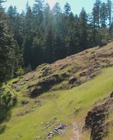
The Jessie Wright section is a typical riverside ride, around Eagle Rock and the Soda Springs reservoir on abandoned doubletrack.
The Deer Leap section is more challenging, traversing the hillside around Deer Leap Rock, to Toketee Lake, and starting from the Soda Creek Reservoir TH avoids the Jessie Wright doubletrack section of the ride.
Toketee Falls is worth a side trip, an 80' two-tiered waterfall which travels through a wall of columnar basalt.

The ride can be extended by starting from the Horseshoe Bend campground, near FR4750, the FR4714 Apple Creek campground or even from Steamboat. A more advanced option is to start from the Soda Creek Reservoir, then ride the Deer Leap and Dread and Terror sections. Advanced riders may not find the other sections of the Umpqua River Trail interesting or challenging.
Shuttle riders will often start at Lemolo Lake Poole Creek campground, or the White Mule TH, and ride the Dread and Terror, Deer Leap and Jesse Wright segments (29mi), ending at the Marsters bridge.
Boulder Creek Wilderness Hiking
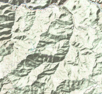
Shown on the Area map, Boulder Creek Tr1552 ascends beside the creek and beneath a closed canopy of Ponderosa, Douglas-fir and hemlock, to the Calapooya Divide ridgeline and FR3810.
Bradley Tr1491 parallels the river trail, from FR4775 to Boulder Creek Tr1552, a short day hike loop opportunity. Soda Springs Tr1493 offers a connector to the Soda Spring Powerplant road.
Be sure to keep a full tank of gas, and get other provisions before the ride, as the Lemolo Lake and Clearwater shops are not 24/7. Ask the Diamond Lake Ranger Station about trail closures before traveling to the area. Expect some trailside poison oak and prepare as needed. Try using Tecnu before the ride.
Directions: See Map. Park at the Marsters bridge or at the Eagle Rock CG. NW Forest Pass required right at the TH. View Larger Map. No Map?.

OAB Directions
penstock doubletrack
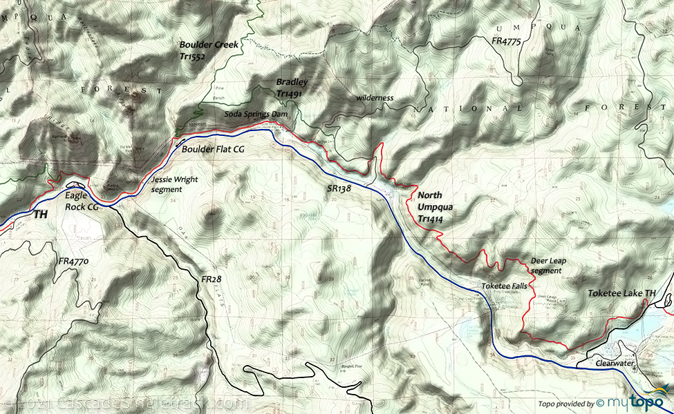
- TH: From the Marsters bridge, ascend to the Dark Canyon creek crossing, then pass Illahee Flat Tr1532 on the left at .8mi. Descend to the riverside, then ride around the volcanic Eagle Rock formation, crossing Eagle Creek at 2.3mi. Cross Boulder Creek at 3mi, across the river from the Boulder Flat campground. The trail merges into FR101, which continues to the Soda Spring power plant.
- 4.4mi: Reach the Soda Spring power plant and reservoir. Ride under the penstock, bear left onto the singletrack, then ride around the reservoir. Ascend past FR4775 and cross Medicine Creek at 6.3mi, with terrain getting progressively steeper as the ride approaches the Deer Leap section.
- 7.3mi: Cross Slide Creek then ascend steeply for 1.3mi, while traversing the hillside. The trail levels off at 8.6mi, but continues to involve intense climbs even while descending towards Deer Leap Rock. Reach Deer Rock point at 11.1mi, followed by some cliff exposure and blind corners.
- 13.3mi: After crossing FR016 at 12.4mi and FR020 at 12.9mi, reach FR34, with an option to continue on the Dread and Terror section, go see Toketee Falls, or just ride back to the TH.
Twin Lakes-Buckhead Mtn Hiking
The Buckhead Mountain CG provides access to some Twin Lakes spur trails, for a nice day hiking opportunity.
The area is open to biking, but none of the trails are suitable for more than a short ride.
This is a remote area, so verify with the forest service that the campground and trails are accessible prior to visiting.
Be prepared for hoards of mosquitos during the late spring and early summer months.
Trail Index
This Ride
North Umpqua River Trail 1414: Marsters to Toketee Segment
Area
Hiking
Boulder Creek Trail 1552, Bradley Trail 1491, BVD Trail 1511, Copeland Trail 1512, Deception Trail 1510, Illahee Flat Trail 1532, Soda Springs Trail 1493, Trail 1487, Twin Lakes Trail 1500
Campgrounds
Boulder Flat Campground, Buckhead Mountain Campground, Eagle Rock Campground, Toketee Lake Campground
Trail Rankings
Ranking consistently applied to all of the listed trails.
- Overall Rating: Ride quality and challenge
- Aerobic: Ascent challenge
- Technical Difficulty: Terrain challenge
- Steepness: Average incline
- Flow: Uninterrupted riding
- Elevation Change: Total elevation gain
- Ride Difficulty: Terrain challenge


