Diamond Lk to Mt Bailey Tr1451
Twitter Search
#mtbaileytrail

Overall: 6
Aerobic: 6
Technical: 5
Steepness: 5
Flow: 4
Singletrack: 100%
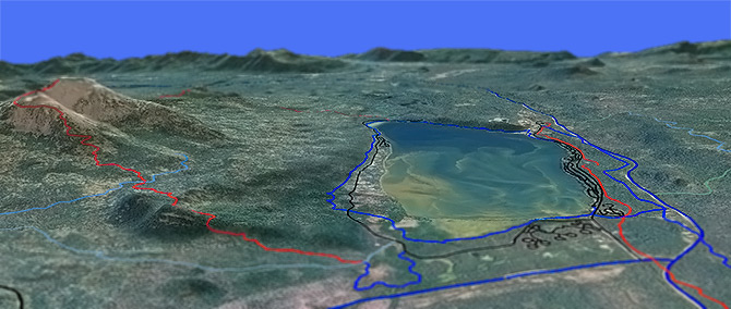
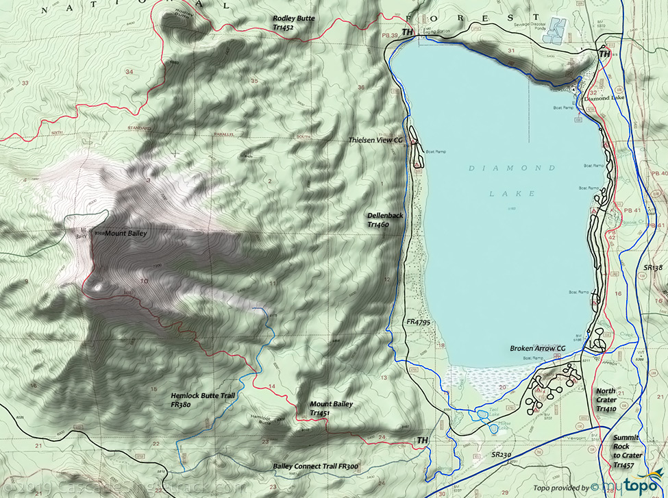
North of Crater Lake Oregon, the Mount Bailey Trail offers OAB and lollipop options when combined with Hemlock Butte and Bailey Connect.
Type
Loop
Length
Avg: 10mi
Ascent
Intense
Elevation Change
TH:5200'
Avg Ascent:3200'
Ascent Incline
17%
Duration
Avg: 3hr
Weather
Forecast
NOAA
popup
USFS
The ride begins on a flat with lodgepole pine, near the Silent Creek Tr1479 TH.
The Diamond Lake Dellenback Tr1460 is 11mi, with 8.5mi of doubletrack connected by campground roads. Expect heavy traffic on this easy trail.
Rodley Butte Tr1452 summits on the northern Mount Bailey flank, about a half mile past Rodley Butte. A full OAB ride (including the 1200' descent to FR600) is 14mi and a 3100' ascent. The lower portion of this trail is sometimes used by nordic skiiers.
Near Three Lakes, the 1.4mi Garwood Butte Tr1471 is a steep, rocky ascent through narrow switchbacks with protruding rocks, gaining 500' in the last half mile. View of Crater Lake rim from the summit lookout.
The 20-person Hemlock Butte Cabin at Three Lakes (built by the Edelweiss Ski Club) is available year round.
Mosquitoes are ferocious in this area until August. Feel free to try the natural repellents, and avoid drinking carbonated drinks prior to riding, but Deet 100 may be the only protection from 'the swarm'. Expect some trailside poison oak and prepare as needed. Try using Tecnu before the ride.
Diamond Lake Nordic
Nordic: The Three Lakes (FR3703) and Diamond Lake (FR6592) Sno Parks serve the southern Diamond Lake area.
The Summit Rock to Crater Trail 1457 page includes the Thielsen and Howlock Sno Park trails.
Contact the Diamond Lake Ranger District for groom conditions and maps.
Hemlock Butte Trail FR380 is also a snowmobile trail for the first two miles until it reaches the Bailey Connect Trail FR300.
The South Diamond Sno-Park trails include Pizza Connect, Horse-N-Teal Tr1481, Outback, Diamond Lake West, Silent Creek, and North Crater. The 1mi Outback Trail is a double-tracked groomed loop that can be accessed at about 0.5mi north of the Sno-Park, which leads to the Broken Arrow CG and ties into the Horse N' Teal Tr1481, Pizza Connect Trail and the Diamond Lake Ski Loop Tr1460.
Silent Creek Tr1479 follows Silent Creek through lodgepole pine and across marshy meadows on boardwalks.
Also see the Crater Lake National Park page, for hiking and nordic activities.
Directions: See Map. View Larger Map. No Map?.

OAB Directions
desc
- TH: Gradual ascent through hemlock and fir to the slopes of Hemlock Butte, to the FR300 (Hemlock Butte trail) intersection.
- 2.3mi: Cross FR300 and ascend 1500' over the next 1.5mi to the timberline, after which the ascent becomes more gradual. The last mile is above the timberline, with increased view of the surrounding area.
- 4.9mi: Reach the rocky summit crater, then descend to FR300.
- 7.5mi: Option to go right on FR300, then left onto FR380 Bailey Connect Trail back to the TH.
Rogue-Umpqua Divide Wilderness
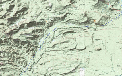
The northern Rogue-Umpqua Divide Tr1470 TH is at FR870, with the trail accessible at FR37 and at Three Lakes Camp. This can be combined with Buck Canyon Tr1046, Sherwood Creek Tr1041 or Muir Creek Tr1042, with a number of camps along these trails.
From the SR230 TH, Sherwood Creek Tr1041 forks, with the alternate path leading through Beaver Meadows, which can be wet in the Spring and difficult to follow.
South of SR230 is Upper Rogue River Tr1034.
From FR760 the 1.7mi Boundary Springs Trail 1057 leads to the 12.5mi Bald Crater Loop Trail.
Muir Creek Tr1042 passes Muir Creek Falls about 3mi from the TH, then connects with Buck Canyon Tr1046.
This map covers the northern Rogue-Umpqua Divide Wilderness area. Most trails are covered on the Golden Stairs Rogue-Umpqua Wilderness Hiking Area Topo Map.
This is a remote area, so verify with the forest service that the trails are accessible prior to visiting.
Be prepared for hoards of mosquitos during the late spring and early summer months.
Trail Index
This Ride
Mount Bailey Trail 1451
Area
FR300 Bailey Connect Trail, Diamond Lake Dellenback Trail 1460, Garwood Butte Trail 1471, North Crater Tr1410, Rodley Butte Trail 1452, Silent Connection Trail 1460H, Summit Rock to Crater Tr1457
Hiking
Bald Crater Loop, Bert Creek Trail, Boundary Springs Trail, Minnehaha Trail 1039, Muir Creek Tr1042, Upper Rogue River Trail 1034, West Lake Trail
Rogue-Umpqua Divide Wilderness
Buck Canyon Trail 1046, Meadow Creek Trail 1044, Mount Bailey West Approach Tr1589F, Rogue-Umpqua Divide Trail 1470, Sherwood Creek Trail 1041
Three Lakes and South Diamond Sno Parks
Bailey Connect Trail FR300, Diamond Lake West Trail, Hemlock Butte Trail FR380, Horse-N-Teal Trail 1481, North Crater Trail 1410, Outback Trail, Pizza Connect Trail, Silent Creek Trail 1479
Campgrounds
Broken Arrow Campground, Diamond Lake Campground, Hamaker Campground, Minnehaha Camp, Old Man Camp, Thielsen View Campground, Three Lakes Camp
Trail Rankings
Ranking consistently applied to all of the listed trails.
- Overall Rating: Ride quality and challenge
- Aerobic: Ascent challenge
- Technical Difficulty: Terrain challenge
- Steepness: Average incline
- Flow: Uninterrupted riding
- Elevation Change: Total elevation gain
- Ride Difficulty: Terrain challenge


