Green Ridge Tr25
Twitter Search
#metoliusriver

Overall: 5
Aerobic: 5
Technical: 5
Steepness: 4
Flow: 6
Singletrack: 100%
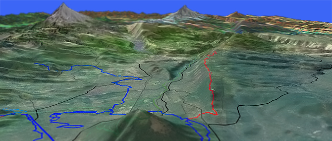
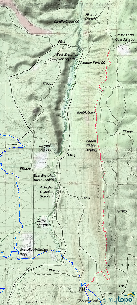
Just north of Black Butte, the Sisters Oregon Green Ridge Tr25 is an OAB ridgeline ride, overlooking the Metolius River. This area has experienced several forest fires in recent years, so be sure to check with the local Ranger District about current trail conditions.
Type
OAB
Length
Avg: 21.5mi
Ascent
Moderate
Elevation Change
TH:3700'
Avg Ascent:2150'
Ascent Incline
4%
Duration
Avg: 4hr
Weather
Forecast
NOAA
popup
USFS
Expect to share the trail with hikers from the Metolius River area campgrounds.
Plenty of trailhead options, depending on how much of the (moderate) ridgeline ascent is desired.
There are several spurs from FR1130, which can eliminate all of the climbing. But then there would be no downhill, either..
The trail constantly crosses doubletrack spur roads, with too many to mention.
Try not to get lured onto the many doubletrack spur roads. A GPS is suggested.
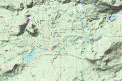
The area map shows the rugged wilderness hiking trails over to the Pacific Crest Trail, as well as the entire northern section of Metolius Windigo Tr99.
Santiam Pass XC Skiing
Near the Hoodoo Ski Area, the Ray Benson SnoPark serves as the upper TH for a XC Ski terrain network, with Blue Lake or the SR20 Corbett SnoPark as the lower TH. Santiam SnoPark is also alongside SR22 for an easy access XC Ski TH.
Directions: US20W 6mi from Sisters, then turn right at Indian Ford CG. Go on FR11N for 4mi, then turn left on FR1120 and go 1mi to TH, near the Riverside CG. Park to the left and begin ride on trail heading up the side of Green Ridge to the East. View Larger Map. No Map?.

OAB Directions
ridge ride
- TH: Switchback ascent through the pine tree forest and ever present manzanita to the ridgeline.
- 2.3mi: Reach the lower step of the ridgeline, with the ride summit at 5.3mi, after about half a dozen benched ascents and some technical, rocky sections. Descend to 7.8mi, crossing several streams, then ascend to 8.9mi.
- 10.7mi: Final descent to a Prairie Farm spur road, near the Prairie Farm Guard Station. Turn around and head back to the TH.
Trail Index
This Ride
Green Ridge Trail 4025, Metolius-Windigo Trail 99
Area
Camp Sherman H Trail 4095, Cross District Trail 4082, Little Three Creek Lake Trail 4076, Park Meadow Tie Trail 4102, Sisters Mountain Bike Trail 4090, Six Mile Butte Trail, Suttle Tie Trail 4094, Three Creek Meadow Trail 4103
Bend Area
Bens Trail 50, COD Trail 71, Edison-Lava Trail 31, Elfin Magic Trail 45, Farewell Trail 26, Flagline Trail 41, Flagline Access Trail 40.1, Flagline Tie Trail 41.1, Funner, Grand Slam Trail 44, Kents Trail 43, KGB Trail 72, Mrazek Trail 32, MTB Trail 51, North Fork Trail 24.2, Phils Trail 42, Sector 16 Trail 27, Skyliners Trail 28, South Fork Trail 25, Sparks Lake Trail 4, Storm King Trail 48, Swampy Lake Trail 23, Swampy Loop Trail 23.2, Swampy-Dutchman Trail 40, Swede Ridge Trail 52, Tiddlywinks, Tumalo Creek Trail 25.1, Tumalo Ridge Trail 25.2, Voodoo Trail 46
Metolius-Windigo Tr99 Biking
Mount Jefferson Wilderness Hiking
Bowerman Lake Trail 3492, Brush Creek Trail 4004, Cabot Lake Trail 4003, Canyon Glacier Trail 4010, Hunts Creek Trail 3440, Jefferson Lake Trail 4001, Lake of the Woods Trail 3493, Minto Lake Trail 4006, Minto Pass Trail 3437, Rockpile Lake Trail 4005, Round Lake Trail 4012, Shirley Lake Trail 4003.1, Sugar Pine Ridge Trail 4002, Summit Lake Trail 4014, Swallow Lake Trail 3488
Santiam Pass XC Ski
Blue Lake XC Trail 4034, Brandenburg Loop Trail 4046.1, Circle Lake XC Trail 4042, Cottonwood XC Trail 4041, Dry Creek Trail 4050, Meadow Lake Trail 4048, North Loop XC Trail 4043, Patjens Lakes Trail 3395, Pocket Way Trail 3522, Round Lake XC Trail 4029, South Loop XC Trail 4046
Campgrounds
Abbot Creek Campground, Allen Spring Campground, Big Lake CG, Blue Bay Campground, Candle Creek Campground, Canyon Creek Campground, Gorge Campground, Jack Creek Campground, Jack Lake Campground, Pine Rest Campground, Lower Bridge Campground, Link Creek CG, Pioneer Ford Campground, Riverside Campground, Round Lake CG, Camp Sherman Campground, Smiling River Campground, South Lake CG, South Shore Campground
Trail Rankings
Ranking consistently applied to all of the listed trails.
- Overall Rating: Ride quality and challenge
- Aerobic: Ascent challenge
- Technical Difficulty: Terrain challenge
- Steepness: Average incline
- Flow: Uninterrupted riding
- Elevation Change: Total elevation gain
- Ride Difficulty: Terrain challenge


