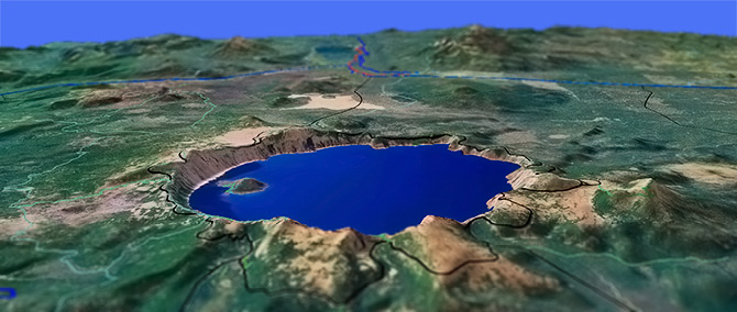
Crater Lake National Park
Twitter Search
#craterlake

Overall: 5
Aerobic: 6
Technical: 6
Steepness: 6
Flow: 5
Singletrack: 100%
No mountainbiking in the Crater Lake NP, but plenty of road biking and hiking opportunities. Most use is by Permit, so be sure to plan ahead of any visit to the park.
Type
OAB
Length
Avg: 6mi
Ascent
Moderate
Elevation Change
TH:6600'
Avg Ascent:1000'
Ascent Incline
10%
Duration
Avg: 6hr
Weather
Forecast
NOAA
popup
NPS
As with the Diamond Lake area, Crater Lake is very crowded in peak season, so timing of any trip to this area can make all the difference in the experience. Campsite reservations must be booked well in advance of any trip.
The park is open year round and offers some great nordic terrain, at Mazama, Hemlock, Rim Drive, Raven and Dutton Creek. See the winter newsletter for more details.
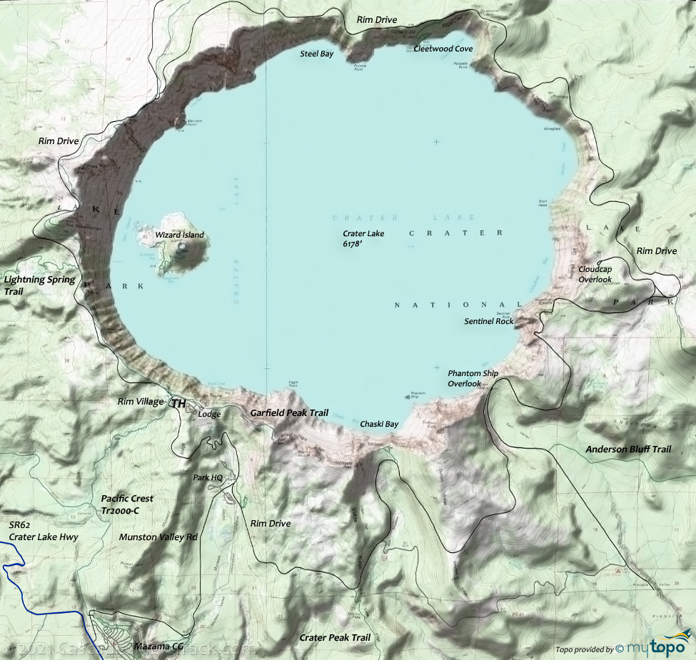
There are several OAB hikes from Rim Drive, to Dutton Creek, Mount Scott, Anderson Bluff, Crater Peak, The Watchman, Garfield Peak and Lightning Spring. In addition, the Pacific Crest Trail 2000-C can be combined with Dutton Creek or Lightning Spring into various loops.
The National Park Service has maps Online.
Mosquitoes are ferocious in this area until August. Feel free to try the natural repellents, and avoid drinking carbonated drinks prior to riding, but Deet 100 may be the only protection from 'the swarm'. Expect some trailside poison oak and prepare as needed. Try using Tecnu before the ride.
Directions: See the Park Directions. View Larger Map. No Map?.

Loop Directions
western loop
Crater Lake National Park Area Topo Map
- As a multi-day backcountry camping trip, connecting Pacific Crest Trail 2000-C with other trails on the western side of Crater Lake creates several loop opportunities. Be sure to get the permits needed for using this area.
- THmi: From Mazama Village, moderately ascend 1.8mi to the Dutton Creek Trail intersection.
- 1.8mi: Continue 4.5mi to the Lightning Spring Trail, crossing Dutton creek, Castle creek, Trapper creek then Bybee creek while moderately traversing the hillside.
- 6.3mi: From the Lightning Spring Trail intersection, descend to the Copeland creek drainage, passing the Bybee creek campsite trail at 7.3mi, followed by 5.7mi steady ascent to the Bald Crater Loop Trail intersection.
- 13mi: Continue from the Bald Crater Loop Trail intersection 1.5mi to the other Bald Crater Loop Trail intersection, passing the Red Cone Spring campsite at 14mi.
- 14.5mi: Go right at the 2nd Bald Crater Loop Trail intersection, traversing the northern flank of Red Cone. Cross the Cascade Lake Hwy to the Grouse Hill intersection.
- 17.7mi: Go right at the intersection near the Grouse Hill campsite, heading south in an ascent to the Hillman Peak summit. Cross Rim drive at 20.5mi and again at 21mi.
- 23.25mi: Pass the Watchman Lookout Trail intersection and the Lightning Spring Trail intersection at 24.2mi.
- 26.3mi: From Rim Village, head south on Dutton Creek Trail to the intersection, and back to Mazama Village.
Sky Lakes Wilderness
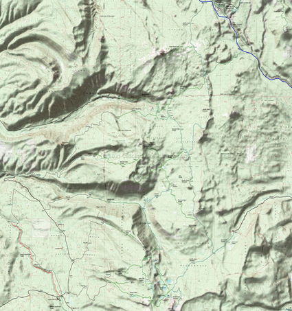
This map covers the northern Sky Lakes Wilderness area, from Crater Lake to the Seven Lakes Basin area.
The southern Sky Lakes Wilderness area is covered on the South Fork Rogue River Tr988 page.
The area offers many loop and shuttle hiking opportunities, most accessed from Prospect.
Middle Fork Trail 978 ascends through the Middle Fork Canyon 2008 burn area, connecting to other trails with Alta Lake Trail 979 and Halifax Trail 1088.
Seven Lakes Trail 981 ascends 1700' to a saddle then drops into the lake basin. Expect equestrian and hiker interaction on this popular trail, particularly at Cliff Lake.
Sevenmile Trail 3703 accesses the Sky Lakes Wilderness from the FR3334 Sevenmile Marsh TH (Horse Camp), with Pacific Crest Trail 2000-C as the connector to the Seven Lakes Basin area trails to the south, or Tom and Jerry Trail 1089 to the north.
Trail Index
Area Rides
Area
Anderson Bluff Trail, Annie Spring Cutoff Trail, Bald Crater Loop Trail, Bert Creek Trail, Boundary Springs Trail Castle Crest Wildflower Trail, Cleetwood Cove Trail, Crater Peak Trail, Discovery Point Trail, Dutton Creek Trail, Garfield Peak Trail, Godfrey Glen Nature Trail, Fumarole Bay Trail, Lightning Spring Trail, Mt Scott Lookout Trail, Sun Creek Trail, Sun Notch Trail, The Watchman Lookout Trail, Union Peak Trail, Wizard Island Trail
Sky Lake Wilderness
Alta Lake Trail 979, Bessie Creek Trail 1084, Devils Peak Trail 984, Halifax Trail 1088, King Spruce Trail 980, Lake Ivern Trail 994, Lucky Camp Loop Trail 1091, Lucky Meadows Trail 1083, Middle Fork Trail 978, Pacific Crest Trail 2000-C, Red Blanket Trail 1090, Seven Lakes Trail 981, Sevenmile Trail 3703, Stewart Falls Trail 1087, Tom and Jerry Trail 1089
XC Ski
Discovery Point, Dutton Creek Trail, East Rim Drive, Garfield-Applegate Ridge, Hemlock Loop, Mazama Loop, Raven Trail, Sun Notch, Vidae Falls
Campgrounds
Bybee Creek Campsite, Dutton Creek Campsite, Grouse Hill Campsite, Lightning Springs Campsite, Lost Creek Campground, Mazama Campground, Red Cone Springs Campsite
Trail Rankings
Ranking consistently applied to all of the listed trails.
- Overall Rating: Ride quality and challenge
- Aerobic: Ascent challenge
- Technical Difficulty: Terrain challenge
- Steepness: Average incline
- Flow: Uninterrupted riding
- Elevation Change: Total elevation gain
- Ride Difficulty: Terrain challenge


