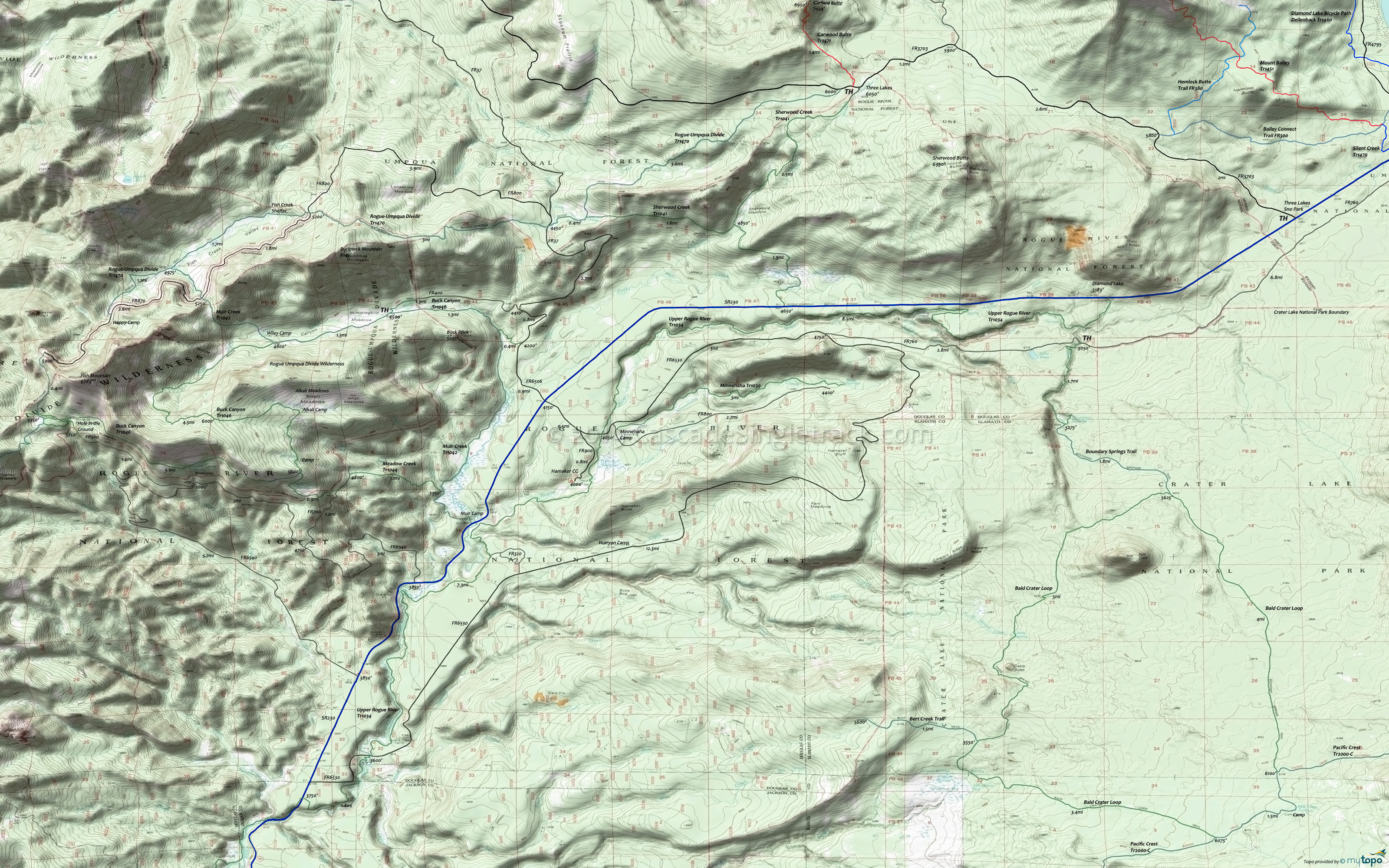
Rogue-Umpqua Wilderness Hiking Topo Map
Map includes: Bald Crater Loop, Bert Creek Trail, Boundary Springs Trail, Buck Canyon Trail 1046, Minnehaha Trail 1039, Meadow Creek Trail 1044, Muir Creek Tr1042, Upper Rogue River Trail 1034, Rogue-Umpqua Divide Trail 1470, Sherwood Creek Trail 1041 Wilderness Hiking Trails.
The northern Rogue-Umpqua Divide Tr1470 TH is at FR870, with the trail accessible at FR37 and at Three Lakes Camp. This can be combine with Buck Canyon Tr1046, Sherwood Creek Tr1041 or Muir Creek Tr1042, with a number of camps along these trails.
From the SR230 TH, Sherwood Creek Tr1041 forks, with the alternate path leading through Beaver Meadows, which can be wet in the Spring and difficult to follow.
South of SR230 is Upper Rogue River Tr1034.
From FR760 the 1.7mi Boundary Springs Trail 1057 leads to the 12.5mi Bald Crater Loop Trail.
Muir Creek Tr1042 passes Muir Creek Falls about 3mi from the TH, then connects with Buck Canyon Tr1046.
This map covers the northern Rogue-Umpqua Divide Wilderness area. Most trails are covered on the Golden Stairs Rogue-Umpqua Wilderness Hiking Area Topo Map.
This is a remote area, so verify with the forest service that the trails are accessible prior to visiting.
Be prepared for hoards of mosquitos during the late spring and early summer months.
Draggable map: Map window adjusts to screen size and will respond to touch control. Use scrollbar for mouse control.
No Map? Browser settings and some browser extensions can prevent the maps from appearing. Please see Site Tech


