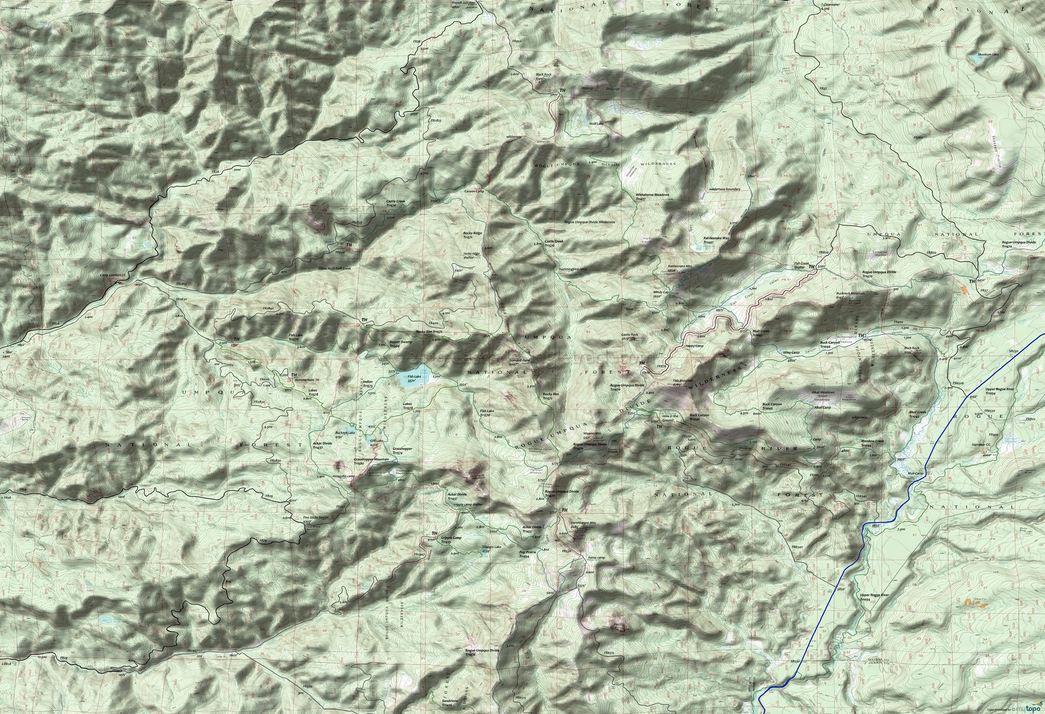
Rogue-Umpqua Wilderness Hiking Topo Map
Map includes: Acker Divide Trail 1437, Beaver Swamp Trail 1569, Castle Creek Trail 1576, Cripple Camp Trail 1435, Fish Lake Trail 1570, Grasshopper Trail 1574, Grasshopper Mountain Trail 1580, Indian Trail 1573, Lakes Trail 1578, Pup Prairie Trail 1434, Rattlesnake Way Trail 1497, Rocky Ridge Trail 1571, Rocky Rim Trail 1572, Rogue-Umpqua Divide Trail 1470, Upper Rogue River Trail 1034, Union Creek Trail 1035, Whitehorse Meadows Trail 1477 Hiking Trails.
This map covers most of the Rogue-Umpqua Divide Wilderness area. Additional trails are covered on the Diamond Lake Rogue-Umpqua Wilderness Hiking Area Topo Map.
FR28 from Tiller provides access to several trailheads on the Umpqua side, near Fish Lake, creating a number of shuttle or loop hiking opportunities.
Draggable map: Map window adjusts to screen size and will respond to touch control. Use scrollbar for mouse control.
No Map? Browser settings and some browser extensions can prevent the maps from appearing. Please see Site Tech


