Golden Stairs Tr1092
Twitter Search
#rogueumpqua

Overall: 5
Aerobic: 6
Technical: 5
Steepness: 6
Flow: 7
Singletrack: 100%
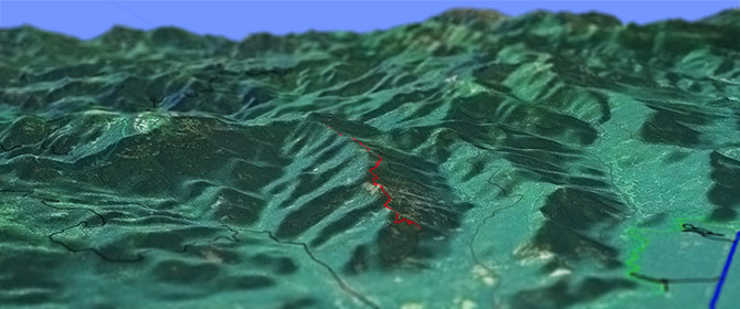
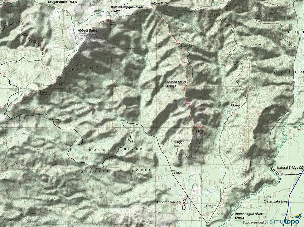
The Prospect Oregon Golden Stairs Trail traverses the southern ridge of Falcon Butte, transitioning from a 6% incline climb to a gentle uphill grade, passing through open areas that provide vistas of the Crater Lake Rim. The last 1.5mi wanders through tall timber and rocky openings until the trail merges with Rogue-Umpqua Divide Tr1470.
Type
Loop
Length
Avg: 8mi
Ascent
Moderate
Elevation Change
TH:3800'
Avg Ascent:2300'
Ascent Incline
6%
Duration
Avg: 2hr
Weather
Forecast
NOAA
popup
USFS
Golden Stairs Tr1092 is only 4mi, but provides access to the 30mi Rogue-Umpqua Divide Tr1470 ridge trail.
The upper section of Rogue-Umpqua Divide Tr1470 is in wilderness area, but the rest of trail is at the edge of the wilderness and is rideable to at least Hershberger Mountain.
The upper 2mi of Golden Stairs Tr1092 is suitable for an OAB while riding Rogue-Umpqua Divide Tr1470.
From the southern trailhead, a 26.7mi OAB Rogue-Umpqua Divide Tr1470 to Hershberger Mt has 6800' climbing with a 9% incline.
Wilderness Area Restrictions: The section of the Rogue-Umpqua Divide Tr1470 trail around Abbott Butte is in wilderness area, which would prevent the use of the southern Rogue-Umpqua Divide Tr1470 TH for any ride.
Verify this prior to riding this section of trail, as it may be ok to use the trail anyway. The TH should be clearly marked if biking is prohibited.
Rogue-Umpqua Divide Tr1470 can also be accessed near Hershberger Mt, using FR6510 to FR6520 to FR6515.
Besides starting from the southern Rogue-Umpqua Divide Tr1470 TH, the use of a shuttle to ride to the Golden Stairs Tr1092 TH creates a nice 9.3mi (10% incline for 1.5mi, 1700' climbing) ride.
Also see the Crater Lake National Park page, for hiking and nordic activities.
Directions: SR62 to FR68 then go left and continue 5mi to FR550. Go right onto FR550 and drive for 2mi to the TH. View Larger Map. No Map?.

OAB Directions
stairsteps
- TH: Rocky climb to the top of the ridge.
- 2mi: Ridge top riding.
- 3mi: Final ascent, through forested area.
- 4mi: Upper TH and intersection with Rogue-Umpqua Divide Tr1470. If continuing then go right to Hersberger Mt.
Rogue-Umpqua Divide Wilderness
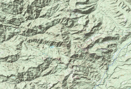
This map covers most of the Rogue-Umpqua Divide Wilderness area. Additional trails are covered on the Diamond Lake Rogue-Umpqua Wilderness Hiking Area Topo Map.
FR28 from Tiller provides access to several trailheads on the Umpqua side, near Fish Lake, creating a number of shuttle or loop hiking opportunities.
Be sure to check with the local ranger district on the trail conditions of this remote wilderness area.
Mosquitoes are ferocious in this area until August. Feel free to try the natural repellents, and avoid drinking carbonated drinks prior to riding, but Deet 100 may be the only protection from 'the swarm'. Expect some trailside poison oak and prepare as needed. Try using Tecnu before the ride.
Trail Index
This Ride
Golden Stairs Trail 1092
Rogue-Umpqua Divide Wilderness Hiking
Abbott Butte Trail 1470A, Acker Divide Trail 1437, Anderson Mountain Trail 1075, Beaver Swamp Trail 1569, Castle Creek Trail 1576, Cougar Butte Trail 1432, Cougar Butte North Trail 1432N, Cripple Camp Trail 1435, Donegan Prairie Trail 1431, Fish Lake Trail 1570, Grasshopper Trail 1574, Grasshopper Mountain Trail 1580, Indian Trail 1573, Lakes Trail 1578, Pup Prairie Trail 1434, Rattlesnake Way Trail 1497, Rocky Ridge Trail 1571, Rocky Rim Trail 1572, Rogue Gorge Trail 1034A, Rogue-Umpqua Divide Trail 1470, Sandstone Trail 1436, Upper Rogue River Trail 1034, Union Creek Trail 1035, Whitehorse Meadows Trail 1477
XC Ski
Farewell Bend Sno-Park
Campgrounds
Abbott Creek Campground, Big Bear Camp, Camp Comfort Campground, Cow Camp, Cripple Camp, Farewell Bend Campground, Mosquito Camp, Natural Bridge Campground, Paradise Camp, Saddle Camp, Union Creek Campground
Trail Rankings
Ranking consistently applied to all of the listed trails.
- Overall Rating: Ride quality and challenge
- Aerobic: Ascent challenge
- Technical Difficulty: Terrain challenge
- Steepness: Average incline
- Flow: Uninterrupted riding
- Elevation Change: Total elevation gain
- Ride Difficulty: Terrain challenge


