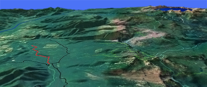
South Fork Rogue River Tr988
Twitter Search
#roguerivertrail

Overall: 5
Aerobic: 5
Technical: 4
Steepness: 4
Flow: 5
Singletrack: 100%
The Butte Falls Oregon South Fork Rogue River Tr988 is a riverside traverse, with a few creek crossings and hillside ascents to keep it interesting.
Type
OAB
Length
Avg: 11.5mi
Ascent
Moderate
Elevation Change
TH:4000'
Avg Ascent:1500'
Ascent Incline
4%
Duration
Avg: 2.5hr
Weather
Forecast
NOAA
popup
USFS
Something to check out if in the area but not a destination ride.
The ride is a gradual descent alongside the river, through sugar pines and with a few bridged creek crossings along the way.
Sky Lakes Wilderness
The area map covers the southern Sky Lakes Wilderness area, from the Seven Lakes Basin area south.
The area offers many loop and shuttle hiking opportunities, most accessed from Prospect.
The northern Sky Lakes Wilderness area is covered on the Crater Lake National Park page.
Middle Fork Trail 978 ascends through the Middle Fork Canyon 2008 burn area, connecting to other trails with Alta Lake Trail 979 and Halifax Trail 1088.
Seven Lakes Trail 981 ascends 1700' to a saddle then drops into the lake basin. Expect equestrian and hiker interaction on this popular trail, particularly at Cliff Lake.
Sevenmile Trail 3703 accesses the Sky Lakes Wilderness from the FR3334 Sevenmile Marsh TH (Horse Camp), with Pacific Crest Trail 2000-C as the connector to the Seven Lakes Basin area trails to the south, or Tom and Jerry Trail 1089 to the north.
Mosquitoes are ferocious in this area until August. Feel free to try the natural repellents, and avoid drinking carbonated drinks prior to riding, but Deet 100 may be the only protection from 'the swarm'. Expect some trailside poison oak and prepare as needed. Try using Tecnu before the ride.
Directions: From Butte Falls, OR, go 1mi east to the Butte Falls Highway, go left then go north 8.5mi to FR34 (Lodgepole Road). Go right and continue 8.1mi to the TH (0.25mi mile after the bridge). View Larger Map. No Map?.

OAB Directions
riverside ride
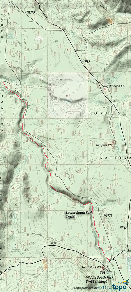
South Fork Rogue River Tr988 Area Topo Map
- TH: Descend alongside the river, crossing Nicolas creek then Green Creek. A few hillside ascents as the trail follows the curving riverbends. Carry the bike over the cattle guard, cross an unnamed creek then reach a South Fork Dam overlook. Go sharply right as it follows Imnaha creek to the lower TH.
- 5.8mi: Return on the trail or go right onto FR3775 back to the TH.
Trail Index
This Ride
Lower South Fork Trail 988
Sky Lakes Wilderness
Alta Lake Trail 979, Blue Canyon Trail 976, Cat Hill Way Trail 992, Cherry Creek Trail 3708, Cold Spring Trail 3710, Devils Peak Trail 984, Divide Trail 3717, Donna Lake Tr3734, Halifax Trail 1088, Isherwood Trail 3729, King Spruce Trail 980, Lake Ivern Trail 994, Meadow Lake Trail 976, Middle Fork Trail 978, Middle South Fork Trail 988, Nannie Creek Trail 3707, Pacific Crest Trail 2000-C, Red Lake Trail 987, Seven Lakes Trail 981, Sevenmile Trail 3703, Snow Lakes Trail 3739, Upper South Fork Trail 986
Campgrounds
Imnaha Campground, Parker Meadows Campground, Saddle Camp, Sevenmile Horse Camp, Snowshoe Campground, South Fork Campground, Sumpter Campground, Upper South Fork Campgrouund
Trail Rankings
Ranking consistently applied to all of the listed trails.
- Overall Rating: Ride quality and challenge
- Aerobic: Ascent challenge
- Technical Difficulty: Terrain challenge
- Steepness: Average incline
- Flow: Uninterrupted riding
- Elevation Change: Total elevation gain
- Ride Difficulty: Terrain challenge


