Twitter Search
#PacificCrestTrail
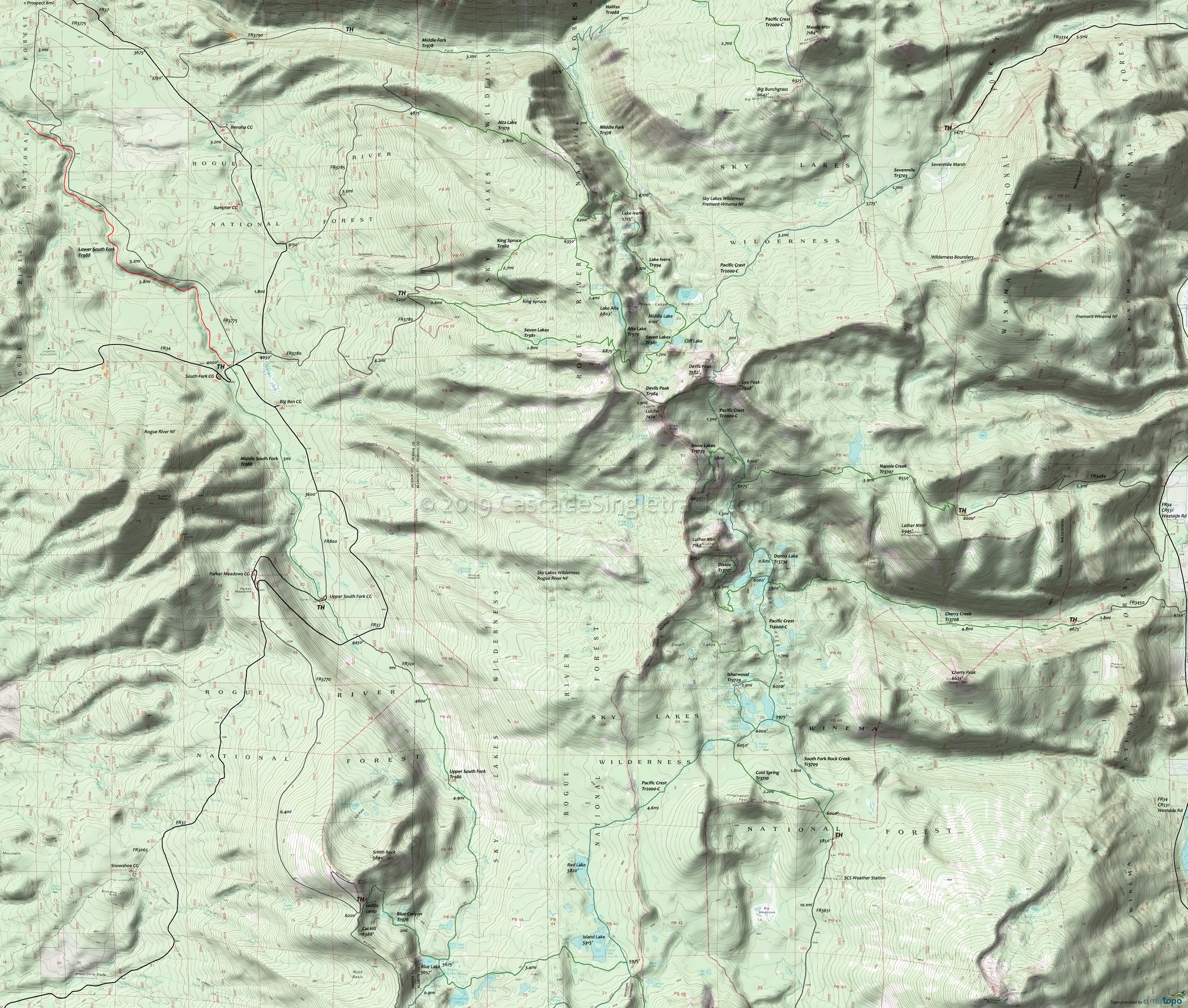
South Fork Rogue River Tr988 Mountain Biking and Hiking Topo Map
Map Includes: Blue Canyon Trail 976, Cat Hill Way Trail 992, Cherry Creek Trail 3708, Cold Spring Trail 3710, Divide Trail 3717, Donna Lake Trail 3734, Isherwood Trail 3729, Meadow Lake Trail 976, Middle South Fork Trail 988, Nannie Creek Trail 3707, Pacific Crest Trail 2000-C, Sevenmile Marsh Trail 3703, Sky Lakes Basin Trail 3728, Snow Lakes Trail 3739, South Fork Rock Creek Trail 3709, South Fork Rogue River Trail 988, Upper South Fork Trail 986 Hiking and Biking Trails.
TH: Descend alongside the river, crossing Nicolas creek then Green Creek. A few hillside ascents as the trail follows the curving riverbends. Carry the bike over the cattle guard, cross an unnamed creek then reach a South Fork Dam overlook. Go sharply right as it follows Imnaha creek to the lower TH.
5.8mi: Return on the trail or go right onto FR3775 back to the TH.
The area map covers the southern Sky Lakes Wilderness area, from the Seven Lakes Basin area south.
The area offers many loop and shuttle hiking opportunities, most accessed from Prospect.
The northern Sky Lakes Wilderness area is covered on the Crater Lake National Park page.
Middle Fork Trail 978 ascends through the Middle Fork Canyon 2008 burn area, connecting to other trails with Alta Lake Trail 979 and Halifax Trail 1088.
Draggable map: Map window adjusts to screen size and will respond to touch control. Use scrollbar for mouse control.
No Map? Browser settings and some browser extensions can prevent the maps from appearing. Please see Site Tech


