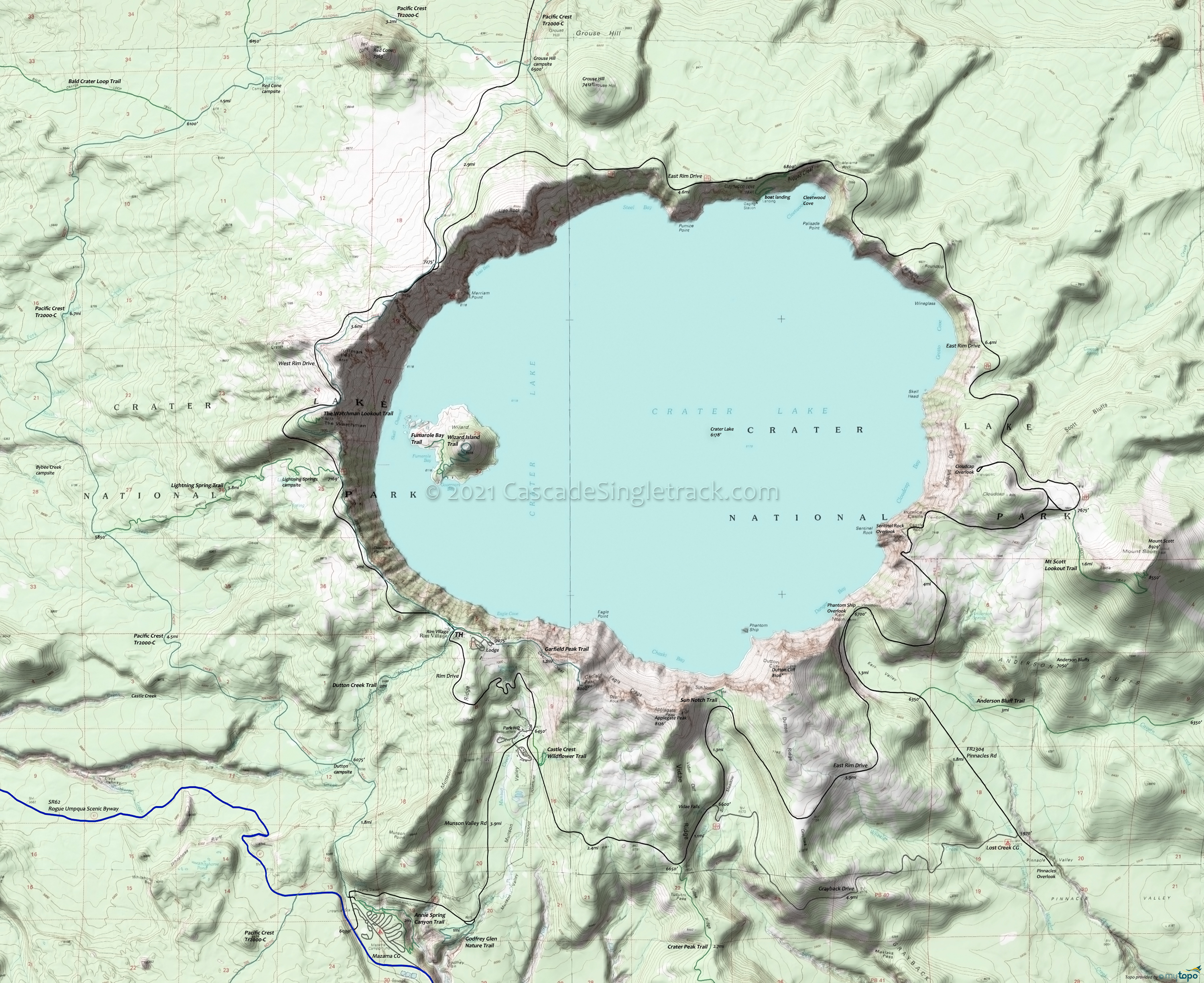
Crater Lake National Park Hiking Topo Map
Map Includes: Anderson Bluff, Annie Spring Cutoff, Castle Crest Wildflower, Cleetwood Cove, Crater Peak, Discovery Point, Dutton Creek, Garfield Peak, Godfrey Glen Nature, Fumarole Bay, Lightning Spring, Mt Scott Lookout, Sun Creek, Sun Notch, The Watchman Lookout, Wizard Island hiking trails.
As a multi-day backcountry camping trip, connecting Pacific Crest Trail 2000-C with other trails on the western side of Crater Lake creates several loop opportunities. Be sure to get the permits needed for using this area.
THmi: From Mazama Village, moderately ascend 1.8mi to the Dutton Creek Trail intersection.
1.8mi: Continue 4.5mi to the Lightning Spring Trail, crossing Dutton creek, Castle creek, Trapper creek then Bybee creek while moderately traversing the hillside.
6.3mi: From the Lightning Spring Trail intersection, descend to the Copeland creek drainage, passing the Bybee creek campsite trail at 7.3mi, followed by 5.7mi steady ascent to the Bald Crater Loop Trail intersection.
13mi: Continue from the Bald Crater Loop Trail intersection 1.5mi to the other Bald Crater Loop Trail intersection, passing the Red Cone Spring campsite at 14mi.
14.5mi: Go right at the 2nd Bald Crater Loop Trail intersection, traversing the northern flank of Red Cone. Cross the Cascade Lake Hwy to the Grouse Hill intersection.
17.7mi: Go right at the intersection near the Grouse Hill campsite, heading south in an ascent to the Hillman Peak summit. Cross Rim drive at 20.5mi and again at 21mi.
23.25mi: Pass the Watchman Lookout Trail intersection and the Lightning Spring Trail intersection at 24.2mi.
26.3mi: From Rim Village, head south on Dutton Creek Trail to the intersection, and back to Mazama Village.
Draggable map: Map window adjusts to screen size and will respond to touch control. Use scrollbar for mouse control.
No Map? Browser settings and some browser extensions can prevent the maps from appearing. Please see Site Tech


