Twitter Search
#PacificCrestTrail
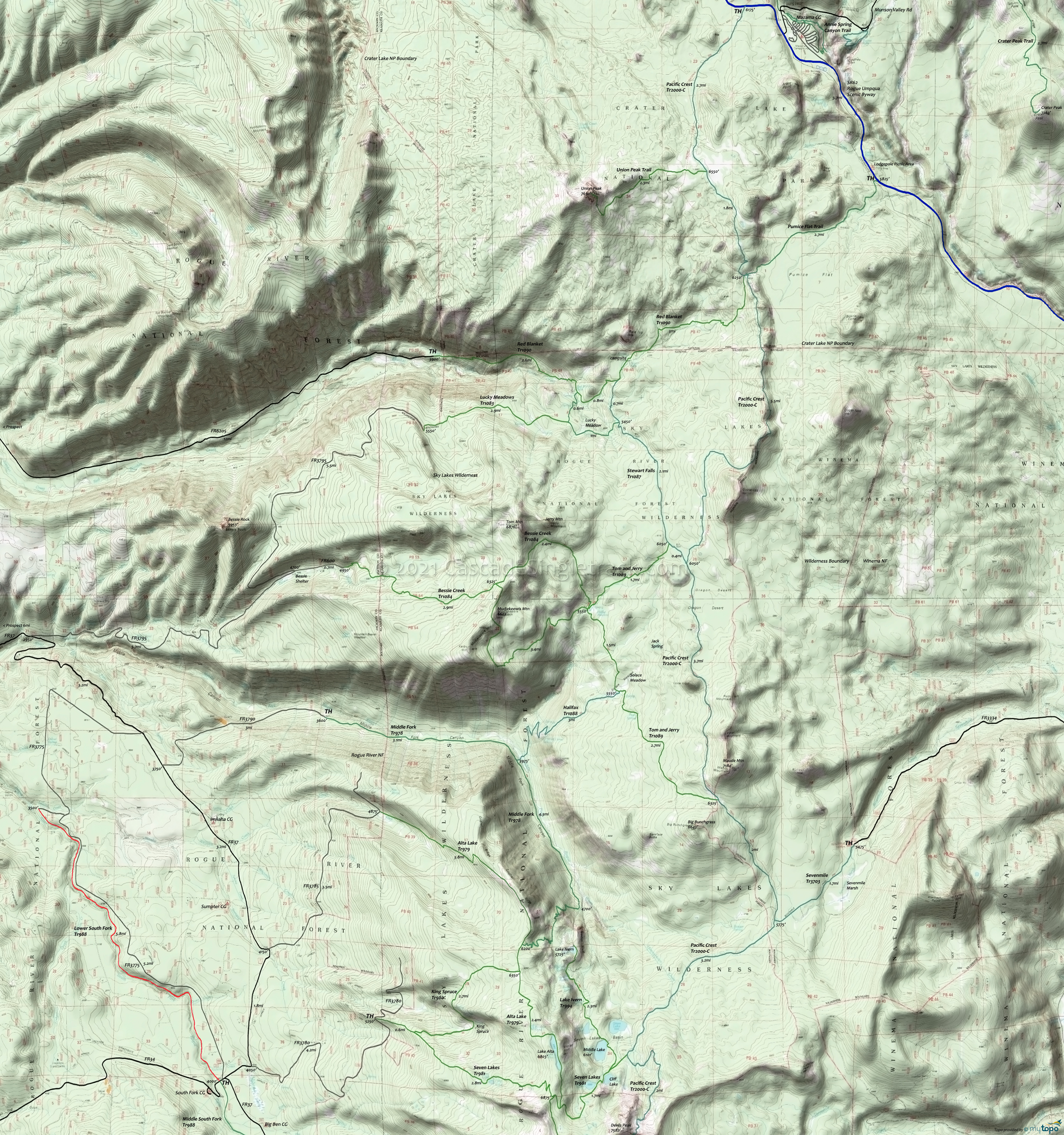
Sky Lakes Wilderness Hiking Topo Map
Map Includes: Alta Lake Trail 979, Bessie Creek Trail 1084, Devils Peak Trail 984, Halifax Trail 1088, King Spruce Trail 980, Lake Ivern Trail 994, Lucky Camp Loop Trail 1091, Lucky Meadows Trail 1083, Middle Fork Trail 978, Pacific Crest Trail 2000-C, Red Blanket Trail 1090, Seven Lakes Trail 981, Sevenmile Trail 3703, Stewart Falls Trail 1087, Tom and Jerry Trail 1089 hiking trails.
This map covers the northern Sky Lakes Wilderness area, from Crater Lake to the Seven Lakes Basin area.
The area offers many loop and shuttle hiking opportunities.
Middle Fork Trail 978 ascends through the Middle Fork Canyon 2008 burn area, connecting to other trails with Alta Lake Trail 979 and Halifax Trail 1088.
Seven Lakes Trail 981 ascends 1700' to a saddle then drops into the lake basin. Expect equestrian and hiker interaction on this popular trail, particularly at Cliff Lake.
Sevenmile Trail 3703 accesses the Sky Lakes Wilderness from the FR3334 Sevenmile Marsh TH (Horse Camp), with Pacific Crest Trail 2000-C as the connector to the Seven Lakes Basin area trails to the south, or Tom and Jerry Trail 1089 to th north.
Draggable map: Map window adjusts to screen size and will respond to touch control. Use scrollbar for mouse control.
No Map? Browser settings and some browser extensions can prevent the maps from appearing. Please see Site Tech


