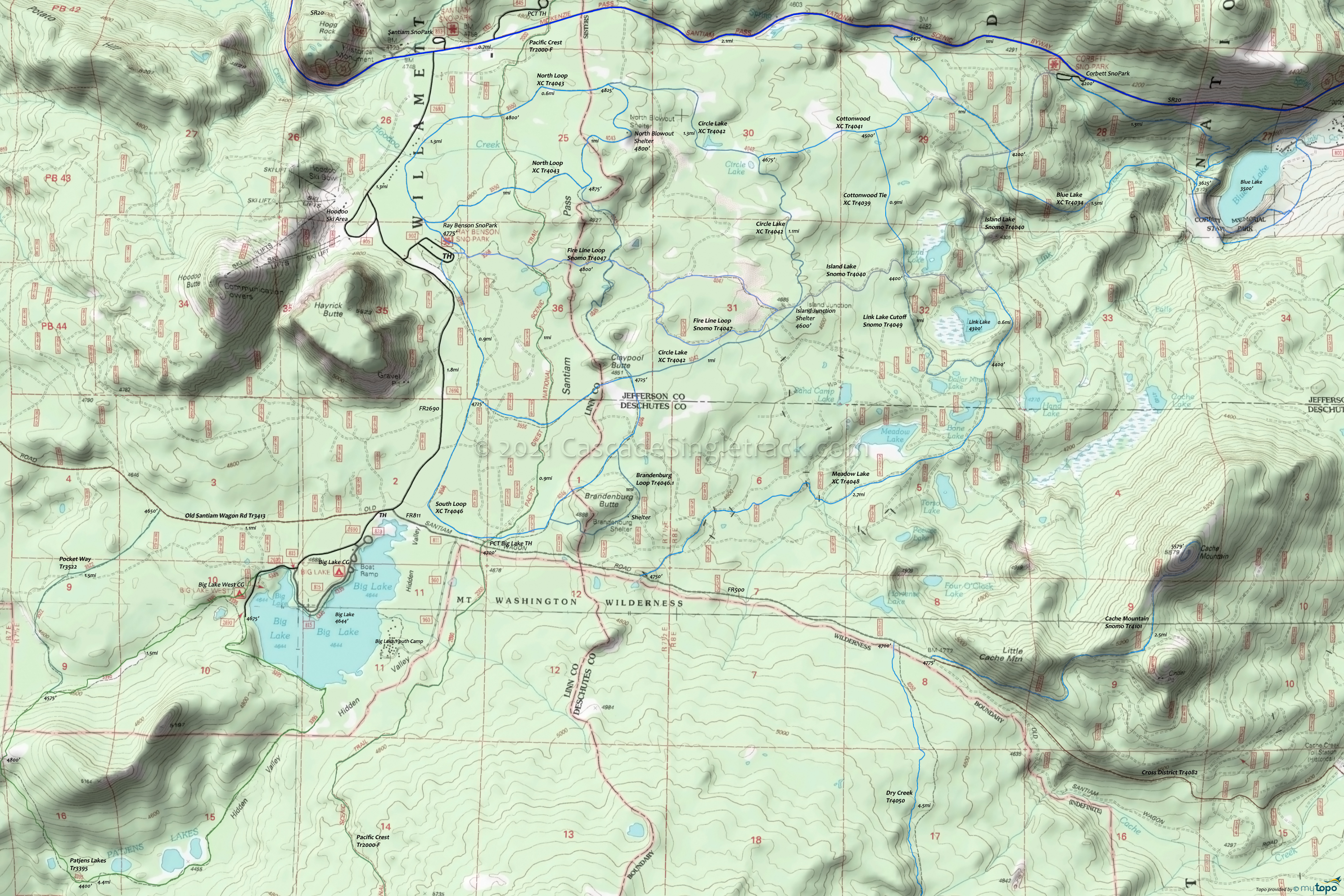
Santiam Pass Ray Benson Sno-Park, Corbett Sno-Park XC Trails Topo Map
Twitter Search
#OregonTimberTrail
The map covers the (mostly nordic) terrain south of SR20, to the Mount Washington Wilderness area, with Blue Lake XC Trail 4034, Brandenburg Loop Trail 4046.1, Circle Lake XC Trail 4042, Cottonwood XC Trail 4041, Dry Creek Trail 4050, Meadow Lake Trail 4048, North Loop XC Trail 4043, Patjens Lakes Trail 3395, Pocket Way Trail 3522, Round Lake XC Trail 4029 and South Loop XC Trail 4046 trails.
The Hoodoo Ski Area maintains some nordic terrain, west of FR2690.
Oregon Timber Trail: The Santiam Wagon Road (Cross District Trail) is part of the Cascade Peaks route.
Draggable map: Map window adjusts to screen size and will respond to touch control. Use scrollbar for mouse control.
No Map? Browser settings and some browser extensions can prevent the maps from appearing. Please see Site Tech


