Hardesty Mountain Tr3469
Twitter Search
#HardestyTrail
Overall: 8
Aerobic: 7
Technical: 6
Steepness: 7
Flow: 7
Singletrack: 65%
One of the oldest trails in the ranger district, the Oakridge Oregon Hardesty Mountain Trail is just inside the Willamette National Forest boundary and right on SR58, so was destined to be popular.
Type
Loop
Length
Avg: 18mi
Ascent
Intense
Elevation Change
TH:1000'
Avg Ascent:5900'
Ascent Incline
11%
Duration
Avg: 5hr
Weather
Forecast
NOAA
popup
USFS
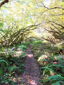
As with Alpine Tr3450, great ridgeline terrain and relatively easy access ensure that Hardesty Mountain Tr3469 earns it's reputation, but expect heavy traffic on the high summer weekends.
This is a downhill favorite, so not suitable for climbing. Hardesty Cutoff Trail 3469A leads to an abandoned fire lookout which was in place from 1920 to 1968.
Note: FR550 has a wide parking area for cars at about .5mi, and is a jeep trail beyond that point to the Hardesty Tr3469 TH.
There are three ways to reach the summit, besides the FR5833 or FR5840 shuttle.
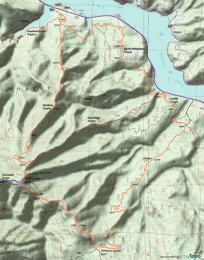
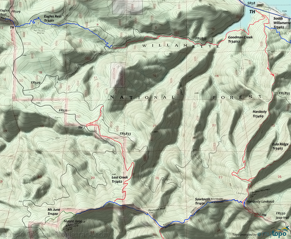
The typical 18.2mi CW loop is described in the route guide and stats: South Willamette Tr3465, Lawler Tr3473, FR5840 (4.3mi at 11% incline), FR550 (1.7mi at 11% incline), Sawtooth Tr1401 to Hardesty Tr3469.
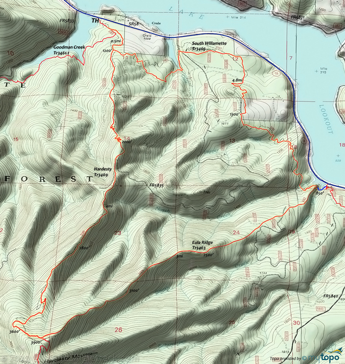
More suitable for hikers, two less useful loop options rely on Eula Ridge Tr3463 and Goodman Creek Tr3461.1, shown below.
Eula-Hardesty CW Loop
Better suited for hiking, strong climbers could also consider South Willamette Tr3465 to Eula Ridge Tr3463 to Hardesty Tr3469. Eula Ridge Tr3463 is a steady 10% grade and prone to downhiller bombing runs on the weekends, so maybe bring some body armor.
Goodman Creek Tr3461.1
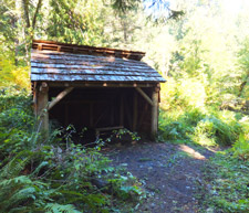
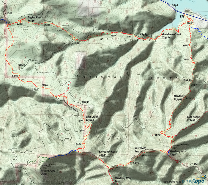
Suitable for intermediates and not a Hardesty ride but the 12mi Goodman Creek to Eagles Rest OAB is another option, and is also a popular hiking route. Expect heavy Goodman Creek Tr3461.1 hiking and equestrian use on the weekends.
The grade is steady although Goodman Creek Tr3461.1 is almost entirely a hillside traverse, with several creek crossings and short ascents. Eagles Rest Tr3461 is a more steady climb and not as heavily used as Goodman Creek Tr3461.1. Eagles Rest Tr3461 passes through stands of second growth trees, crosses two marshy swales on board walks on the approach to the Ash Swale Shelter. Across FR509 (BLM Rd 20-1-14, Eagles Rest Access Road), Eagles Rest Tr3461 continues as a hiking trail, to the site of an abandoned lookout.
The technical feature of both trails are exposed roots, and a few switchback sections along the way.
Directions: See Map. NW Forest Pass required right at the TH. View Larger Map. No Map?.
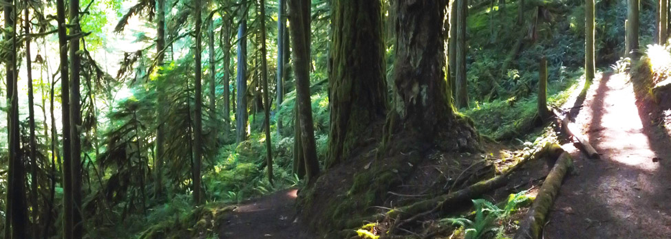
Loop Directions
amusement park for idiots
- TH: From the Hardesty TH
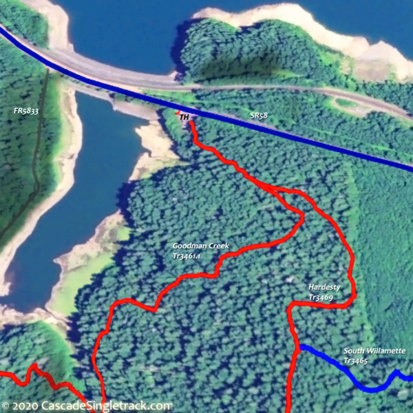
View of the Hardesty TH, go .2mi up Hardesty Tr3469, then go left on South Willamette Tr3465 and ride to Eula Rdg Tr3463. - 5.3mi: Pass the Eula Rdg Tr3463 intersection, to Lawler Tr3473, then ride 1.5mi to FR5840.
- 6.6mi: Go right onto FR5840 (Patterson Mt Rd) and ascend to FR17. 8.2mi: Bear right at the FR536/FR537 fork. As usual, take a topo map if not familiar with this road, or risk making a wrong turn to nowhere.
- 10.8mi: Go right at the 4-way FR17 Patterson Saddle junction, onto FR550. The 2hr road climb on FR5840 and FR550 is 6mi and 2500'.
- 12.5mi: Near the end of FR550, go left onto Hardesty Tr3469, then go .6mi to the Sawtooth Tr1401 TH, passing the hairpin switchback onto Hardesty Cutoff Trail 3469A on the right. The cutoff trail leads to the old lookout site.
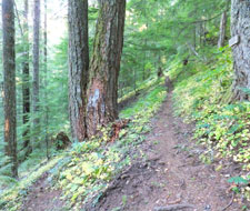
- 13.8mi: Pass the Eula Ridge Tr3463 TH on the right.
- 16.1mi: Go right onto FR5835 and continue to the corner, where the singletrack resumes. Go through a series of hairpin switchbacks and watch for hikers along the way back to the TH.
Goodman-Hardesty CCW Loop
The 18.6mi Goodman Cr Tr3461.1, Eagles Rest Tr3461, FR551, Lost Cr Tr3462, Sawtooth Tr1401 to Hardesty Tr3469 is the best loop option, with 3mi of FR551 road climbing and a 10% grade on portions of Goodman Cr Tr3461.1, Eagles Rest Tr3461 and Lost Cr Tr3462.
Trail Index
This Ride
Eagles Rest Trail 3461, Eula Ridge Trail 3463, Goodman Creek Trail 3461.1, Hardesty Trail 3469, Hardesty Cutoff Trail 3469A, Lawler Trail 3473, South Willamette Trail 3465
Area
Alpine Trail 3450, Clark Butte Trail 3456.1, Cloverpatch Trail 3457, Eugene to Pacific Crest Trail 3559, Hardesty Way Trail 1402, Jones Trail 3472, Larison Creek Trail 3646, Larison Rock Trail 3607, Lone Wolf-Patterson Mountain Trail 3470, Lost Creek Trail 3462, Middle Fork Willamette Trail 3609, North Fork Trail 3666, Sawtooth Trail 1401, Tire Mountain Trail 3485, Winberry Divide Trail 3476
Campgrounds
Black Canyon Campground, Shady Dell Campground
Trail Rankings
Ranking consistently applied to all of the listed trails.
- Overall Rating: Ride quality and challenge
- Aerobic: Ascent challenge
- Technical Difficulty: Terrain challenge
- Steepness: Average incline
- Flow: Uninterrupted riding
- Elevation Change: Total elevation gain
- Ride Difficulty: Terrain challenge

