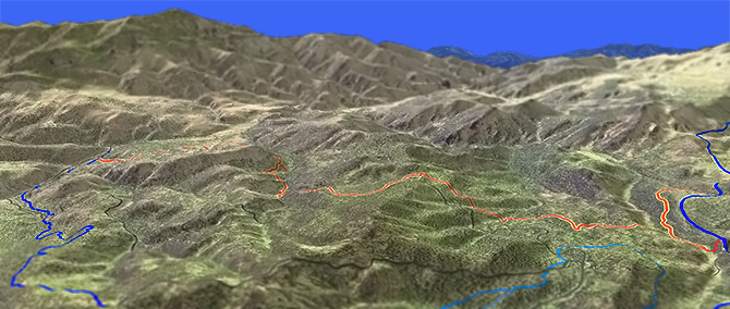
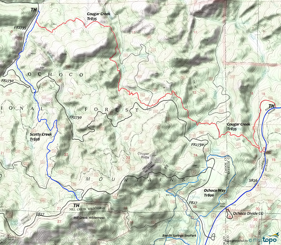
Cougar Creek Tr835
Twitter Search
#ochocos

Overall: 5
Aerobic: 6
Technical: 4
Steepness: 5
Flow: 5
Singletrack: 80%
The Prineville Oregon Cougar Creek Trail was a pack trail in use from 1915-1922 by early Forest Rangers and settlers traveling between Prineville and the John Day River, with doubletrack narrowing to singletrack.
Type
OAB
Length
Avg: 15mi
Ascent
Moderate
Elevation Change
TH:4300'
Avg Ascent:4350'
Ascent Incline
9%
Duration
Avg: 3hr
Weather
Forecast
NOAA
popup
USFS
Starting from the SR26 TH results in an inverted ride profile, when riding to the FR2735 TH. Driving to the western TH would provide a better ride profile, but would be time consuming.
If Scotty Creek Tr838 is ridable, then a CW loop creates an alternate route. Ride SR26, FR27 then Scotty Creek Tr838 to Cougar Creek Tr835. The forest service does not suggest Scotty Creek Tr838 for biking. As with any trail, if not recently ridden it may not be in good enough condition for riding.
The 2014 Bailey Butte fire burned this area, resulting in charred ponderosa pine and conifer trees, and some erosion.
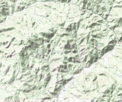
Bandit Springs SnoPark: The intersections are all marked with letters as shown on the Area map.
Ponderosa Tr801 is the main snopark connector and 1.6mi beginner loop over relatively flat terrain
The 2.9mi Ochoco Way Tr806 is considered most difficult, with some steep terrain between FR2730 and FR27 (CCW loop, 500' ascent).
McGinnis Creek Tr802 is a 4mi CCW intermediate doubletrack route through old ponderosa pine forest.
Woodpecker Tr810 is a 1.3mi intermediate CW loop with steady 300' ridgeline ascent, leading to a steep descent to Ponderosa Tr801.
If there is no snow at the SR26 snopark, try FR27. A shelter is located near FR27 on Ochoco Way Tr806.
For experienced backcountry skiiers: On the way to Whistler Spring CG on FR27 at 6181' is the View Point, a 12mi ridgeline OAB. Maps are available from the Forest Service.
Green Mountain
The Green Mountain area is used for grazing (there may be cows), so please leave all gates as they are found. Green Mountain Tr831 is multiuse, so please share the trail. Trail conditions may not be suitable for biking when wet or if used extensively by ORV.
The southern Green Mountain TH is at FR3380, a 3.2mi rough secondary gravel road. The total elevation gain on the 8mi trail is about 1700', so stronger riders might consider an OAB starting from FR3380.
Technically challenging and sometimes steep sections intermix with rolling terrain through juniper and pine forests.
Steins Pillar Tr837 wanders through meadows and old growth forest to a 400' volcanic plug (outcrop), offering views of Mill Creek valley.
Giddy-Up-Go Tr830 is an equestrian loop around the Dry Creek drainage, consisting of a mix of doubletrack and singletrack.
The area trails are open to equestrians, so please be sure to yield and not startle the horses.
Directions: See Map. From Prineville, go east 27mi on US26 to just past the Ochoco Divide. View Larger Map. No Map?.

OAB Directions
down and out
- TH: Ride FR650 for 1.1mi or start from the alt SR26 TH. Cross FR555 at 1.8mi. At 2mi, go right onto FR550, for .2mi then find the trail on the left side of the road.
- 2.2mi: Exit FR550 then after a short distance go left onto FR556 and continue for .3mi. Cross Dodds Creek at 2.5mi, then go left at the curve to rejoin the trail.
- 3.4mi: Cross FR502 then FR501. This is the ride summit. Parallel FR2730 then cross FR450 at 3.9mi. Descend the switchbacks to Cougar Creek.
- 4.6mi: Cross Cougar Creek and descend the drainage to the 5.6mi connector to FR450. The trail turns away from the creek at 6mi, crosses several smaller creeks, then ends at Scotty Creek Tr838.
- 7.6mi: At Scotty Creek Tr838, either continue on to the FR2735 TH or turn around and return to the SR26 TH.
Mill Creek Wilderness Hiking
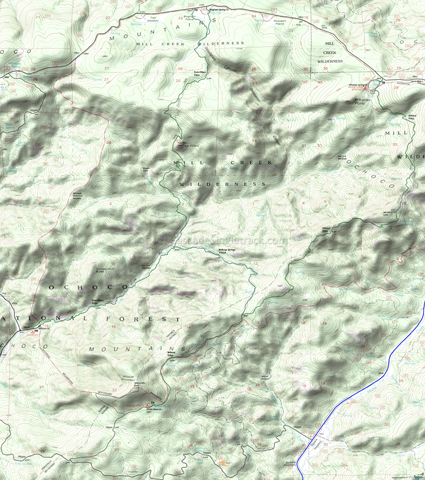
Easy access from Prineville and the Twin Peaks help make the Mill Creek Wilderness a popular hiking destination.
Twin Peaks are a pair of 200' volcanic plugs, exposed by surrounding material erosion.
Wildcat Tr833 is a lightly used ridgeline trail through a mixed conifer forest, with some sections open to cattle grazing.
Belknap Springs Tr833A is a 2.2mi connector trail, which follows a ridgeline above Belknap Creek.
Twin Pillars Tr832 follows Mill Creek, with many side stream crosssings prior to crossing Brogan Creek on the 5.5mi hike to Two Pillars from the Wildcat CG.
Trail Index
This Ride
Cougar Creek Trail 835
Area
Green Mountain Trail 831, Lookout Mountain Trail 804, Round Mountain Trail 805, Scotty Creek Trail 838
Mill Creek Wilderness
Belknap Springs Trail 833A, Twin Pillars Trail 832, Wildcat Trail 833
Hiking
Giddy-up-Go Trail 830, Steins Pillar Trail 837
XC Ski
Bike Tie Trail 810A, Easy Trail 811, McGinnis Creek Tr802, Ochoco Way Tr806, Ponderosa Trail 801, Ridge Trail 802A, Woodpecker Trail 810
Campgrounds
Bingham Spring Campground, Ochoco Divide Campground, Whistler Spring Campground, White Rock Campground, Wildcat Campground
Trail Rankings
Ranking consistently applied to all of the listed trails.
- Overall Rating: Ride quality and challenge
- Aerobic: Ascent challenge
- Technical Difficulty: Terrain challenge
- Steepness: Average incline
- Flow: Uninterrupted riding
- Elevation Change: Total elevation gain
- Ride Difficulty: Terrain challenge


