Lookout Mountain Tr804
Twitter Search
#ochocos

Overall: 6
Aerobic: 7
Technical: 4
Steepness: 6
Flow: 6
Singletrack: 100%
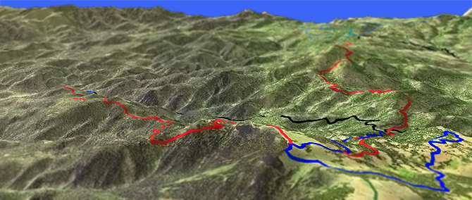
Located just east of Prineville Oregon, the Lookout Mountain Trail offers a great late summer loop ride, ascending to the highest peak in the Ochoco Mountains.
Type
Loop
Length
Avg: 19mi
Ascent
Moderate
Elevation Change
TH:4000'
Avg Ascent:4500'
Ascent Incline
11%
Duration
Avg: 4hr
Weather
Forecast
NOAA
popup
USFS
XC Skiing
Independent Mine Tr808 and lower Lookout Mountain Tr804 are suitable for backcountry XC Ski, with a winter shelter near the Lookout Mountain summit.
The Walton Lake Sno-Park is located at the intersection with FR135 and extends north and east of the lake. Walton SnoPark Map

The ride starts at the Ochoco Ranger Station, ascending FR42 and Independent Mine Tr808 to the upper Lookout Mountain Tr804 TH, descending the northeast side of Lookout Mountain.
Offering a great view of the Cascade range, the upper sections of Lookout Mountain are marshland meadows, prone to flooding and high enough to be covered in snow till late Spring.
Lookout Mountain is managed as a semi-primitive area. The spring melt occurs sooner than in the Cascade range.
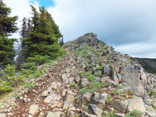
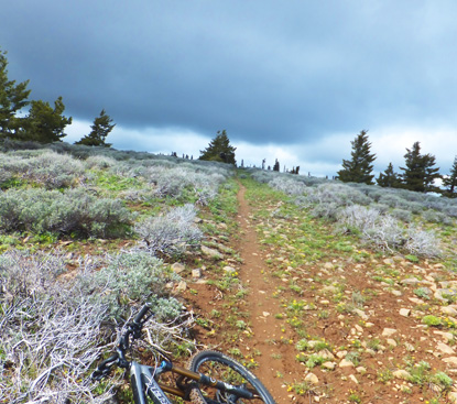
Accessible from a side path, the Lookout Mountain summit has the foundation remnants of the old lookout, in the middle of a sagebrush meadow (yellow balsamroot, blue larkspur, lupine and red scarlet gilia) that runs the length of Lookout Mountain.
Just downhill from the intersection with Independent Mine Tr808 is a log winter sports shelter with fireplace.
Do not explore the Motherlode mine or mine tailing areas due to hazardous conditions. Baneberry Tr812 offers a short hike to an abandoned miners camp.
COTA has an agreement with the forest service to maintain Lookout and Round Mountain Trails.
Directions: See Map. Use the ranger station parking area or park at the TH. Go on SR26 through Prineville, then go 16mi to CR23 (Ochoco Cr Rd) and continue 8mi to the TH. View Larger Map. No Map?.


Loop Directions
a motherlode of climbing
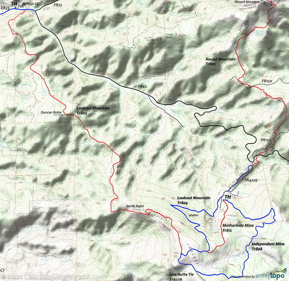
Lookout Mountain Area Topo Map
- TH: Go left from the parking area on CR23 (Ochoco Ranger Rd), Past the lower Lookout Mountain Tr804 TH, to FR42 (Canyon Creek Rd).
- 0.3mi: Go right onto FR42 and ascend 6.6mi to FR4205. Ascend the road or Independent Mine Tr808 to the Motherload Mine upper parking area.
- 7.7mi: Cross the road and find the Independent Mine Tr808 TH and parking area. Ascend the trail to the upper Lookout Mountain Tr804 intersection, crossing Brush Creek along the way, passing the Line Butte Tr807 on the left at 11.3mi.
- 11.8mi: Pass the Lookout Mountain Tr804 intersection and continue on Lookout Mountain Tr804. Cross the meadows to North Point.
- 13mi: Descend the steep grade from North Point, then ascend Duncan Butte at 15.6mi.
- 16.1mi: Pass the Duncan Butte summit and descend to the lower TH. Sections of the trail are narrow and require speed control.
Trail Index
This Ride
Independent Mine Trail 808, Lookout Mountain Trail 804
Hiking
Baneberry Trail 812, Line Butte Tr807, Line Butte Tie Tr807A, Motherlode Mine Tr808A
XC Ski
Campgrounds
Canyon Creek Campground, Ochoco Campground, Walton Lake Campground
Trail Rankings
Ranking consistently applied to all of the listed trails.
- Overall Rating: Ride quality and challenge
- Aerobic: Ascent challenge
- Technical Difficulty: Terrain challenge
- Steepness: Average incline
- Flow: Uninterrupted riding
- Elevation Change: Total elevation gain
- Ride Difficulty: Terrain challenge


