Round Mountain Tr805
Twitter Search
#Ochocos

Overall: 6
Aerobic: 6
Technical: 4
Steepness: 6
Flow: 5
Singletrack: 100%
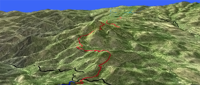
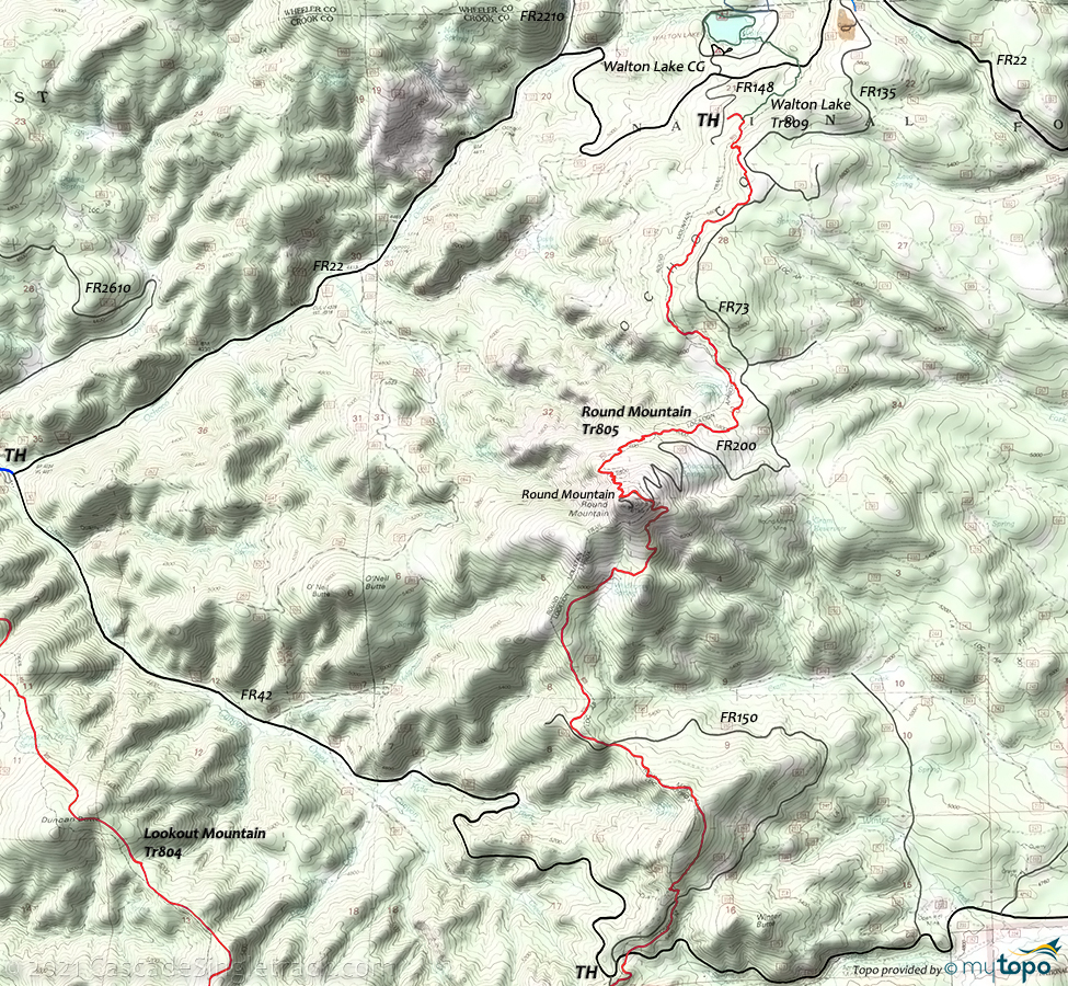
Starting at Walton Lake, the Prineville Oregon Round Mountain Trail ascends a long, sustained grade to the summit of Round Mountain, followed by a steep descent to FR42.
Type
OAB
Length
Avg: 8.8mi
Ascent
Moderate
Elevation Change
TH:5450'
Avg Ascent:2250'
Ascent Incline
12%
Duration
Avg: 3hr
Weather
Forecast
NOAA
popup
USFS
From Walton Lake, Round Mountain Tr805 switchbacks to a bench then ascends steeply to the summit, followed by a steep descent to FR42.
The trail offers a great northern view of the Cascade range, and can be combined with Lookout Mountain Tr804 as a full day semi-epic ride.
Even at high elevation, the spring melt occurs sooner in the Ochoco mountains than in the Cascade range, making this a late Spring to Fall ride.
The best non-shuttle (and non-multi-peak) option is an 8mi OAB to Round Mountain Summit from Walton Lake.
There are some signal transponders at the Round Mountain summit, but no cell service exists in this area. The area is also relatively dry, so bring plenty of water.
Do not explore the Motherlode mine or mine tailing areas due to hazardous conditions. Baneberry Tr812 offers a short hike to an abandoned miners camp.
COTA has an agreement with the forest service to maintain Lookout and Round Mountain Trails.
Directions: See Map. Use the ranger station parking area or park at the upper TH. Go on SR26 through Prineville, then go 16mi to CR23 (Ochoco Cr Rd) and continue 8mi to the ranger station. Conitnue 6.5mi on FR22 to Walton Lake. View Larger Map. No Map?.


OAB Directions
return to walton
- TH: From Walton Lake, go left on FR22 to FR148, then ride .5mi to the TH. Ascend through switchbacks for .5mi to the upper bench.
- 0.5mi: Ride across meadows to the base of Round Mountain. This route parallels FR073.
- 2.3mi: Pass the Scissors Creek headwaters, then ascend at a steady 12% grade to the Round Mountain Summit.
- 4.0mi: Reach the summit. If continuing on to Lookout Mountain Tr804, go left onto FR200 for 0.3mi to the hairpin turn, watching for the Round Mountain Tr805 trail marker on the right. Descend to Wildhorse Spring, crossing Cram Creek.
- 6.5mi: Cross FR150, then ascend the headwaters of Kyle Creek. Cross FR150 again at 7.9mi, then conitnue to FR42.
- 8.4mi: Cross FR42 (Canyon Creek Rd) if continuing on to Lookout Mountain Tr804.
Walton Lake Snopark
FR22 is plowed about once per week, so getting to the Snopark is likely to require a 4WD vehicle and may be impassable. Contact the Ranger Station for conditions prior to use.
Sno Park permit required between Nov 15th and Apr 30th. See the Ochoco NF Walton Snopark page for more area info. Some of this terrain is also open for Snomobile use (see NF map).
Trail Index
This Ride
Round Mountain Trail 805
Hiking
Walton Lake Trail 809
XC Ski
Campgrounds
Canyon Creek Campground, Ochoco Campground, Walton Lake Campground
Trail Rankings
Ranking consistently applied to all of the listed trails.
- Overall Rating: Ride quality and challenge
- Aerobic: Ascent challenge
- Technical Difficulty: Terrain challenge
- Steepness: Average incline
- Flow: Uninterrupted riding
- Elevation Change: Total elevation gain
- Ride Difficulty: Terrain challenge


