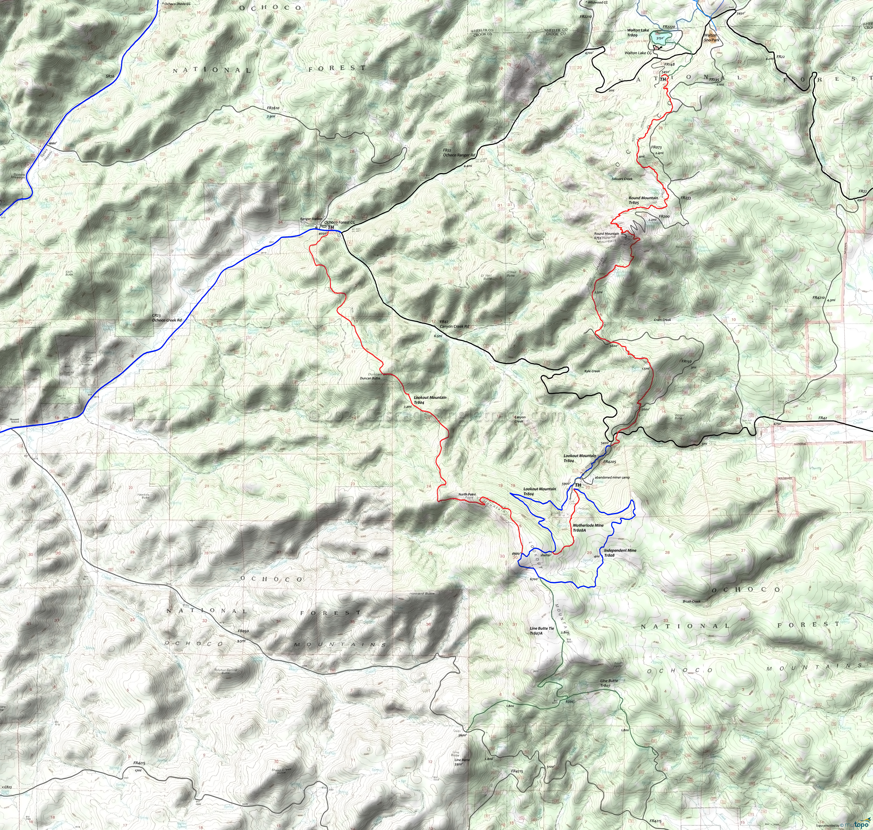
Lookout and Round Mtn Trails Mountain Biking and Hiking Topo Map
Map includes: Lookout Mountain Trail, Independent Mine Trail, Motherlode Mine Trail, Line Butte Tie Trail, Line Butte Trail, Round Mountain Trail, Walton Lake Mountain Bike and Hiking Trails.
Round Mtn: From Walton Lake, go left on FR22 to FR148, then ride .5mi to the TH. Ascend through switchbacks for .5mi to the upper bench.
0.5mi: Ride across meadows to the base of Round Mountain. This route parallels FR073.
2.3mi: Pass the Scissors Creek headwaters, then ascend at a steady 12% grade to the Round Mountain Summit.
4.0mi: Reach the summit. If continuing on to Lookout Mountain Tr804, go left onto FR200 for 0.3mi to the hairpin turn, watching for the Round Mountain Tr805 trail marker on the right. Descend to Wildhorse Spring, crossing Cram Creek.
6.5mi: Cross FR150, then ascend the headwaters of Kyle Creek. Cross FR150 again at 7.9mi, then conitnue to FR42.
8.4mi: Cross FR42 (Canyon Creek Rd) if continuing on to Lookout Mountain Tr804.
Draggable map: Map window adjusts to screen size and will respond to touch control. Use scrollbar for mouse control.
No Map? Browser settings and some browser extensions can prevent the maps from appearing. Please see Site Tech


