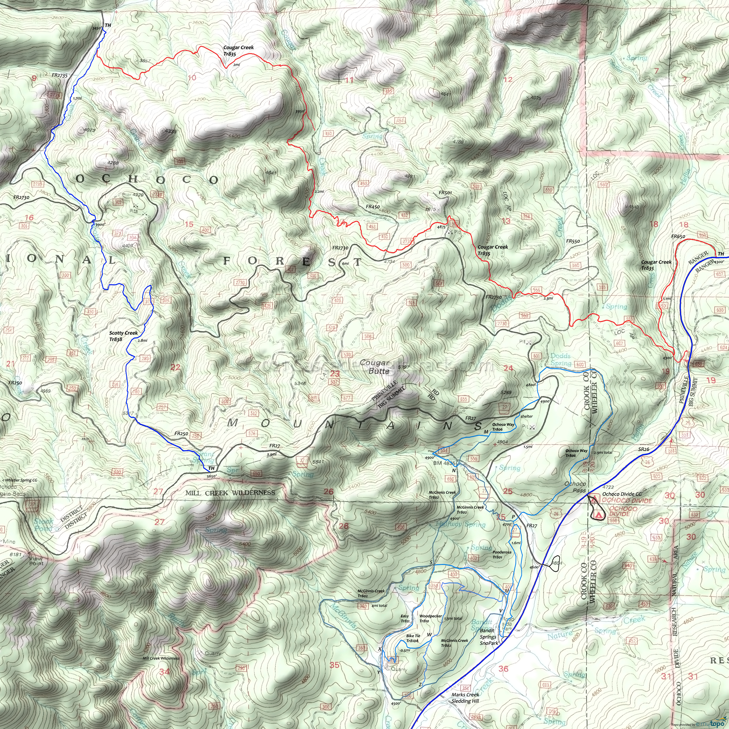
Cougar Creek Mountain Biking and Hiking Topo Map
Map includes: Bike Tie Trail, Cougar Creek, Easy Trail, McGinnis Creek, Ochoco Way, Ponderosa Trail, Ridge Trail, Scotty Creek, Woodpecker Mountain Bike, Hiking and XC Ski Trails.
TH: Ride FR650 for 1.1mi or start from the alt SR26 TH. Cross FR555 at 1.8mi. At 2mi, go right onto FR550, for .2mi then find the trail on the left side of the road.
2.2mi: Exit FR550 then after a short distance go left onto FR556 and continue for .3mi. Cross Dodds Creek at 2.5mi, then go left at the curve to rejoin the trail.
3.4mi: Cross FR502 then FR501. This is the ride summit. Parallel FR2730 then cross FR450 at 3.9mi. Descend the switchbacks to Cougar Creek.
4.6mi: Cross Cougar Creek and descend the drainage to the 5.6mi connector to FR450. The trail turns away from the creek at 6mi, crosses several smaller creeks, then ends at Scotty Creek Tr838.
7.6mi: At Scotty Creek Tr838, either continue on to the FR2735 TH or turn around and return to the SR26 TH.
Draggable map: Map window adjusts to screen size and will respond to touch control. Use scrollbar for mouse control.
No Map? Browser settings and some browser extensions can prevent the maps from appearing. Please see Site Tech


