Twitter Search
#MillCreekWilderness
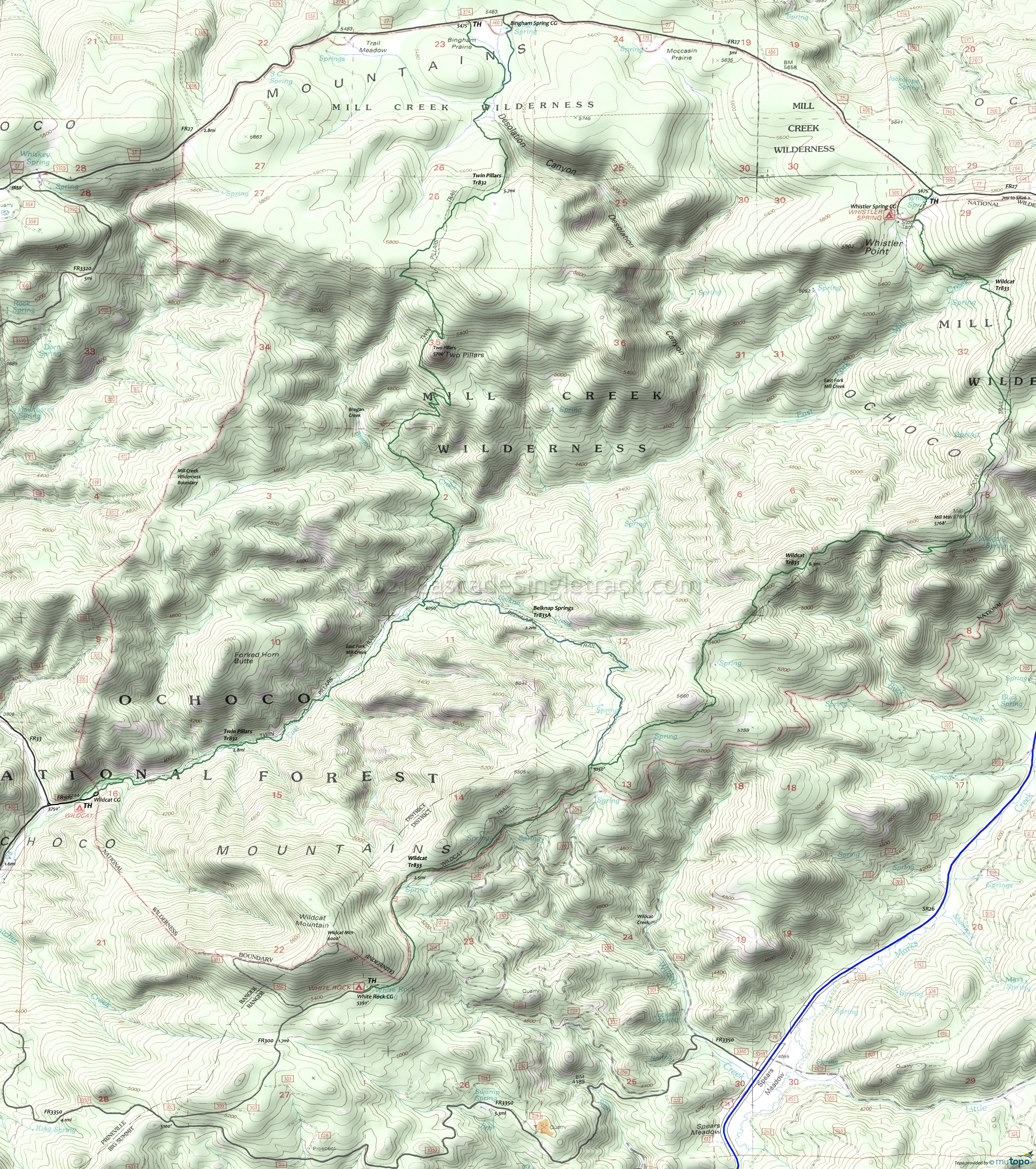
Mill Creek Wilderness Trails Hiking Topo Map
Map includes: Wildcat Trail, Belknap Springs Trail and Twin Pillars Hiking Trail.
Area is recovering from the 2017 Desolation Canyon fire, so be sure to get current conditions before visiting.
Easy access from Prineville and the Twin Peaks help make the Mill Creek Wilderness a popular hiking destination.
Twin Peaks are a pair of 200' volcanic plugs, exposed by surrounding material erosion.
Wildcat Tr833 is a lightly used ridgeline trail through a mixed conifer forest, with some sections open to cattle grazing.
Belknap Springs Tr833A is a 2.2mi connector trail, which follows a ridgeline above Belknap Creek.
Twin Pillars Tr832 follows Mill Creek, with many side stream crosssings prior to crossing Brogan Creek on the 5.5mi hike to Two Pillars from the Wildcat CG.
See the Ochoco NF Site for closures.
As always, it is best to call the local Ranger District for trail conditions and other restrictions prior to visiting, as the ONF website may not contain trip-specific details.
Draggable map: Map window adjusts to screen size and will respond to touch control. Use scrollbar for mouse control.
No Map? Browser settings and some browser extensions can prevent the maps from appearing. Please see Site Tech


