Woods Line Rail to Trail
Twitter Search
#woodslinetrail

Overall: 4
Aerobic: 4
Technical: 3
Steepness: 2
Flow: 6
Singletrack: 0%
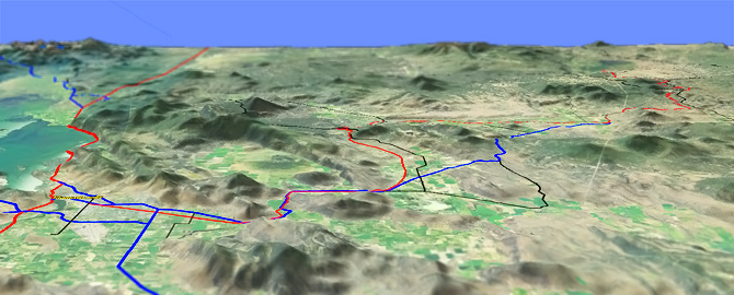
The Klamath Falls Oregon 109mi OCnE and Woods Line Rail To Trail system consists of two logging railroads, the OC%E (Oregon, California and Eastern Railroad) from Klamath Falls to Bly, and the Woods Line Railroad from Beatty to the Sycan Marsh. Built between 1917 and 1930, the railroad operated until 1990, when the line was converted to a trail system.
Type
OAB
Length
Avg: 68mi
Ascent
Easy
Elevation Change
TH:4300'
Avg Ascent:2700'
Ascent Incline
4%
Duration
Avg: 6hr
Weather
Forecast
NOAA
popup
USFS
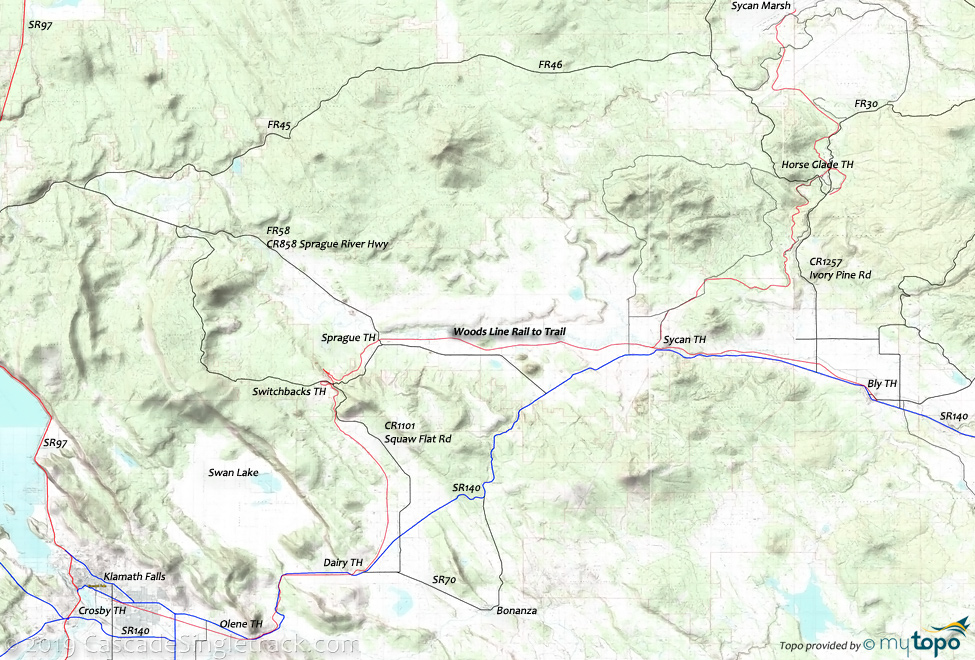
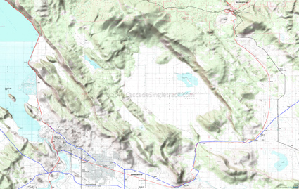
Klamath Falls to the Switchback TH is mostly flat terrain, covered on the southern topo map below. The ride stats are based on Woods Line, between Beatty and Sycan Marsh. An OCnE map for the section between Klamath Falls and the Switchback TH is also provided. Expect a lot of local traffic near Klamath Falls. The trail is paved between Klamath Falls and Olene, and gated at Olene (please close the gate when passing through).
The 50' high and 400' long Merritt Creek Trestle is a trail highlight. The trail breaks, then continues 7mi beyond the Sycan marsh (not shown on map), for those exploring the northern section of the trail system (please no biking in the marsh).
Oregon State Parks has an OCnE Woods Line brochure and other trail info.
The Horseglade TH has a picnic table, campfire ring, vault toilet and a parking area. Dispersed camping is permitted.
Directions: SR140 to Beatty, then ride from the Beatty siding. Horseglade TH: SR140 to CR1257 Ivory Pine Rd to FR30 to FR27 to the TH. View Larger Map. No Map?.

OAB Directions
ride to merritt
- TH: Ride from Beatty Station, crossing the Sprague River and passing the Sycan Siding. Cross several roads then reach Fivemile Creek at 8.5mi, crisscrossing the creek for a few miles.
- 19.8mi: Cross FR27 and pass the Horseglade TH. Pass FR30 at 23mi, reaching Merritt Creek trestle at 27mi.
- 34mi: Reach the Sycan River. Take a break at the Sycan Marsh then return to the TH.
Klamath Falls OCnE to the Switchback TH
The trail is paved between Klamath Falls and Olene, and gated at Olene (please close the gate when passing through). The Olene Gap is a narrow break in the mountain through which passes the trail, the Lost river and SR140.
Pass through juniper and sagebrush to Dairy. Near the Swithcback TH are the Devils Garden volcanic remains.
The double switchbacks allowed trains to pass through this ride summit.
Mosquitoes are ferocious in this area until August. Feel free to try the natural repellents, and avoid drinking carbonated drinks prior to riding, but Deet 100 may be the only protection from 'the swarm'. Expect some trailside poison oak and prepare as needed. Try using Tecnu before the ride.
Trail Index
This Ride
OCnE Woods Line Rail to Trail
Campgrounds
Horseglade Camp
Trail Rankings
Ranking consistently applied to all of the listed trails.
- Overall Rating: Ride quality and challenge
- Aerobic: Ascent challenge
- Technical Difficulty: Terrain challenge
- Steepness: Average incline
- Flow: Uninterrupted riding
- Elevation Change: Total elevation gain
- Ride Difficulty: Terrain challenge


