Rogger Meadow to Crane Mountain Tr161
Twitter Search
#roggermeadow

Overall: 7
Aerobic: 6
Technical: 5
Steepness: 5
Flow: 6
Singletrack: 100%
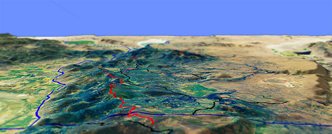
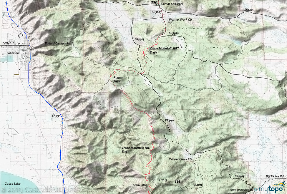
The Lakeview Oregon Crane Mountain National Recreation Trail, or Crane Mountain Tr161, is a ridgeline ascent from Rogger Meadow 11mi to Crane Mountain, with views of the Goose Lake valley. The southern section has views of Mount Shasta.
The 2020 Crane Fire damaged most of this trail. See the NF Site for closures.
As always, it is best to call the local Ranger District for trail conditions and other restrictions prior to riding, as the NF website may not contain trip-specific details.
Type
OAB
Length
Avg: 23mi
Ascent
Intense
Elevation Change
TH:6500'
Avg Ascent:3800'
Ascent Incline
6%
Duration
Avg: 4hr
Weather
Forecast
NOAA
popup
USFS
Due to the 6500' to 8000' terrain, expect snow on the trail till July, making this a good high summer ride.
The first 8mi are fairly moderate, with half of the elevation gain occurring in the final 3.4mi Crane Mountain ascent.
The Rogger Meadow to Crane Mountain section gets the most use, with a southern section from Crane Mountain to just across the border in California, and a Northern Fremont NRT (non-motorized) section from the Walker TH to Vee Lake.
The Camas Sno-Park provides an easy starting point, with the Walker TH suitable for the northern section and the FR4011 Willow Point TH suitable for the southern section. The 5-point FR3915 intersection Rogger Meadow TH can be used to shorten the ride.
Note: many roads in this area are unmaintained and may not be passable. They are shown with a lighter shade, as drop-out paths to the main roads.
Local clubs use about 30mi of ungroomed terrain (most of the forest roads shown) for nordic skiing.
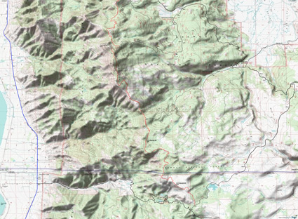
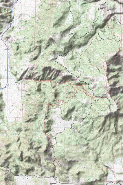
Crane Mountain NRT to Modoc
This map covers the less-frequented southern section, which terminates near Cave Lake. Due to light use, some pathfinding may be needed, so be sure to pack accordingly (thermal blanket, water, food).
Mosquitoes are ferocious in this area until August. Feel free to try the natural repellents, and avoid drinking carbonated drinks prior to riding, but Deet 100 may be the only protection from 'the swarm'. Expect some trailside poison oak and prepare as needed. Try using Tecnu before the ride.
Directions: Directions to the trailhead are a bit complicated. From Lakeview Ranger District Office, go on US395N for 2.5mi, turn right on SR140 and go for 8mi to FR3615. Walker TH: Go left on FR3615 then continue for 4.5mi. Rogger Meadow TH: Go turn right on FR3615. Start the ride from here or go .5mi and turn right on old SR140W (Clover Flat Rd 2-20) and go for 1.4mi then turn left on FR3915. Crane Mt TH: Continue on FR3915S for 9mi then turn right on FR4011. Go on FR4011 for 2.5mi, then turn left on FR012 and go .25mi to the TH. FR4011, past the turn off to the trailhead, goes to the top of Crane Mountain. If you choose to drive to the top of Crane Mt., the road is very rough and steep. View Larger Map. No Map?.

OAB Directions
ride it if you can find it
- TH: From the SR140 Camas Sno Park TH, ride FR3615 2mi, past the Warner Work Center and onto FR3910. Continue to the sharp curve and find the trail.
- 2.1mi: Ride 3mi to the FR3915 TH, then either find the trail on the far side of the intersection or ride FR030 to FR147 and continue around Rogger Peak.
- 8mi: Leave FR146 onto single track, crossing FR281 at 10mi. Switchback through some knolls then pass Red Peak at 12mi, then cross FR264.
- 13mi: Climb 800' over 1mi, then cross over to start another ridgeline ascent near Willow Point.
- 15.7mi: Go right on FR015 and ride to the Crane Mountain summit. Continue South over moderate terrain to the California border, or head back to the TH.
Fremont National Recreational Trail
From the Mill TH, ascend the Crooked Creek drainage for 7.5mi, through mixed conifer and large ponderosa pine forest. Then traverse Twelvemile Peak, McDowell Peak, and Crook Peak to the Swale TH and on to Vee Lake.
Mosquitoes are ferocious in this area until August. Feel free to try the natural repellents, and avoid drinking carbonated drinks prior to riding, but Deet 100 may be the only protection from 'the swarm'. Expect some trailside poison oak and prepare as needed. Try using Tecnu before the ride.
Trail Index
This Ride
Crane Mountain Trail 161
Area
Fremont National Recreational Trail 160
Campgrounds
Cave Lake Campground, Deep Creek Forest Camp, Dismal Creek Forest Camp, Lily Lake Campground, Mud Creek Campground, Vee Lake Campground, Willow Creek Forest Camp
Trail Rankings
Ranking consistently applied to all of the listed trails.
- Overall Rating: Ride quality and challenge
- Aerobic: Ascent challenge
- Technical Difficulty: Terrain challenge
- Steepness: Average incline
- Flow: Uninterrupted riding
- Elevation Change: Total elevation gain
- Ride Difficulty: Terrain challenge


