Twitter Search
#OregonTimberTrail
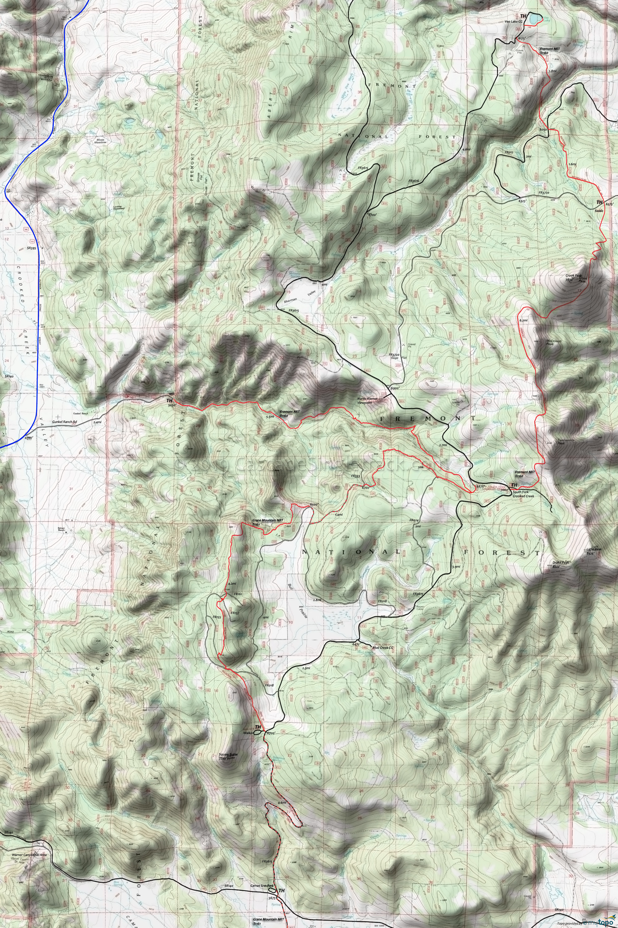
Fremont National Recreational Trail Mountain Biking and Hiking Topo Map
Oregon Timber Trail: The Fremont National Recreational Trail is part of the Fremont Tier route.
From the Mill TH, ascend the Crooked Creek drainage for 7.5mi, through mixed conifer and large ponderosa pine forest. Then gradually descend, traversing Twelvemile Peak, McDowell Peak, and Crook Peak to the Swale TH and on to Vee Lake.
Draggable map: Map window adjusts to screen size and will respond to touch control. Use scrollbar for mouse control.
No Map? Browser settings and some browser extensions can prevent the maps from appearing. Please see Site Tech


