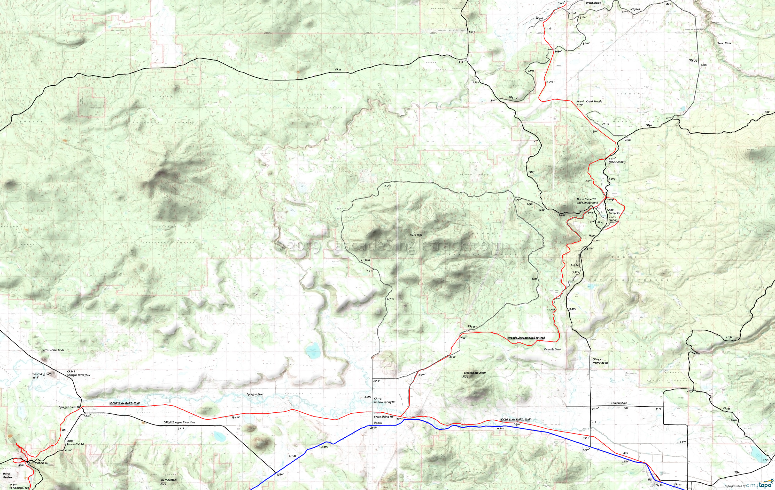
Woods Line Biking and Hiking Topo Map
TH: Ride from Beatty Station, crossing the Sprague River and passing the Sycan Siding. Cross several roads then reach Fivemile Creek at 8.5mi, crisscrossing the creek for a few miles.
19.8mi: Cross FR27 and pass the Horseglade TH. Pass FR30 at 23mi, reaching Merritt Creek trestle at 27mi.
34mi: Reach the Sycan River. Take a break at the Sycan Marsh then return to the TH.
Mosquitoes are ferocious in this area until August. Feel free to try the natural repellents, and avoid drinking carbonated drinks prior to riding, but Deet 100 may be the only protection from 'the swarm'. Expect some trailside poison oak and prepare as needed. Try using Tecnu before the ride.
Draggable map: Map window adjusts to screen size and will respond to touch control. Use scrollbar for mouse control.
No Map? Browser settings and some browser extensions can prevent the maps from appearing. Please see Site Tech


