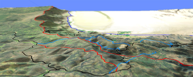
Hanan Tr142

Overall: 6
Aerobic: 5
Technical: 5
Steepness: 5
Flow: 6
Singletrack: 100%
The Paisley Oregon Hanan Trail accesses the Hanan Roadless Area and the headwaters of the Sycan River (a National Wild and Scenic River), part of a native transportation route into the upper Sycan River country, to travel from the Chewaucan Basin to Sycan Marsh.
The 2020 Brattain Fires damaged Hanan and Campbell trails. See the NF Site for closures.
As always, it is best to call the local Ranger District for trail conditions and other restrictions prior to riding, as the NF website may not contain trip-specific details.
Type
OAB
Length
Avg: 14.5mi
Ascent
Moderate
Elevation Change
TH:6650'
Avg Ascent:1500'
Ascent Incline
4%
Duration
Avg: 3hr
Weather
Forecast
NOAA
popup
USFS
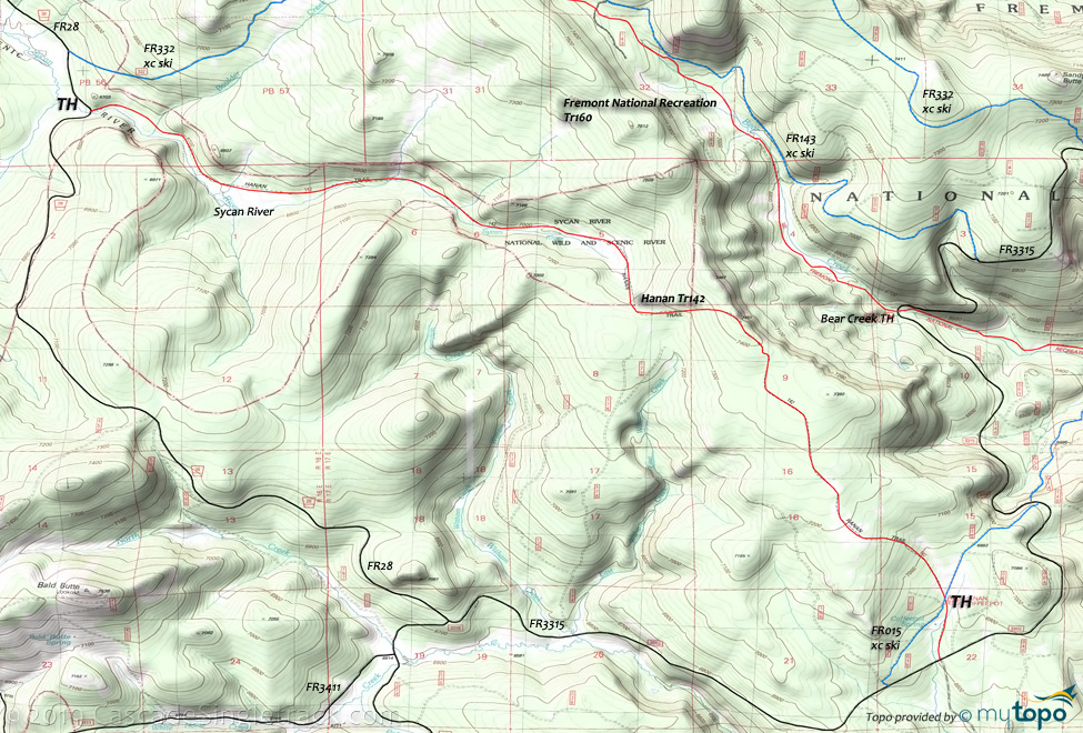
Hanan Tr142 crosses the divide between the Great Basin and the Pacific drainages on the top of Bear Creek Rim, resulting in a mid ride summit, although the terrain is moderate enough to enable a full OAB ride. The grade within 0.5mi of the Bear Creek Rim summit increases to 10%, so may require some hike-a-bike for intermediate riders.
Pass through a diverse environment, with mixed conifer old growth stands, quaking aspen groves, a large scab-rock flat, dense stands of lodgepole pine, and large open upland meadows.
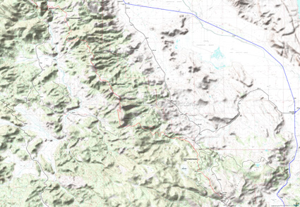
The ride could be combined with the Fremont National Recreation Tr160 into a loop, connected with FR3316 and FR332.
Fremont National Recreation Trail
The 42.5mi Fremont National Recreation Tr160 segment between Government Harvey Pass and Cox Pass offers high elevation sub-alpine vegetation, colorful lichen encrusted rimrocks, open ponderosa pine stands, dense stands of lodgepole pine, lush meadows, deeply shaded mixed conifer old growth stands, and sagebrush/juniper covered rolling hills. The trail is well signed and is marked with grey diamonds and red, white, and blue National Recreation Trail logo reassurance markers.
Headed south from the Chewaucan River crossing, the trail ascends a high ridge (2400' over 10mi) over rugged terrain to the Morgan Butte summit.
Fremont-Winema National Forest FRT #160 page.
The section between the Bear Creek TH and Gov't Harvey Pass is a steady, relatively even ascent out of the Bear Creek drainage to the 2000' high Winter Rim fault block.
Mosquitoes are ferocious in this area until August. Feel free to try the natural repellents, and avoid drinking carbonated drinks prior to riding, but Deet 100 may be the only protection from 'the swarm'. Expect some trailside poison oak and prepare as needed. Try using Tecnu before the ride.
Directions: From the Paisley Ranger District Office, go 11mi north on SR31, then go left onto FR29 (Gov't Harvey Rd), continuing 10mi to the top of Winter Rim. Go left at Gov't Harvey Pass intersection then continue for 2mi to FR28. Go left onto FR28 and continue 4.5mi to the TH. This trailhead is surrounded by a pole fence. The Coffeepot TH is 18mi from Paisley on (Mill Street then) FR3315. View Larger Map. No Map?.

OAB Directions
sycan to rim
- TH: Ascend alongside the Sycan river, crossing several side drainages on the way to the top of the valley.
- 3.3mi: Increasing ascent to the ride summit, near the Bear Creek rim, then descend to the Coffeepot TH.
- 7.2mi: At FR3315, return to the FR28 TH or go to the Fremont National Recreation Tr160 Bear Creek TH and ascend to FR332 or FR29, then return to the FR28 TH.
Fremont National Recreational Trail - Cox to Chewaucan
From the Cox Pass TH, ascend to the manned Morgan Butte lookout, passing through level terrain near Moss Pass but otherwise encountering mixed terrain as the trail shifts from ridgeline to valley.
The Moss Pass to Round Mountain ascent is steep enough to require some hike-a-bike, with many elevation changes between Round Mountain and Morgan Butte.
Avery Pass to Chewaucan Crossing has a flat section near Burford Canyon to break the steep descent to FR33.
Overall this 29mi segment of the Fremont National Recreational Trail involves an ascent of 5500', requiring strong intermediate climbing and technical skills.
Other segments of the FRT are covered on the Antler Springs Trail 160 and Crane Mountain Trail 161 pages.
Mosquitoes are ferocious in this area until August. Feel free to try the natural repellents, and avoid drinking carbonated drinks prior to riding, but Deet 100 may be the only protection from 'the swarm'. Expect some trailside poison oak and prepare as needed. Try using Tecnu before the ride.
Trail Index
This Ride
Hanan Trail 142
Area
Antler Springs Trail 160, Cottonwood Creek Trail 127, Crane Mountain Trail 161, Dead Horse Rim Trail 139, Fremont National Recreation Trail 160
Hiking
Slide Lake Trail 144, Withers Lake Trail 143
XC Ski
Hadley Sno Park
Campgrounds
Campbell Lake Campground, Dead Horse Lake Campground, Jones Crossing Campground, Lee Thomas Campground, Marsters Spring CG
Trail Rankings
Ranking consistently applied to all of the listed trails.
- Overall Rating: Ride quality and challenge
- Aerobic: Ascent challenge
- Technical Difficulty: Terrain challenge
- Steepness: Average incline
- Flow: Uninterrupted riding
- Elevation Change: Total elevation gain
- Ride Difficulty: Terrain challenge


