Twitter Search
#OregonTimberTrail
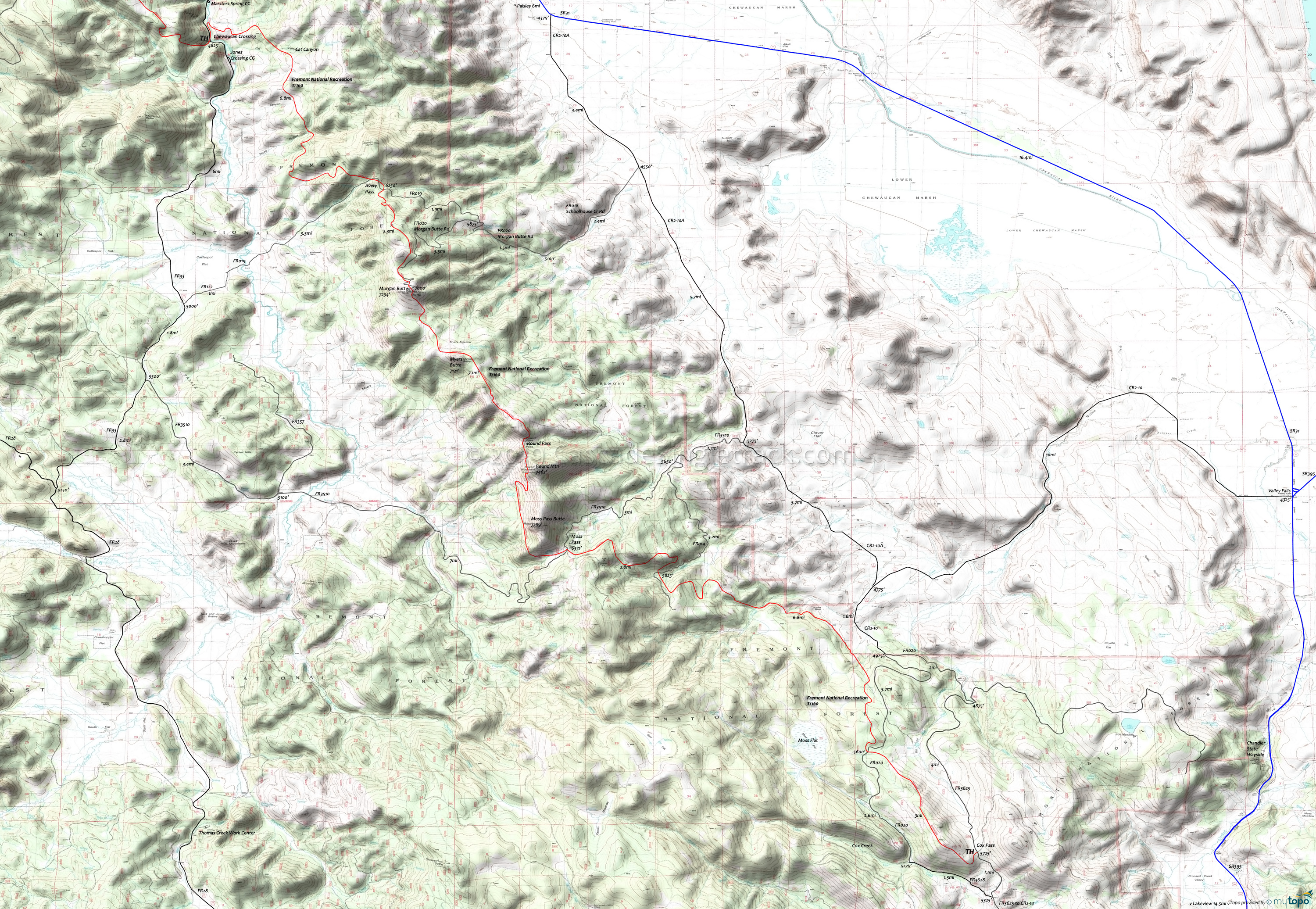
Fremont National Recreation Trail Mountain Biking and Hiking Topo Map
Oregon Timber Trail: The Fremont National Recreational Trail is part of the Fremont Tier route.
From the Cox Pass TH, ascend to the manned Morgan Butte lookout, passing through level terrain near Moss Pass but otherwise encountering mixed terrain as the trail shifts from ridgeline to valley.
The Moss Pass to Round Mountain ascent is steep enough to require some hike-a-bike, with many elevation changes between Round Mountain and Morgan Butte.
Avery Pass to Chewaucan Crossing has a flat section near Burford Canyon to break the steep descent to FR33.
Overall this 29mi segment of the Fremont National Recreational Trail involves an ascent of 5500', requiring strong intermediate climbing and technical skills.
Mosquitoes are ferocious in this area until August. Feel free to try the natural repellents, and avoid drinking carbonated drinks prior to riding, but Deet 100 may be the only protection from 'the swarm'. Expect some trailside poison oak and prepare as needed. Try using Tecnu before the ride.
Draggable map: Map window adjusts to screen size and will respond to touch control. Use scrollbar for mouse control.
No Map? Browser settings and some browser extensions can prevent the maps from appearing. Please see Site Tech


