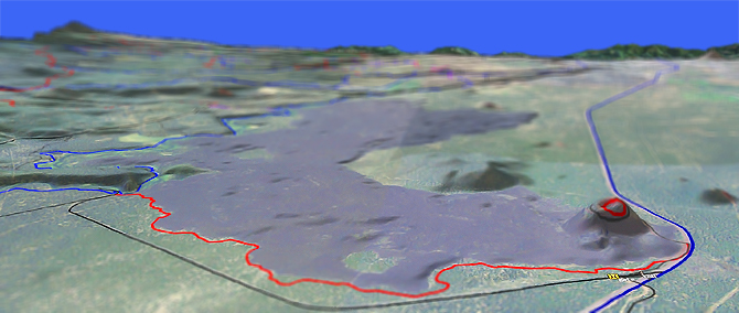
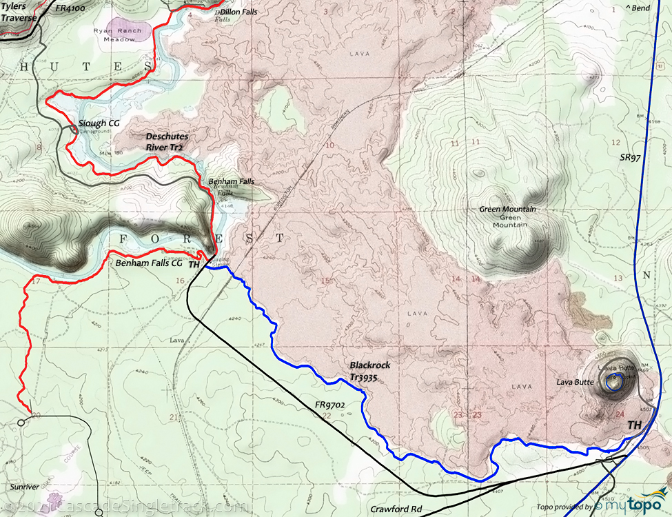
Lava Butte: Blackrock Tr3935
Twitter Search
#lavabutte

Overall: 5
Aerobic: 4
Technical: 4
Steepness: 3
Flow: 7
Singletrack: 100%
The Sunriver Oregon Blackrock Tr3935 connects to Deschutes River Tr2.1 at the periphery of the Lava Butte Geological Area, covering the kind of jagged, rocky terrain expected at the edge of a lava field.
Type
OAB
Length
Avg: 12.5mi
Ascent
Easy
Elevation Change
TH:4100'
Avg Ascent:1100'
Ascent Incline
1.5%
Lava Butte:9%
Duration
Avg: 2hr
Weather
Forecast
NOAA
popup
USFS
A scenic ride (not challenging enough to be a destination ride), there are a number of jeep trails which could be used to make this into a much longer loop but it is good enough as an end-of-day or last-day OAB ride.
The 1mi Lava Butte road ascends 470' (9% incline). The other 5.3mi. 420' ascent is at a 1.5% incline.
The ride can be extended by starting from one of the Deschutes Rvr Tr2 campgrounds and riding to Lava Butte.
Directions: See Map. View Larger Map. No Map?.

OAB Directions
conical grind
- TH: From the Benham Falls campground, cross FR9702 and the railroad tracks, and briefly climb to a plateau at .8mi then ascend moderately to a doubletrack at 2.7mi and continue ascending moderately to the Lava Butte road.
- 4.8mi: Go left onto FR100 and climb the cone, a short but steep circular grind to the top. Cruise around the top and get a good look at the Lava Butte Geological Area, then return to the TH.
Trail Index
This Ride
Blackrock Trail 3935, Deschutes River Trail 2.3
Area
Arnold Ice Cave Trail 3963, Charlton Lake Trail 19, Clover-Lemish Trail 18, Clover Meadow Trail 21, Coyote Loop Trail 3962, Crater Rim Trail 3957, Crescent to Windy Lake: Summit Lake Trail 46, Cultus: Deer Lake Trail 6, Edison-Lava Trail 31, Lily Lake Trail 19.3, Many Lakes Trail 15, Newberry Crater Trail 3958, Parallel Trail 3958.3, Peter Skene Ogden Trail 3956, Swamp Wells Trail 3961, Windy Lakes Trail 3850, Winopee Tie Trail 16.5
Bend Area
Bens Trail 50, COD Trail 71, Edison-Lava Trail 31, Elfin Magic Trail 45, Farewell Trail 26, Flagline Trail 41, Flagline Access Trail 40.1, Flagline Tie Trail 41.1, Funner, Grand Slam Trail 44, Kents Trail 43, KGB Trail 72, Mrazek Trail 32, MTB Trail 51, North Fork Trail 24.2, Phils Trail 42, Sector 16 Trail 27, Skyliners Trail 28, South Fork Trail 25, Sparks Lake Trail 4, Storm King Trail 48, Swampy Lake Trail 23, Swampy Loop Trail 23.2, Swampy-Dutchman Trail 40, Swede Ridge Trail 52, Tiddlywinks, Tumalo Creek Trail 25.1, Tumalo Ridge Trail 25.2, Voodoo Trail 46
Campgrounds
Aspen Campground, Benham Falls Campground, Dillon Falls Campground, Lava Island Campground, Meadow Campground, Siough Campground
Trail Rankings
Ranking consistently applied to all of the listed trails.
- Overall Rating: Ride quality and challenge
- Aerobic: Ascent challenge
- Technical Difficulty: Terrain challenge
- Steepness: Average incline
- Flow: Uninterrupted riding
- Elevation Change: Total elevation gain
- Ride Difficulty: Terrain challenge


