Horse Ridge
Twitter Search
#HorseRidge

Overall: 6
Aerobic: 5
Technical: 5
Steepness: 4
Flow: 7
Singletrack: 98%
The Bend Oregon Horse Ridge trail is one of the best area winter rides, along with Arnold Ice Cave Tr3963 and Gray Butte Tr852.
Type
Loop
Length
Avg: 15.5mi
Ascent
Moderate
Elevation Change
TH:3650'
Avg Ascent:2050'
Ascent Incline
4%
Duration
Avg: 2.5hr
Weather
Forecast
NOAA
popup
BLM

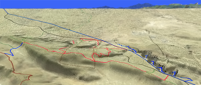
The 40 square mile region of lava and juniper is managed by the Prineville District of the Bureau of Land Management, bounded to the north by Oregon Badlands Wilderness and Dry River Canyon to the northeast. Pine Mountain is at the ridge's southeast quarter.
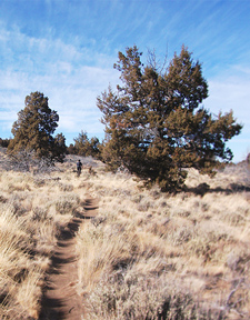
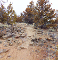
The trail is buff, but rocky sections add some technical challenges, requiring some attention and speed control to navigate the best line.
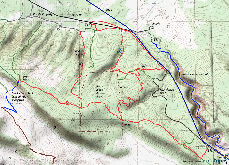
The aptly named Sand Canyon is the primary descent route but the ride can be lengthened by descending the mid-route, which winds through the hillside prior to the final, fast run to the TH.
The abandoned road provides a very steady, moderate ascent route. Those seeking more challenge can ascend the mid-route, as indicated by the arrows on the map. Ascending Sand Canyon should only be tried when no one else is around, to avoid spectacular, yet painful, collisions.
The area is covered in abandoned trails, some of which are marked as hiking trails on the map, little more than wildlife paths.
The Oregon Desert Trail passes to the south of the Horse Ridge area, shown on the area map. There is also an OHV loop access shown on the map, which ties into the South Millican seasonal OHV area.
The viewpoint offers a great view of Paulina Peak, Pine Mountain, Mount Bachelor and the ever-present Three Sisters peaks. There is a sandy hiking trail from the summit to a jeep trail, which leads to Fort Rock Rd, which is not useful for biking.
Note: Horse Ridge Summit is on the abandoned road, near US20, at the midpoint of the ascent. The ride peak is at the viewpoint of this reverse lollipop ride.
Please remain on the trail, especially in the Research Area. Biking has been allowed on the designated path through that area, which is clearly marked otherwise and would be cut off if the terrain became damaged from bike traffic.
Directions: See Map. From 3rd St in Bend, go east on US20 17.9mi to the Oregon Badlands Wilderness sign, then go right and continue .7mi to the Horse Ridge TH. View Larger Map. No Map?.


Loop Directions
a windy ridge
- TH: Go left at the sign, just off the parking area. Ride along the frontage road, passing the return intersection at .6mi.
- 1.9mi: After ascending slowly along US20, pass the other return intersection at 1.8mi then go right onto the abandoned highway and enjoy the moderate ascent to Horse Ridge Summit.
- 4.3mi: Pass a jeep trail at 4mi then go right onto Horse Ridge Trail at 4.3mi. Bear right at the 4.6mi intersection with an abandoned jeep trail. Crest a 5.2mi knoll then descend to the 6.4mi fence. Cross the fence and continue on the trail, which continues to be mildly technical. Manage the speed and pick lines carefully.
- 7.3mi: Cross the western research area fence and pass the Sand Canyon intersection on the moderate viewpoint ascent.
- 8.9mi: Enjoy the open view of Newberry, Mt Bachelor and the Three Sisters, then enjoy the fast descent to the first and second fence.
- 11.3mi: Go left just prior to the eastern fence, immediately scale a little technical knoll, then begin the increasingly fast, winding downhill to the frontage road trail and back to the TH. Watch for ascending bikers, as this route is often ridden in both directions.

Trail Index
This Ride
Horse Ridge Trails
Area
Arnold Ice Cave Trail 3963, Bessie Butte Trail 3968, Boyd Cave Trail 3966, Coyote Loop Trail 3962, Crater Rim Trail 3957, Fuzztail Butte Trail 3965, Hole in the Ground Trail, Lost Lake Trail 3958.2, Newberry #1 Trail 83901, Newberry #4 Trail 83904, Newberry #64 Trail 83964, Newberry #500 Trail 83950, Newberry Crater Trail 3958, Parallel Trail 3958.3, Peter Skene Ogden Trail 3956, Silica Trail 3925.5, Skeleton Cave Trail 3967, Swamp Wells Trail 3961
Bend Area
Bens Trail 50, COD Trail 71, Deschutes River Trail 2.3, Edison-Lava Trail 31, Elfin Magic Trail 45, Farewell Trail 26, Flagline Trail 41, Flagline Access Trail 40.1, Flagline Tie Trail 41.1, Funner, Grand Slam Trail 44, Kents Trail 43, KGB Trail 72, Mrazek Trail 32, MTB Trail 51, North Fork Trail 24.2, Phils Trail 42, Sector 16 Trail 27, Skyliners Trail 28, South Fork Trail 25, Sparks Lake Trail 4, Storm King Trail 48, Swampy Lake Trail 23, Swampy Loop Trail 23.2, Swampy-Dutchman Trail 40, Swede Ridge Trail 52, Tiddlywinks, Tumalo Creek Trail 25.1, Tumalo Ridge Trail 25.2, Voodoo Trail 46
Trail Rankings
Ranking consistently applied to all of the listed trails.
- Overall Rating: Ride quality and challenge
- Aerobic: Ascent challenge
- Technical Difficulty: Terrain challenge
- Steepness: Average incline
- Flow: Uninterrupted riding
- Elevation Change: Total elevation gain
- Ride Difficulty: Terrain challenge


