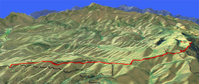
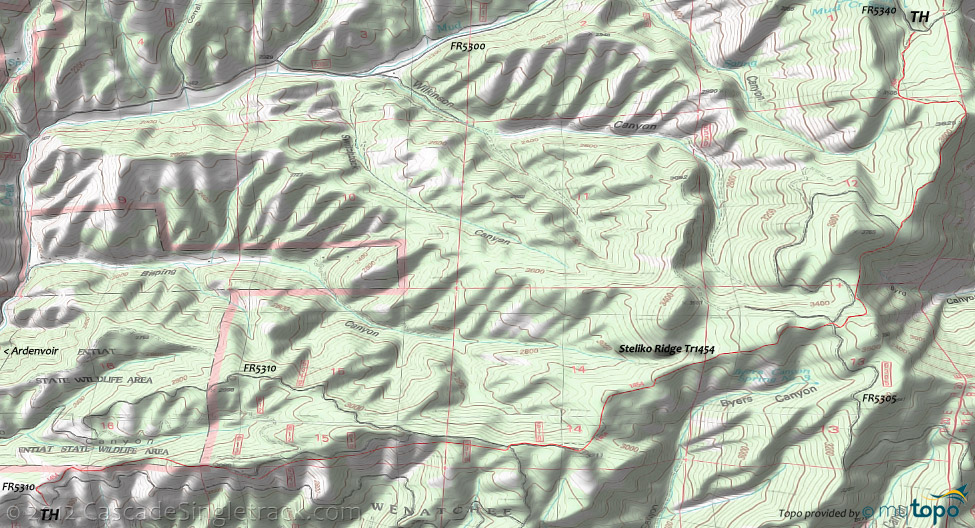
Steliko Ridge Tr1454
Twitter Search
#StelikoRidgeTrail

Overall: 5
Aerobic: 6
Technical: 5
Steepness: 6
Flow: 5
Singletrack: 100%
Not a destination ride, the Entiat Washington Steliko Ridge Trail winds through the Entiat State Wildlife Area.
Type
OAB
Length
Avg: 10mi
Ascent
Moderate
Elevation Change
TH:2500'
Avg Ascent:2350'
Ascent Incline
11%
Duration
Avg: 2hr
Weather
Forecast
NOAA
popup
USFS
The Entiat State Wildlife Area burned in 1994 so expect the typical regrowth foliage as the ride ascends along the ridgeline between Steliko and Byers Canyons.
Shuttling from the FR5340 TH would create a fast downhill ride, but the terrain is moderate enough for a reasonable OAB.
Directions: From Co Rd 19 go onto FR5310 (Steliko Lookout Rd) and go 2mi to the TH, just past the Steliko Lookout tower road. View Larger Map. No Map?.

OAB Directions
foothills ridgeline ride
- TH: From the FR5310 TH, ascend 600' over the first mile to reach the ridgeline, then ride alongside FR610 for another mile.
- 2.2mi: Cross FR5310 and ride .2mi on FR510, then bear left onto the trail. After riding through several saddles, climb to the next ridgeline at 2.9mi, cresting the top of a knoll at 3.5mi.
- 3.7mi: Cross FR5305 and bear right, with an unmarked doubletrack to the left. Ride alongside some Byrd Canyon cliff exposure then pass the doubletrack intersection at 4.5mi.
- 5.1mi: Turnaround at the ridgeline summit, or continue .7mi to FR5340, in a steep 460' descent.
Trail Index
This Ride
Steliko Ridge Trail 1454
Area
Angle Peak Orv Trail 1444, Billy Creek Trail 1416, Billy Ridge Trail 1413, Blue Creek Orv Trail 1426, Cougar Mountain Orv Trail 1420, Cougar Ridge Orv Trail 1418, Devils Backbone Orv Trail 1448, Entiat River Trail 1400, Four Mile Ridge Orv Trail 1445, Hi Yu Orv Trail 1403, Hornet Ridge Trail 1410, Jimmy Creek Trail 1419, Lake Creek Orv Trail 1443, Lost Lake Orv Trail 1421, Mad River Orv Trail 1409, Middle Tommy Orv Trail 1424, Miners Ridge Trail 1411, North Tommy Orv Trail 1425, Pond Camp Trail 1409.2, Tyee Ridge Orv Trail 1415
Trail Rankings
Ranking consistently applied to all of the listed trails.
- Overall Rating: Ride quality and challenge
- Aerobic: Ascent challenge
- Technical Difficulty: Terrain challenge
- Steepness: Average incline
- Flow: Uninterrupted riding
- Elevation Change: Total elevation gain
- Ride Difficulty: Terrain challenge


