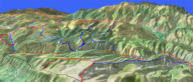
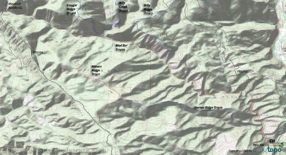
Mad River Orv Tr1409

Overall: 7
Aerobic: 6
Technical: 7
Steepness: 5
Flow: 7
Singletrack: 100%
Mad River Orv Tr1409 is a moderate river trail with steady climbing for 14mi, providing access to the Tyee Ridge trail system, and a fine river ride all by itself.
Type
OAB
Length
Avg: 29mi
Ascent
Moderate
Elevation Change
TH:1650'
Avg Ascent:5200'
Ascent Incline
5%
Duration
Avg: 5hr
Weather
Forecast
NOAA
popup
USFS
Trail
Review
Burned out in the 1994 Tyee Creek fire, the trail is a rough, technical climb, so either shuttle or be ready for some hike-a-bike.
The apocalyptic landscape will give plenty to look at along the way.
The Tyee Rdg Tr1415 page covers other Tyee Ridge loops.
An alternate descent can be created by combining Mad River Tr1409 with Miners Rdg Tr1411 and the very steep Hornet Rdg Tr1409 into a 28mi, 6700' ascent near-epic ride, for those seeking something more exciting than the Mad River Orv Tr1409 descent.
Mad River Tr1409 can be combined Tyee Ridge Orv Tr1415 and either Billy Cr Tr1416 or Billy Ridge Tr1413 into a too-epic 42mi, 9200' ascent CW lollipop. Bring some carbs.
Directions: NW Forest Pass required right at the TH. From Ardenvoir the Mad Rvr Rd turns into FR5700. Go to the Pine Flat CG. View Larger Map. No Map?.

OAB Directions
charred stumps and river snakes
- TH: Start climbing directly from the Pine Flats campground, passing the Hornet Ridge Orv Tr1410 intersection/river crossing on the left at 1.5mi.
- 3mi: Just past a creek crossing, hike-a-bike .5mi up a steep, rocky slope, then descend back to the riverside at 4.4mi and cross Windy Creek at 4.8mi.
- 6mi: Cross a small creek then pass a sharp fork, leading to the Camp Nine campground. Cross a creek at 7.2mi then pass the Young Creek Shelter at 8.1mi.
- 8.5mi: Just past the Young Creek crossing, pass the Billy Ridge Tr1413 intersection on the right, at 8.6mi.
- 9.8mi: Use the footbridge to cross to the south side of Mad River, then cross Alma Creek at 10.5mi. A side trail to the Cougar Creek shelter intersects with the trail at 10.6mi.
- 11mi: Cross to the north side of Mad River, near the Cougar Creek shelter, at the intersection with Cougar Ridge Orv Tr1418. Cross a small creek at 12.2mi, then cross Berg Creek at 13.5mi, near the Berg Camp.
- 14.3mi: Reach the Maverick Saddle campground. Either head back or extend the ride with some of the other loops mentioned.
Trail Index
This Ride
Hornet Ridge Trail 1410, Mad River Orv Trail 1409, Miners Ridge Trail 1411
Area
Alder Ridge Trail 1523, Basalt Ridge Trail 1515, Billy Creek Trail 1416, Billy Ridge Trail 1413, Blue Creek Orv Trail 1426, Chikamin Creek Orv Trail 1534, Chiwawa Orv Trail 1548, Cougar Mountain Orv Trail 1420, Cougar Ridge Orv Trail 1418, Entiat River Trail 1400, Hi Yu Orv Trail 1403, Jimmy Creek Trail 1419, Lost Lake Orv Trail 1421, Middle Tommy Orv Trail 1424, Nason Ridge Trail 1583, North Tommy Orv Trail 1425, Pond Camp Trail 1409.2, Tyee Ridge Orv Trail 1415
Wilderness
Campgrounds
Camp Nine Campground, Deer Camp Campground, Goose Creek Campground, Maverick Saddle Campground, Pine Flat Campground
Trail Rankings
Ranking consistently applied to all of the listed trails.
- Overall Rating: Ride quality and challenge
- Aerobic: Ascent challenge
- Technical Difficulty: Terrain challenge
- Steepness: Average incline
- Flow: Uninterrupted riding
- Elevation Change: Total elevation gain
- Ride Difficulty: Terrain challenge


