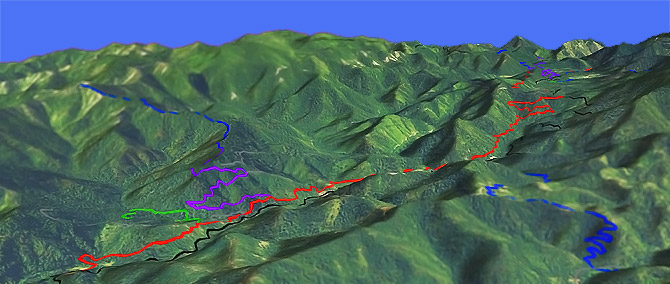
Taylor Creek Tr1142

Overall: 6
Aerobic: 6
Technical: 6
Steepness: 5
Flow: 6
Singletrack: 60%
The smooth and flowing Taylor Creek Tr1142 ascends Briggs Valley, crosses Lone Tree Pass, then descends the Taylor Creek drainage.
Type
Loop
Length
Avg: 20mi
Ascent
Moderate
Elevation Change
TH:1250'
Avg Ascent:6200'
Ascent Incline
7%
Duration
Avg: 4hr
Weather
Forecast
NOAA
popup
USFS
Note: this area has experienced many wildfires over the past decade. Please check trail conditions with the Forest Service, to ensure the trail has received maintenance in the current year.
Contact Rogue Valley MTB Assn if interested in helping with trail maintenance or for trail information.
The northern section has hillside exposure and a number of creek crossings. Damaged bridges may require wet crossings.
Taylor Creek Tr1142, serves a number of spur trails: Briggs Cr Tr1132, China Cr Tr1130, Dutchy Cr Tr1146.
Connectors: Minnow Creek Tr1156, China Cr Tr1130, Big Pine Spur, Dutchy Cr Tr1146 and Onion Way Tr1157.
Taylor Creek Tr1142 parallels FR25 to the south end of Briggs Valley.
Short of the northern TH, many riders start at the Taylor Creek Tr1142 FR035 Burned Timber Rd TH, across the bridge near Burned Timber Interpretive Tr1148.
The terrain is suitable for a Figure Eight, with moderate FR25 ascent to Lone Tree Pass. The section which descends south from Lone Tree Pass is referred to the Jedi, a fast and flowing descent into Briggs Valley.
A connector switchbacks to the Big Pine CG, or continue south on the short but steep Onion Way Tr1157 connector to loop Whiskey Gulch Tr1281 and Secret Way Tr1282.
Directions: I-5 Merlin exit 61, then go west on Merlin Galice Road. Go left onto FR25 and continue 3.7mi to the FR023 TH or the FR035 Burned Timber Rd TH. View Larger Map. No Map?.

OAB Directions
the jedi
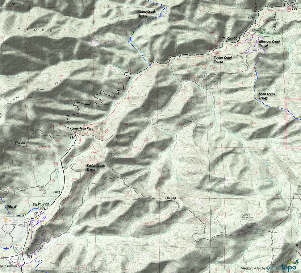
Taylor Creek, Shan Creek Area Topo Map
- TH: Ascend FR25 to Lone Tree Pass.
- 6.7mi: Go onto Taylor Creek Tr1142 (jedi section) and descend Briggs Valley.
- 10.1mi: Go left onto the connector, to Big Pine CG. Option: descend Onion Way Tr1157 to Whiskey Gulch Tr1281, returning on Secret Way Tr1282 or FR25.
- 11.7mi: Ascend FR25 to Lone Tree Pass.
- 13.6mi: Descend Taylor Creek Tr1142 switchbacks, resolving to a hillside descent back to the TH alongside Taylor Creek.
Trail Index
This Ride
Taylor Creek Trail 1142
Area
Briggs Creek Trail 1132, China Creek Trail 1130, Dutchy Creek Trail 1146, Hobson Horn Trail 1166, Little Silver Lake Trail 1184, Minnow Creek Trail 1156, Onion Way Trail 1157, Secret Way Trail 1282, Shan Creek Trail 1145, Whiskey Gulch Trail 1281
Hiking
Big Pine Interpretive Loop Trail 1155, Burned Timber Interpretive Trail 1148
Campgrounds
Big Pine Campground, Sam Brown Campground, Tin Can Campground
Trail Rankings
Ranking consistently applied to all of the listed trails.
- Overall Rating: Ride quality and challenge
- Aerobic: Ascent challenge
- Technical Difficulty: Terrain challenge
- Steepness: Average incline
- Flow: Uninterrupted riding
- Elevation Change: Total elevation gain
- Ride Difficulty: Terrain challenge


