Mount Muller Tr882
Twitter Search
#mullertrail

Overall: 6
Aerobic: 7
Technical: 6
Steepness: 7
Flow: 6
Singletrack: 100%
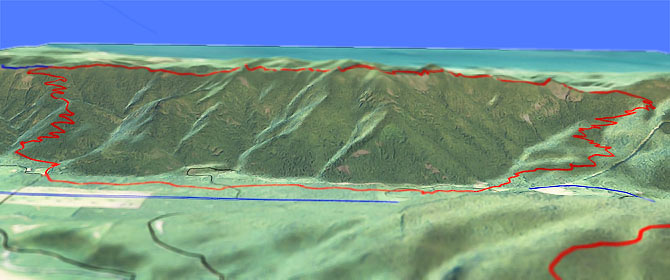
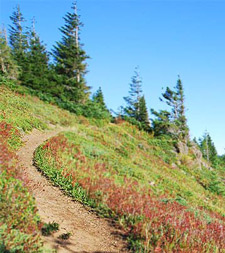
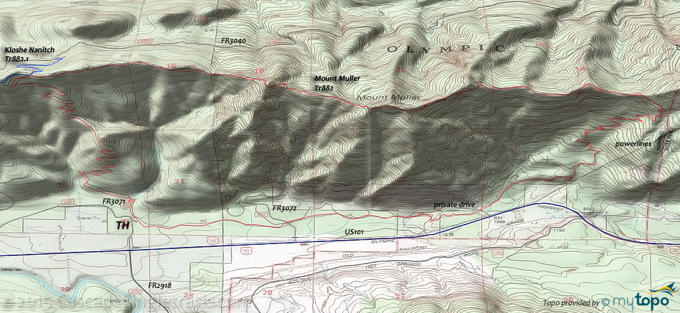
The Lake Crescent Washington CW Mount Muller Trail loop starts with a steep 2200' 3mi Snider Ridge ascent, then 4mi of ridge riding to Mosley Gap, descending past boulder formations to the TH.
Type
Loop
Length
Avg: 12mi
Ascent
Intense
Elevation Change
TH:1050'
Avg Ascent:3800'
Ascent Incline
12%
Duration
Avg: 2.5hr
Weather
Forecast
NOAA
popup
USFS
Trail
Review

At Jim's Junction (past Grouse Meadow), the Kloshe Nanitch Tr882.1 goes 3.2mi to the Kloshe Nanitch lookout and is rideable but not maintained.
The switchback section of Kloshe Nanitch Tr882.1 which accesses FR3040 is mostly overgrown and not ridable, with a good chance of riders getting lost on what remains of the trail.
As a 16mi (5100' ascent) CCW loop, returning 6mi on FR2070 and U.S. 101, Kloshe Nanitch Tr882.1 includes a 3.3mi corkscrewing downhill.
Some limited camping spaces are available at the summit.
Directions: NW Forest Pass required right at the TH. US101 to FR3071 (near MP 216). 31mi from Port Angeles. View Larger Map. No Map?.

Loop Directions
can you clean it?
- TH: From the FR3071 TH, cross Littleton Creek and continue to ascend or hike-a-bike through the switchbacks to Jim's Junction. Go left (of the visitors register) and uphill out of the parking area.
- 3.1mi: At Jim's junction, either go OAB on Kloshe Nanitch Tr882.1 or continue on to Mount Muller Summit, passing through Millsap, Jasmine, Allison and Markham Meadows.
- 5.3mi: Pass the Mount Muller ride summit, followed by a 1.5mi switchback descent towards Cahill Overlook, passing Molly's Meadow and Panorama Point.
- 8.6mi: The steep switchbacks begin at the 7.3mi Cahill Overlook, descending steeply to a private drive roadcrossing at 9.9mi. Pass the cave-like rock formation called Fouts Rock House at 8.5mi.
- 10mi: Cross Hutch Creek then return to the TH, paralleling U.S. 101.
Olympic National Park Hiking
The Bogachiel and Hoh rain forest vallys are the wildest and wettest in the Northwest, with both trails leading to Mount Olympus' western flanks, and long enough to suit a variety of hiking experiences.
The 23.5mi (6100' ascent, with 3000' ascent in the first 18mi) Bogachiel River trail is so long it is not entirely shown on the topo map. From Forks, go south on US101 to Bogachiel State Park, then go left onto FR2932 (Bogachiel River Road) and continue for 4mi to the TH parking area on the right.
Nearby Indian Pass Trail and Rugged Ridge Trail create a shuttle possibility for those seeking a shorter, low elevation (but still challenging) hike.
Expect to get wet and bring suitable gear to handle the heavy rainfall on the Pacific (i.e. wet) side of Mount Olympus.
Further to the south, the 15mi (1000') Queets River Trail offers a valley hike to the Pelton Creek Shelter, on the south side of Mount Olympus.
The National Park includes most of the National Forest, with some wilderness areas at the periphery.
Always carry the 10 Essentials: map, compass, flashlight, knife, matches, nylon cord, extra food and water, and rain gear with warm clothes.
The ONP site offers current wilderness trail conditions and map.
For ONP camping permits, go to the Wilderness Information Center (WIC) in Port Angeles, which is shown on the Area Map. No reservations necessary.
Trail Index
This Ride
Kloshe Nanitch Trail 882.1, Mount Muller Trail 882
Area
Dry Hill DH
Olympic NP Hoh-Bogachiel Area Hiking
Aurora Ridge Trail, Bogachiel River Trail 825, Bogachiel River South Bank Trail, Hoh-Bogachiel Primitive Trail, Indian Pass Trail, Rugged Ridge Trail
NP Campgrounds
Hoh Rainforest Campground, Klahowya Campground, Minnie Peterson Campground, Morgans Crossing Campground
Trail Rankings
Ranking consistently applied to all of the listed trails.
- Overall Rating: Ride quality and challenge
- Aerobic: Ascent challenge
- Technical Difficulty: Terrain challenge
- Steepness: Average incline
- Flow: Uninterrupted riding
- Elevation Change: Total elevation gain
- Ride Difficulty: Terrain challenge


