Foothills Trail
Overall: 4
Aerobic: 4
Technical: 5
Steepness: 5
Flow: 5
Singletrack: 100%
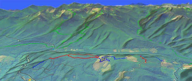
The Port Angeles Washington Foothills is a local trail, too short or interesting to be a destination ride, but worth checking out if camping in the area.
Type
Loop
Length
Avg: 6mi
Ascent
Easy
Elevation Change
TH:2150'
Avg Ascent:1850'
Ascent Incline
8%
Duration
Avg: 1hr
Weather
Forecast
NOAA
popup
USFS
There are some views of Port Angeles and the Strait of Juan de Fuca, but otherwise the main attraction is the long riding season, due to low elevation and seasonally dry conditions.
The north and east sides of the Olympic National Park are relatively dry and sheltered from Pacific storms, due to Mount Olympus and surrounding ranges wringing hundreds of inches of moisture year round, resulting in an extended riding season and better trail conditions than one might expect for coastal Washington biking.
Expect a few technical sections, with a hard packed and sometimes rooty trail surface. Extensive use keeps the trail clean and easy to navigate and there are signs posted at major intersections.
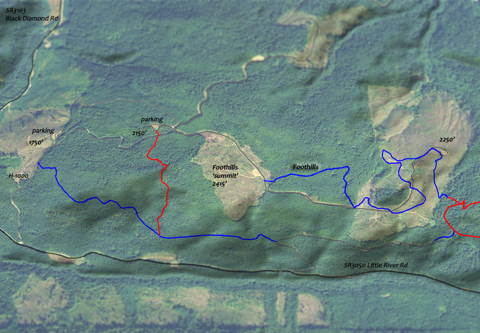
The H-1000 parking areas are the usual TH. H-1200 could also be used, which would require some gravel road climbing.
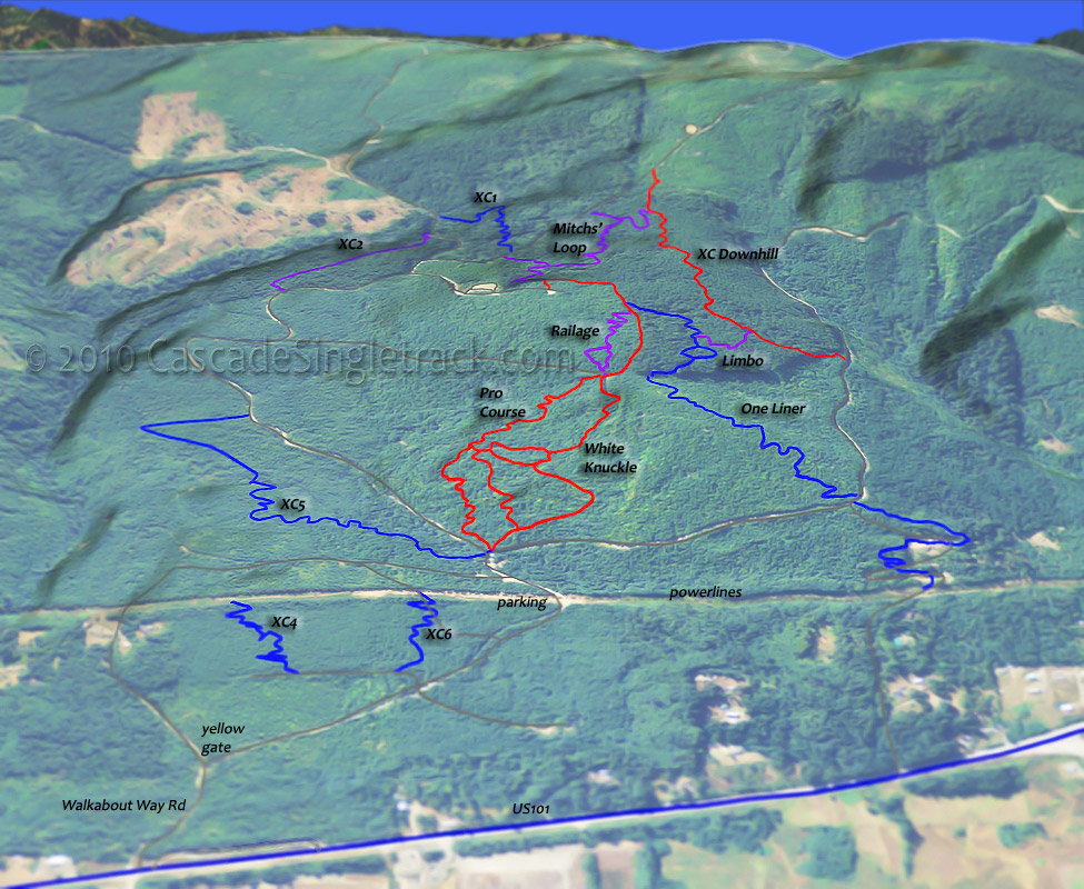
The technically challenging Dry Hill area has about 6mi of trails and is mostly for downhill riders, but worth checking out as well.
White Knuckle was the original DH run and is one-way, like the other DH trails. Plenty of stunts and jumps. Park at Walkabout Rd and ride as much of it as skills allow.
Directions: See Map. From US101 go south on Race St, then bear right onto Heart O' the Hills Parkway at the Mt. Angeles Road intersection (near the Hurricane Ridge Visitor Center). Go 5.1mi then go right onto Lake Dawn Rd, just prior to the Olympic National Park entrance. Go .3mi, then bear right onto Little River Rd (gravel) and continue 3.3mi to H-1000. Follow the signs posted on trees to one of two parking areas. View Larger Map. No Map?.
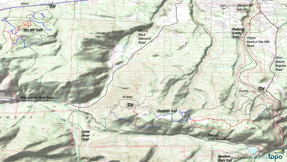
Loop Directions
foothill racetrack
- TH: From the upper H-1000 parking area, create a figure eight loop of the single and doubletrack. Ascend from the parking area, with singletrack breaking from the jeep road, then returning to follow alongside the road again.
- 2.4mi: After reentering the woods, reach the loop and bear left. Ride the loop, passing the eastern spur at 3.2mi, with an option to explore 1mi further to the east, then return.
- 4mi: Bear left onto singletrack that merges with an abandoned road. Continue on the road to the curve, then take the singletrack.
- 5.2mi: Either climb the steep section back to the TH, or continue on to H-1000, then climb the road back to the TH...or do another lap.
Olympic National Park Hiking
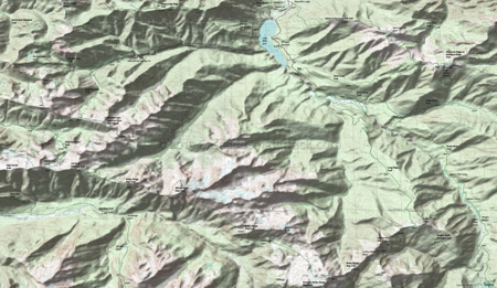
Shown on the Area Map, the 5.5mi (5100' ascent) Heather Park Trail ascends the northern slopes of Mount Angeles, and can be combined with 6mi of Lake Angeles and Switchback trails to form a very challening loop. An ice ax may be needed to hike Lake Angeles during the spring and early summer.
From Kiaski Rd, the 3.4mi (1200' ascent) Heart of the Hills trails is a far more intermediate hike, for those not seeking high elevation wilderness climbing.
The 7mi (4500' ascent) Little River Trail is another day-hike option requiring intermediate skills and stamina, and could even be shuttled from Hurricane Ridge Rd.
Hurricane Ridge is often accessed from Lake Mills, using the Wolf Creek trail and the Elwha-to-Hurricane trail.
From the Whiskey Bend TH, the Elwha River trail passes through lowland forest and valleys, passing Lillian River Camp, Mary's Falls Camp, Canyon Camp, Elkhorn, Hayes River Guard Station, Camp Wilder and Chicago Camp along the way.
The Chicago Camp, river crossing limits access to the Low Divide upper reaches, but that leaves the the lower 23mi of trail to explore. Expect plenty of fellow hikers, as this is a very popular hike.
Elwha to Hurricane Hill Trail and Wolf Creek Trail combine to form a challening 16mi (7000' ascent) CCW loop day hike, which includes 4mi of hiking along the Whiskey Bend Road.
The Long Ridge Trail, Bailey Range Way and Appleton Pass trails can be combined into an epic 31mi (13500' ascent) loop, far beyond a typical day hike.
Needless to say, the Mount Olympus climbing routes should only be attempted by experienced mountaineers who have glacier travel and crevasse rescue skills and gear. Camp areas are located at Caltech Rocks and Snow Dome, with no camping between Glacier Meadows and Blue Glacier.
The National Park includes most of the National Forest, with some wilderness areas at the periphery.
Always carry the 10 Essentials: map, compass, flashlight, knife, matches, nylon cord, extra food and water, and rain gear with warm clothes.
The ONP site offers current wilderness trail conditions and map.
For ONP camping permits, go to the Wilderness Information Center (WIC) in Port Angeles, which is shown on the Area Map. No reservations necessary.
Trail Index
This Ride
Foothills Trail
Area
Dry Hill DH
Beeline, Cakewalk, Limbo, Mitchs’ Loop, One Liner, Pro Course, Railage, White Knuckle, XC Downhill
Olympic NP Hiking
Appleton Pass Trail, Bailey Range Way Trail, Boulder Lake Trail, Boulder Lake-Appleton Pass High Route, Cat Basin Primitive Trail, Cox Valley Primitive Trail, Dodger Point Primitive Trail, Elwha to Hurricane Hill Trail, Happy Lake Ridge Trail, Heart of The Forest Trail, Heather Park Trail, Hurricane Ridge-Klahhane Ridge Trail, Griff Creek Primitive Trail, Lake Angeles Trail, Lillian River Trail, Little River Trail, Long Ridge Trail, Ludden Peak Way Trail, Mount Carrie Way Trail, West Elwha Trail, Wolf Creek Trail
Campgrounds
Altaire Campground, Elwha Campground, Heart of the Hills Campground, Olympic Hot Springs Campground
Trail Rankings
Ranking consistently applied to all of the listed trails.
- Overall Rating: Ride quality and challenge
- Aerobic: Ascent challenge
- Technical Difficulty: Terrain challenge
- Steepness: Average incline
- Flow: Uninterrupted riding
- Elevation Change: Total elevation gain
- Ride Difficulty: Terrain challenge

