Sahalie Falls to Umbrella Falls Tr667
Twitter Search
#SahalieFallsTrail

Overall: 4
Aerobic: 7
Technical: 6
Steepness: 7
Flow: 4
Singletrack: 100%
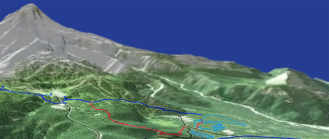
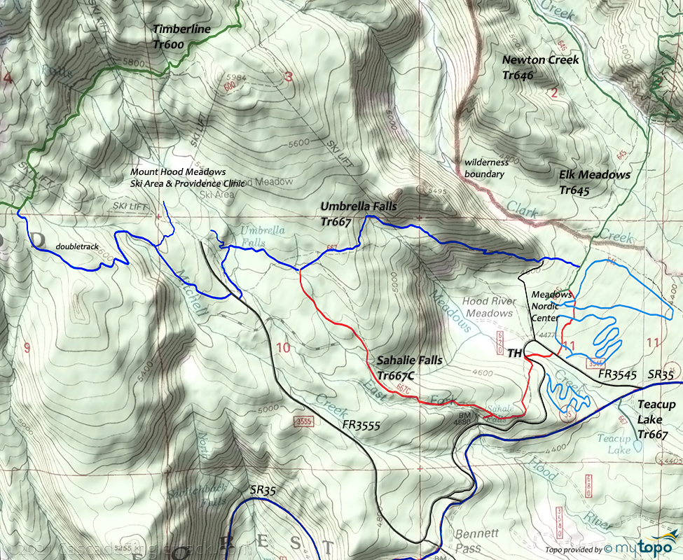
Mount Hood Oregon Sahalie Falls Trail combines with Umbrella Falls Tr667 to make a short CW loop, with the two falls to add to the scenery of this non-destination ride.
Type
Loop
Length
Avg: 3.5mi
Ascent
Moderate
Elevation Change
TH:4450'
Avg Ascent875'
Ascent Incline
10%
Duration
Avg: 1hr
Weather
Forecast
NOAA
popup
USFS
The nearby nordic center has some XC Ski trails to wander around on, and the ski resort has some access roads which can be used to create a 9mi figure 8 loop.
For the amount of climbing involved, Gunsight Tr485 or High Prairie Tr639 offer much more terrain than this loop.
Climb around Mt Hood Meadows? Feel free to skip this portion of the ride.
Find the south service road near the lift, ascend to the top. Pass by the two chairlifts (quad and dual), then take the service road back to the resort parking lot.
Mount Hood Wilderness Hiking
Timberline Trail 600, Pacific Crest Trail 2000-G and surrounding trails form a hub and spoke trail system around Mount Hood in classic Pacific Northwest trails circumnavigating Mount Hood with alpine vistas, waterfalls, alpine meadows and west side Cascade forest.
This section of the Pacific Crest Trail extends from Barlow Pass to Lolo Pass, with Timberline Trail 600 surrounding the north and east sides of Mount Hood at the treeline, from Yocum Ridge to Timberline Lodge.
Timberline Trail 600 was constructed by the Civilian Conservation Corps in the 1930’s, with challenging glacial-fed drainages crossing Newton, Coe, Muddy Fork, Sandy and White Rivers.
Wilderness permits are required and locator beacons are suggested. Mount Hood Summit info.
The large Area Maps on the following pages cover most of this trail system Tilly Jane Trail 643, East Fork Trail 650, Pioneer Bridle Trail 795 Timberline Glade Trail 661.
Elk Meadows Tr645 traverses the eastern flank of Mount Hood alongside Bluegrass Ridge Tr647.
From Elk Meadows Tr645, Newton Creek Tr646 provides a steep (1000' in 1.8mi) access to Timberline Trail 600.
Between Cloud Cap and Newton Creek (6mi), Timberline Trail 600 has one unbridged stream crossing, at Newton Creek, which can be challenging depending on weather conditions. Expect early season snow field crossings at higher elevations, requiring careful footing. There are a few established campsites, near Gnarl ridge and on the south side of Newton Creek crossing. The 5.6mi section from Newton Creek to the Pacific Crest Tr2000-G crosses the unbridged Clark Creek and White River, which can be difficult-to-dangerous. Water flow increases during the day, due to rising temperatures, so early morning is the best time to attempt those water crossings.
Directions: SR35S to FR3545, the Mt Hood Meadows Nordic Center entrance. Go .4mi to the Sahalie Falls FR3545 TH. View Larger Map. No Map?.

Loop Directions
the scenic tour
- TH: From the nordic center, or from the Sahalie Falls FR3545 TH

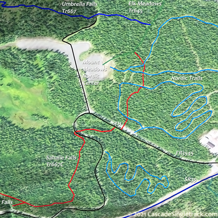
View of the Sahalie Falls TH, go on Sahalie Falls Tr667C. Cross a tributary of Meadow Creek at 1.1mi. - 1.6mi: Option to go left onto Umbrella Falls Tr667, 0.4mi to the falls area. Otherwise, go right and descend the ridgeline. Pass a nordic center access trail at 2.8mi, then go right onto the nordic trails at 3mi and wander back to the TH.
Trail Index
This Ride
Sahalie Falls Trail 667C, Umbrella Falls Trail 667
Area
Alpine Trail 600, Bonney Meadows Trail 471, Bottle Prairie Trail 455, Boulder Lake Trail 463, Casey Creek Trail 476, Cedar Creek Trail 457, Cooks Meadow Trail 639, Dog River Trail 675, East Fork Trail 650, Eightmile Creek Trail 459, Fifteenmile Trail 456, Forest Creek Trail 473, Glade Trail 661, Gumjuwac Trail 480, Gunsight Trail 485, Hidden Meadows Trail 472, Horkelia Meadows Trail 20, Knebal Springs Trail 474, Lookout Mountain Trail 450, Oak Ridge Trail 688A, Pioneer Bridle Trail 795, Pocket Creek Trail 684, Polallie Ridge Trail 643A, Surveyors Ridge Trail 688, Tilly Jane Trail 643, Underhill Trail 683, Zig Zag Trail 678
Mount Hood Wilderness Hiking
Bluegrass Ridge Trail 647, Elk Meadows Trail 645, Gnarl Ridge Trail 652, Newton Creek Trail 646, Polallie Falls Trail 29, Robinhood Trail 11, Tamanawas Falls Trail 650B, Tamanawas Tie Trail 650B, Timberline Trail 600
XC Ski
Hood River Meadows Nordic, White River SnoPark
Campgrounds
Robinhood Campground, Sherwood Campground
Trail Rankings
Ranking consistently applied to all of the listed trails.
- Overall Rating: Ride quality and challenge
- Aerobic: Ascent challenge
- Technical Difficulty: Terrain challenge
- Steepness: Average incline
- Flow: Uninterrupted riding
- Elevation Change: Total elevation gain
- Ride Difficulty: Terrain challenge


