
Pioneer Bridal Tr795
Twitter Search
#pioneerbridaltrail

Overall: 5
Aerobic: 6
Technical: 6
Steepness: 5
Flow: 6
Singletrack: 100%
Paralleling SR26 between Rhododendron and Government Camp Oregon, Pioneer Bridal Tr795 is certainly long enough and offers some technical challenges, but is not a destination ride.
Type
OAB
Length
Avg: 22.5mi
Ascent
Intense
Elevation Change
TH:1700'
Avg Ascent:5000'
Ascent Incline
6%
Duration
Avg: 4hr
Weather
Forecast
NOAA
popup
USFS

Crosstown Tr755 can be used to extend the Pioneer Bridal Tr795 ride, adding some fast mileage around Government Camp. Crosstown Tr755 is suitable for beginners and the Pioneer Bridal Tr795 downhill is suitable for advanced beginners ready to learn how to ride in loose trail conditions. Due to the loose trail conditions the Pioneer Bridal Tr795 ascent is only suited for strong climbers.
There are a number of marked loops between Gov't Camp and Enid Lake, so some time can be spent noodling around Crosstown Tr755.
From Timberline, a Glade Tr661 shuttle (called the "Timberline to Rhododendron" ride) will nearly double the vertical and offers more exciting and somewhat technical downhill than just riding Pioneer Bridal Tr795.
Road climbers can create a loop with a Still Cr Tr680 ascent to Still Cr Rd (FR2612), then FR126 at Summit Meadows, to Gov't Camp.
For downhillers, Ski Bowl has lift service to some doubletrack and singletrack loops, and Timberline runs lift service to Glade Tr661 and Alpine Tr600.
Due to the close proximity to Government Camp, this system of trails gets a LOT of use, and is often not very pristine. The Laurel Hill section, from the Glacier View Snopark to the SR26 TH, is the best singletrack on this ride.
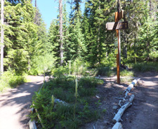
Directions: SR26E to mile post 36, 3mi past the Dairy Queen at the chain-up area. The TH is on the south side of the road. View Larger Map. No Map?.


OAB Directions
rhodo to govy
- TH: Most of this ride consists of ascending alongside SR26 to Gov't camp, which includes countless road crossings.
- 2mi: Pass FR2628 and the Still Creek Tr780 TH on the right, near the Camp Creek campground.
- 3.8mi: Cross to the north side of SR26, where the ascent gets more serious as the trail switchbacks up the west side of Laurel Hill.
- 8.3mi: Climb to Enid Lake and the FR522 intersection with Crosstown Tr755. Go left on Crosstown Tr755 and continue the ascent around the Enid Lake area, reaching the ride summit at the 10.4mi Glade Tr661 intersection. Turn around or continue the ride into town.


Mount Hood Wilderness Hiking
Timberline Trail 600, Pacific Crest Trail 2000-G and surrounding trails form a hub and spoke trail system around Mount Hood in classic Pacific Northwest trails circumnavigating Mount Hood with alpine vistas, waterfalls, alpine meadows and west side Cascade forest.
This section of the Pacific Crest Trail extends from Barlow Pass to Lolo Pass, with Timberline Trail 600 surrounding the north and east sides of Mount Hood at the treeline, from Yocum Ridge to Timberline Lodge.
Timberline Trail 600 was constructed by the Civilian Conservation Corps in the 1930’s, with challenging glacial-fed drainages crossing Newton, Coe, Muddy Fork, Sandy and White Rivers.
Wilderness permits are required and locator beacons are suggested. Mount Hood Summit info.
The large Area Maps on the following pages cover most of this trail system Tilly Jane Trail 643, East Fork Trail 650, Sahalie Falls Trail 667C, Timberline Glade Trail 661.
Shown at the top of the Area Map, Zigzag Mountain Tr775 is the primary east-west connector from FR18 to Pacific Crest Tr2000, with two abandoned lookout sites alongside the trail.
Paradise Park Tr778 is a steady ascent along a forested ridge above the north side of the Zigzag River, eventually accessing Pacific Crest Tr2000 and the Paradise Park alpine meadow with views of Mount Hood.
Hidden Lake Tr779 ascends to a small wooded lake through rhododendron bushes, with a challenging 12mi loop created by combining Hidden Lake Tr779 with the Pacific Crest Tr2000 for 2.4mi, then returning 5.6mi on Paradise Park Tr778.
To the south, in the Salmon Huckleberry Wilderness, Salmon River Tr742 is a key east-west connector passing through mossy old growth forest next to the wild and scenic Salmon River, with several back country campsites along the way.
South from Green Canyon CG, the Salmon Butte Tr791 ascend 3000’ in 4.3mi to the 4,870’ Salmon Butte, offering great views of Mount Jefferson, Three Sisters, Mount Hood, Mount Adams, Mount St. Helens, Mount Rainier and the Salmon River valley. The trail merges with an old road at 4mi. Go right and continue to Salmon Butte summit.
FR2613 is 9mi of rough jeep trail along the dry ridge top of Hunchback Mountain and leads to Kinzel Lake and Kinzel Lake Tr665. This can be combined with Veda Lake Tr673 for a hike loop.
Trail Index
This Ride
Crosstown Trail 755, Pioneer Bridle Trail 795
Ant Farm Trail, Brobi-Wan Trail, Camino de Michoacan CDM Trail, Dirtbag Down Trail, Gotta-Go Trail, Gravy Train Trail, Quandry Trail, Re-Align Trail, The Rock Trail, Xerces Trail
SkiBowl Bike Park
Cannonball Trail, Fire Hydrant Trail, Gnar-Gnar Trail, Optimator Trail, Powerline Trail, ProLine Trail, South Trail, Sunrise Trail, Sunset Trail, Summit Trail 691
Area
Alpine Trail 660, Bonney Meadows Trail 471, Bottle Prairie Trail 455, Boulder Lake Trail 463, Casey Creek Trail 476, Cedar Creek Trail 457, Cooks Meadow Trail 639, Dog River Trail 675, East Fork Trail 650, Eightmile Creek Trail 459, Eureka Peak Trail 671, Fifteenmile Trail 456, Forest Creek Trail 473, Glade Trail 661, Gumjuwac Trail 480, Gunsight Trail 485, Hidden Meadows Trail 472, Horkelia Meadows Trail 20, Knebal Springs Trail 474, Lookout Mountain Trail 450, Oak Ridge Trail 688A, Pocket Creek Trail 684, Polallie Ridge Trail 643A, Sahalie Falls Trail 667C, Still Creek Trail 780, Surveyors Ridge Trail 688, Tilly Jane Trail 643, Umbrella Falls Trail 667, Underhill Trail 683, Zig Zag Trail 678
Sandy Ridge Trails
Mount Hood Wilderness Hiking
Burnt Lake South Trail 772, Cool Creek Trail 794, Mirror Lake Trail 664, Pacific Crest Trail 2000-F
Salmon Huckleberry Wilderness Hiking
Dry Fir Trail 674A, Fir Tree Trail 674, Green Canyon Way Trail 793A, Hunchback Trail 793, Jackpot Meadows Trail 492, Kinzel Lake Trail 665, Salmon Butte Trail 791, Salmon River Trail 742, Old Salmon River Trail 742A, Veda Lake Trail 673
Campgrounds
Alpine Campground, Camp Creek Campground, Clear Lake Campground, Frog Lake Campground, Green Canyon Campground, Rolling Riffle Campground, Still Creek Campground, Tollgate Campground, Trillium Lake Campground
Trail Rankings
Ranking consistently applied to all of the listed trails.
- Overall Rating: Ride quality and challenge
- Aerobic: Ascent challenge
- Technical Difficulty: Terrain challenge
- Steepness: Average incline
- Flow: Uninterrupted riding
- Elevation Change: Total elevation gain
- Ride Difficulty: Terrain challenge
