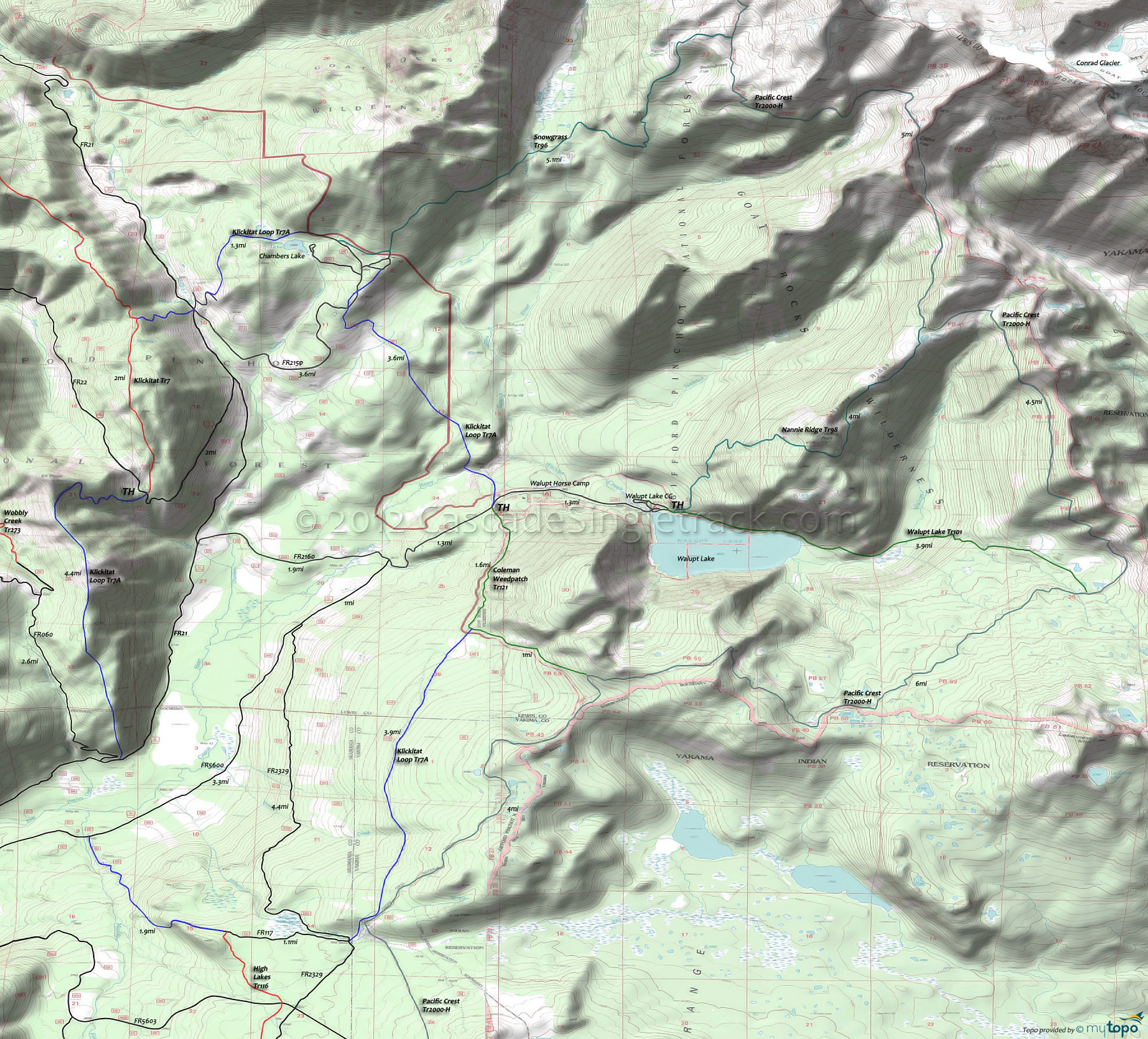
Klickitat Loop and Pacific Crest Trail Area Hiking Topo Map
Twitter Search
#PacificCrestTrail
Map includes: Coleman Weedpatch Trail 121, Klickitat Loop Tr7A, Nannie Ridge Trail 98, Pacific Crest Trail 2000-H, Snowgrass Trail 96 and Walupt Lake Trail 101 Hiking Trails.
Klickitat Loop and Goat Rocks Wilderness Hiking: Just north of High Lakes Tr116 and east of Klickitat Tr7 are some trail segments which are popular with Walupt Horse Camp equestrians (constructed and are maintained by members of Backcountry Horsemen of Washington) but also open to biking. To prevent user conflicts and 'mud', avoid Klickitat Loop Tr7A on summer weekends and after rainfall.
Snowgrass Tr96 ascends through conifers until crossing Goat Creek, then switchbacks through talus and timber to Pacific Crest Tr2000-H at Snowgrass Flat.
The easily accessible and popular Walupt Lake Tr101 starts at the Walupt Lake CG and follows the lakeshore to Walupt Creek, then ascends into an open alpine area before turning southeast, ending at Pacific Crest Tr2000-H.
Draggable map: Map window adjusts to screen size and will respond to touch control. Use scrollbar for mouse control.
No Map? Browser settings and some browser extensions can prevent the maps from appearing. Please see Site Tech


