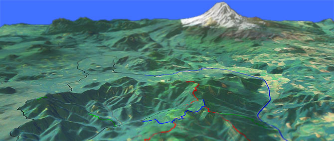
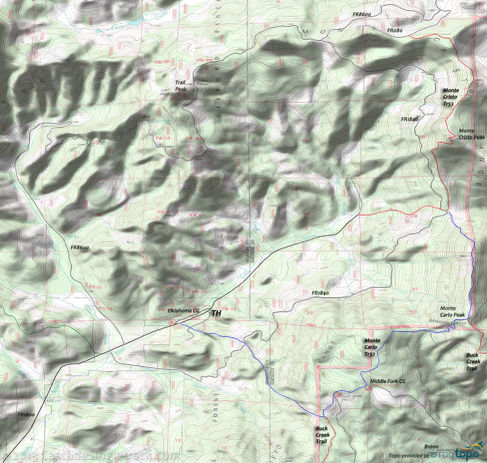
Monte Carlo Tr52 to Monte Cristo Tr53

Overall: 7
Aerobic: 6
Technical: 6
Steepness: 7
Flow: 6
Singletrack: 98%
Monte Carlo Tr52 ascends through second-growth and old-growth forests, crossing several roads before climbing the ridge overlooking Holmes Creek and the White Salmon drainage.
Type
Loop
Length
Avg: 15mi
Ascent
Intense
Elevation Change
TH:1700'
Avg Ascent:5100'
Ascent Incline
17%
Duration
Avg: 3hr
Weather
Forecast
NOAA
popup
USFS
The trail then passes through old-growth Douglas fir and several burned areas before reaching Monte Carlo Ridge, with views of the Little Salmon drainage and surrounding peaks.
Monte Carlo Tr52 connects with Buck Creek Trail, although the Buck Creek ride profile is better when using the lower TH.
The ride could start from the Middle Fork Campground, accessed from the Buck Creek side of the mountain.
This would avoid the steep 2mi climb at the beginning of the ride, with the remaining ride as an OAB to the top of Monte Cristo Tr53.
Monte Cristo Tr53 is an extension of the Monte Carlo Tr52 ride, climbing a sparsely forested ridge to Monte Cristo Mountain, with views of the Little White Salmon drainage and passing by an old lookout site.
FR1800 can be used to create a loop, or as a shuttle option.
The upper Monte Cristo Tr53 TH is just off of FR8600, but is not worth the extra drive.
Directions: From Cook, WA, go 14.2mi on FR1800, past the Oklahoma Campground to FR752. Either park at the CG or go right onto FR752 and go .2mi to the TH. View Larger Map. No Map?.

Loop Directions
intense climb
- TH: The first 2mi are the toughest, ascending 1800' to the upper Buck Creek TH and Middle Fork CG.
- 2.6mi: Pass the Middle Fork CG and ascend to the Monte Carlo summit.
- 4.4mi: At the Monte Carlo Mountain summit, pass the second Buck Cr intersection, ride along a ridge, then enjoy the steep descent to Monte Cristo Tr53.
- 5.9mi: Go right onto Monte Cristo Tr53 and climb 1000' to the top of Monte Cristo Mt, then ride along the Monte Cristo range to FR080.
- 8.9mi: Reach FR080 and ride Monte Cristo to the lower TH, passing the Monte Carlo Tr52 intersection then descending another 1000' to FR1800.
- 12.8mi: Reach the lower Monte Cristo TH at FR1800 and ride back to the Monte Carlo TH.
Trail Index
This Ride
Monte Carlo Trail 52, Monte Cristo Trail 53
Area
Hiking
Little Huckleberry Mountain Trail 49
XC Ski
Atkisson SnoPark
Campgrounds
Oklahoma Campground, Middle Fork Campground, Moss Creek Campground, Peterson Prairie Campground, Trout Lake Campground
Trail Rankings
Ranking consistently applied to all of the listed trails.
- Overall Rating: Ride quality and challenge
- Aerobic: Ascent challenge
- Technical Difficulty: Terrain challenge
- Steepness: Average incline
- Flow: Uninterrupted riding
- Elevation Change: Total elevation gain
- Ride Difficulty: Terrain challenge


