Buck Creek Trail

Overall: 7
Aerobic: 7
Technical: 6
Steepness: 7
Flow: 7
Singletrack: 100%
There are two Buck Creek trails near Mt Adams. This is the larger of the two, located on DNR land next to...Buck Creek.
Type
Loop
Length
Avg: 21mi
Ascent
Intense
Elevation Change
TH:900'
Avg Ascent:6700'
Ascent Incline
15%
Duration
Avg: 5hr
Weather
Forecast
NOAA
popup
WA DNR
The other buck: Buck Cr Tr54, is shown on the Morrison Creek page, next to the White Salmon River.
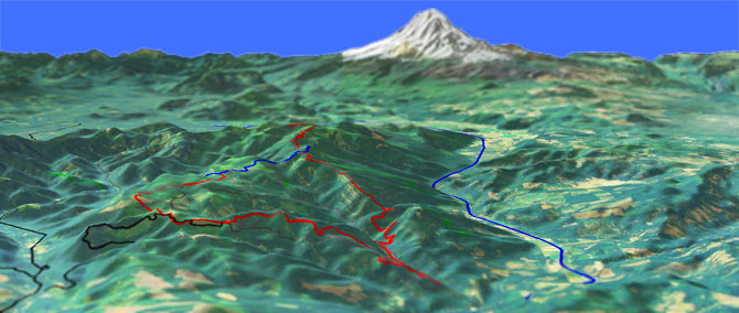
Sharing a portion of Monte Carlo Tr52, the CW Buck Creek loop starts in a forested valley bottom and climbs about 13mi over undulating terrain to the Monte Carlo ridgetop, followed by an 8mi relentless 9% descent down to Buck Creek.
The eastern half of the trail does not get as much use, as many riders prefer to ascend B1000 then descend the western half of the trail.
A description of the entire CW loop is described in the guide below.
A shuttle ride can start at the upper Buck Creek TH, taking B1000 to B1800 to the TH, then riding back about 10mi in either direction.
Directions: Go 4.1mi on SR141 to Northwestern Lake Road. Go left then continue .9mi to N-1000 (Oak Rdg Rd, or sometimes called Nestor Pk Rd). Go left and continue 1.8mi to the TH, where the trail crosses the road. There is another TH 3.3mi up B-1000 (Buck Cr Rd), where the trail crosses the road. View Larger Map. No Map?.

Loop Directions
flaming quads, burnt discs
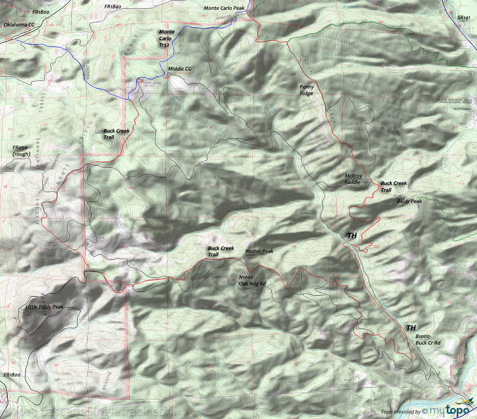
- TH: There are several TH near the base of the trail. Mileage is noted from the lowest tip of the trail, accessible from N1000 by a fire road. Start with a steep 1mi ascent, then cross the road twice and cross several streams before the main ascent begins.
- 2.3mi: Begin the 2.2mi (15% grade) Nestor Pk ascent, then ease into an undulating climb for the rest of the way to Monte Carlo Mt.
- 5.7mi: Cross N1000 then cross and briefly merge with several fire roads before reaching FR050.
- 8.5mi: Go right onto FR050, and go .6mi to the intersection with B1000 and N1000, then go north onto Monte Carlo Tr52.
- 10.4mi: Go right at T intersection with Monte Carlo Tr52 and ride to the Monte Carlo summit, passing the upper Buck Cr TH and Middle Fork CG along the way.
- 12.9mi: Complete brief, steep switchback climb to the Monte Carlo summit, then go right onto Buck Creek Trail.
- 13.8mi: Go right onto doubletrack and rapidly descend to hairpin curve at mile 15, then continue steep descent on singletrack.
- 16.4mi: Cross the fire road at Mcllroy Saddle, then begin a steep switchback descent through several drainages, down to B1000.
- 18.8mi: Go right (uphill) on B1000 to rejoin the trail, near the pullout, then ride alongside Buck Creek before trail pulls away from the road and returns to the TH.
Panther Creek Hiking
Trail Index
This Ride
Buck Creek Trail
Hiking
Grassy Knoll Trail 146, Pacific Crest Trail 2000-H
Campgrounds
Middle Fork Campground, Moss Creek Campground, Oklahoma Campground
Trail Rankings
Ranking consistently applied to all of the listed trails.
- Overall Rating: Ride quality and challenge
- Aerobic: Ascent challenge
- Technical Difficulty: Terrain challenge
- Steepness: Average incline
- Flow: Uninterrupted riding
- Elevation Change: Total elevation gain
- Ride Difficulty: Terrain challenge


