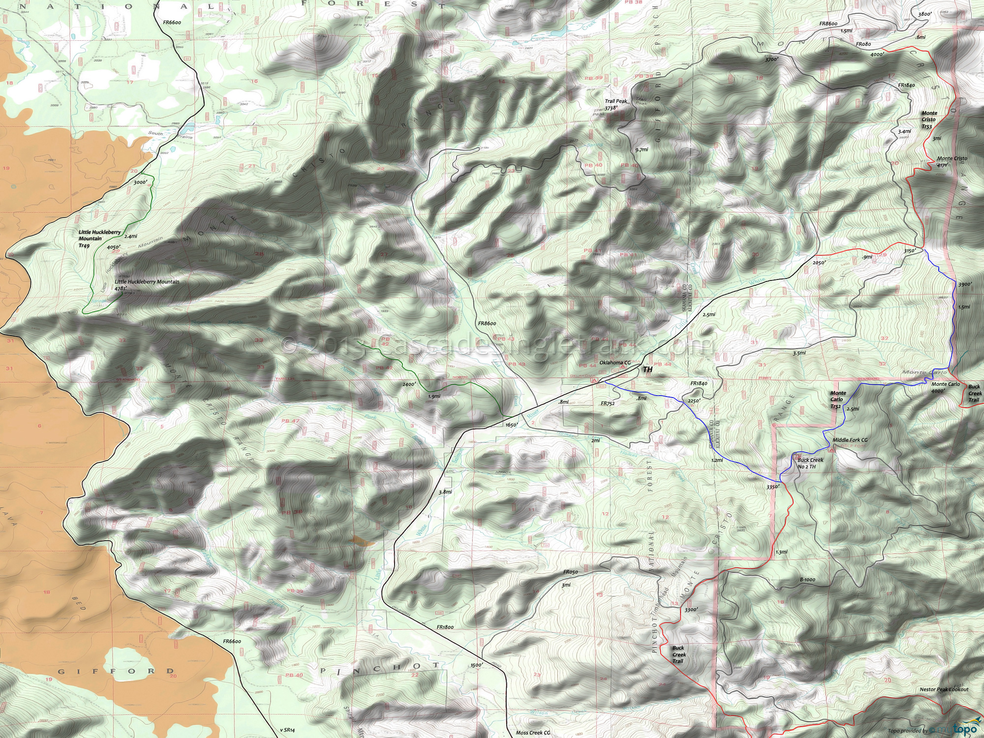
Monte Carlo Trail 52, Monte Cristo Trail 53 Mountain Biking and Hiking Topo Map
TH: The first 2mi are the toughest, ascending 1800' to the upper Buck Creek TH and Middle Fork CG.
2.6mi: Pass the Middle Fork CG and ascend to the Monte Carlo summit.
4.4mi: At the Monte Carlo Mountain summit, pass the second Buck Cr intersection, ride along a ridge, then enjoy the steep descent to Monte Cristo Tr53.
5.9mi: Go right onto Monte Cristo Tr53 and climb 1000' to the top of Monte Cristo Mt, then ride along the Monte Cristo range to FR080.
8.9mi: Reach FR080 and ride Monte Cristo to the lower TH, passing the Monte Carlo Tr52 intersection then descending another 1000' to FR1800.
12.8mi: Reach the lower Monte Cristo TH at FR1800 and ride back to the Monte Carlo TH.
Draggable map: Map window adjusts to screen size and will respond to touch control. Use scrollbar for mouse control.
No Map? Browser settings and some browser extensions can prevent the maps from appearing. Please see Site Tech


