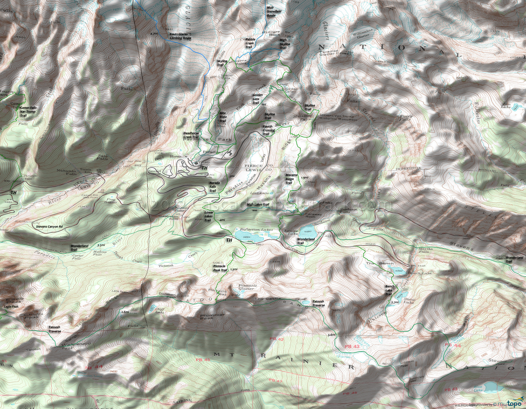
Mount Rainier Paradise Park: Deadhorse Creek Trail, Mazama Ridge Trail Area Hiking Topo Map
Map includes: Deadhorse Creek Trail, High Lakes Trail, Mazama Ridge Trail, Pinnacle Peak Trail, Skyline Trail, Tatoosh Traverse and Wonderland Trail Hiking Trails.
The southwestern flank of Mount Rainier contains some easily accessible but very challenging day-hikes.
See the Osborne Mtn Tr250 page for the more western Rainier and Glacier View Wilderness hiking trails.
Skyline is the main Paradise Park loop trail, with Deadhorse Creek and Alta Vista providing western extensions and Golden Gate as a mid loop connector.
Tatoosh Traverse provides a more advanced hiking option, with Pinnacle Peak Trail and Bench Lake Trail making a natural loop option.
Families use the Wonderland trail from the Cougar Rock CG to Narada Falls as a popular day-hike, often stopping at Carter Falls.
The Paradise River Camp is 1mi south of Narada Falls. As with all other camping at Mount Rainier, permits are required and expect summertime weekend crowds.
Wonderland Trail is 93mi and circumnavigates Mount Rainier, crossing varied terrain, from lowland forests to high alpine. The northwestern section of Wonderland Trail is covered on the Christoff Tr1171 page.
For much more information, check out the Mount Rainier National Park Trail guide, which includes descriptions of all trails and a variety of maps.
Draggable map: Map window adjusts to screen size and will respond to touch control. Use scrollbar for mouse control.
No Map? Browser settings and some browser extensions can prevent the maps from appearing. Please see Site Tech


