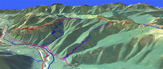
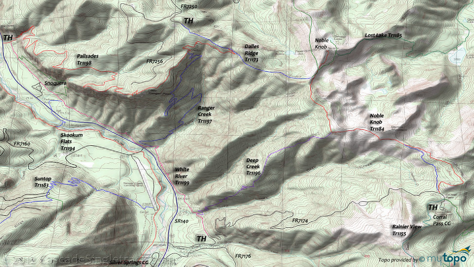
Ranger Creek Tr1197
Twitter Search
#rangercreek

Overall: 7
Aerobic: 7
Technical: 6
Steepness: 7
Flow: 5
Singletrack: 70%
The best option for accessing the Washington State Ranger Creek Tr1197 is to shuttle from FR7200/FR7250 or FR7174, leaving non-shuttling riders the tough options of climbing Palisades Tr1198 or climbing FR7174.
Type
Loop
Length
Avg: 16.5mi
Ascent
Intense
Elevation Change
TH:2900'
Avg Ascent:8000'
Ascent Incline
14%
Duration
Avg: 5hr
Weather
Forecast
NOAA
popup
USFS
Trail
Review
White River Trails
About 1.5hrs from downtown Seattle, the White River area trails are extremely popular...and happen to also cover some great terrain.
Skookum Flats Tr1194 can be ridden nearly all year, although the glacial water flow of the White River demands some thermal protection most of the year. The higher elevation trails become available when the snow melts (April-July).
The other major rides in the area are Crystal Mt Tr1163, Noble Knob Tr1184, Palisades Tr1198, Ranger Cr Tr1197 and Suntop Tr1183.

All three ride options lead to a 5mi, 10%+, non-stop, brake-melting downhill, with some cliff exposure just to keep it interesting.
Where to begin? Ranger Creek Tr1197 is described on this page as the downhill section of the Noble Knob Tr1184, starting from FR7174.
Many riders prefer to start from Camp Shepard, avoiding an end of ride trek back to FR7174.
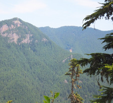
Expect benched singletrack with plenty of rooty terrain which wanders through dense Douglas Fir, and sharp switchbacks that will challenge the technical skills of most riders.
Strong climbers may also want to consider combining Palisades Tr1198 and Ranger Cr Tr1197 into an epic 13mi, 4900' CW Loop, or even extending the loop to Deep Cr Tr1196. The first .5mi of Palisades Tr1198 is hike-a-bike.
Directions: NW Forest Pass required right at the TH or at Camp Shepard. SR410E 29.8mi from Enumclaw to parking area on right. Take the spur trail across SR410 to White River Tr1199S, for .2mi to the Ranger Creek TH. View Larger Map. No Map?.

Loop Directions
doug fir, dust and melting brake pads
- TH: If starting from FR7174, grind 5mi up FR7174 to Corral Pass in a steady climb.
- 4.8mi: Prior to reaching the Coral Pass campground, go left onto Noble Knob Tr1184. Go right at the T and ride on to Mutton Mountain, then pass the Deep Cr Tr1196 intersection at 7mi.
- 8.1mi: Go left at the intersection with Dalles Ridge Tr1173, or continue .5mi to the Noble Knob summit. This is the highest elevation of the ride (5950') and Noble Knob Tr1184 defines the edge of the Norse Peak wilderness so do not take any trails to the right. Dalles Ridge Tr1173 covers rough, uneven ridgeline terrain.
- 9.2mi: Go left onto Ranger Cr Tr1197 and navigate steep switchbacks to the intersection with Palisades Tr1198 (at 10.3mi), just past the log shelter. Go around the log shelter and then go left at the fork.
- 10.4mi: The ride starts with steep switchbacks and a cambered trail surface which many riders will choose to hike. Go left at the fork (12.6mi), then continue on more gradual switchbacks.
- 14.4mi: After navigating some swooping switchbacks near the bottom of the Ranger Creek drainage, reach White River Tr1199 and go left if parked at FR7174.
Trail Index
This Ride
Deep Creek Trail 1196, Palisades Trail 1198, Ranger Creek Trail 1197
Area
Bone Lake Trail 1172.1, Buck Creek Trail 1169, Christoff Trail 1171, Crystal Mountain Trail 1163, Dalles Ridge Trail 1173, Divide Trail 1172, Doe Falls Trail 1174, Grass Mountain Trail 1170, Hen Skin Lake Trail 1193, Noble Knob Trail 1184, Silver Creek Trail 1192, Skookum Flats Trail 1194, Suntop Trail 1183, White River Trail 1199
Hiking
George Lake Trail 1184.1, Lost Lake Trail 1185, Rainier View Trail 1155, Snoquera Falls Trail 1167
Campgrounds
The Dalles Campground, Silver Springs Campground, Corral Pass Campground, White River Campground
Trail Rankings
Ranking consistently applied to all of the listed trails.
- Overall Rating: Ride quality and challenge
- Aerobic: Ascent challenge
- Technical Difficulty: Terrain challenge
- Steepness: Average incline
- Flow: Uninterrupted riding
- Elevation Change: Total elevation gain
- Ride Difficulty: Terrain challenge


