
King Castle to Castle Rock Tr4326
Twitter Search
#KingCastleTrail

Overall: 7
Aerobic: 6
Technical: 6
Steepness: 6
Flow: 7
Singletrack: 99%
The Rainbow Oregon Castle Rock Trail is a hillside traverse, leading to the too-fun King Castle Tr4326 tapeworm descent.
Type
OAB
Length
Avg: 14mi
Ascent
Moderate
Elevation Change
TH:1200'
Avg Ascent:3900'
Ascent Incline
10%
Duration
Avg: 3hr
Weather
Forecast
NOAA
popup
USFS

It's unusual to find good quality, steep downhill switchbacks so close to a state highway, making this ride very popular.
Shuttle or ascend to the O'Leary TH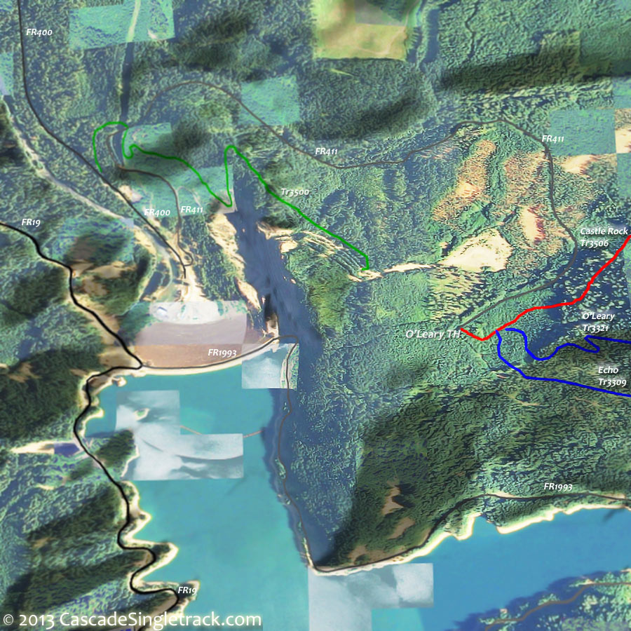
O'Leary Trail 3321 TH to ride the combined Castle Rock Tr3506 and King Castle Tr4326.
King Castle Tr4326 and Castle Rock Tr3506 area at the edge of the McLennen Mountain / Macduff Mountain trail system.
All of the trails to the east and south of FR1993 are in wilderness areas.
The King Castle Tr4326 ride can be shortened to a 12.4mi CCW loop, reducing the ascent from 10% over 4mi, to 6% over 5mi, by using FR480 for the ascent.

Those seeking an epic ride could combine the King Castle loop with the O'Leary Tr3321 ride.
North of SR126, Frissel Tr3512 is open to biking but not well-maintained, so best left to hikers. From FR1506, Lookout Creek Old Growth Tr4105 passes through old growth alongside Lookout Creek.
Directions: SR126W to FR2638 (Horse Creek Road), then go 2mi to FR2639 (King Road). Go on FR2639 2.5mi to the trailhead. View Larger Map. No Map?.


OAB Directions
fast switchbacks
- TH: Ascend 4mi of switchbacks over a hard packed trail to Castle Rock. Watch for oncoming traffic. King-Castle Tr4326 merges with FR488 at 2.9mi, then crosses FR480 at the 3.6mi T intersection with FR488.
- 4.1mi: At the Castle Rock Tr3506 intersection, option to go straight and summit Castle Rock. It's a tough climb but worth the view. Otherwise make a very sharp left and descend Castle Rock Tr3506 to the O'Leary Tr3321 intersection. Cross FR480 at 4.5mi then cross Cougar Creek at 5.7mi.
- 7mi: Turn around at the O'Leary Tr3321 intersection and climb back to the top, then enjoy the steep King-Castle Tr4326 singletrack descent.

Trail Index
This Ride
Castle Rock Trail 3506, King-Castle Trail 4326
Area
Three Sisters Wilderness Hiking
Campgrounds
Cougar Crossing Campground, Delat Campground, Horse Creek Campground, Limberlost Campground, Mona Campground, McKenzie Bridge Campground, Paradise Campground, Slide Creek Campground, Sunnyside Campground
Trail Rankings
Ranking consistently applied to all of the listed trails.
- Overall Rating: Ride quality and challenge
- Aerobic: Ascent challenge
- Technical Difficulty: Terrain challenge
- Steepness: Average incline
- Flow: Uninterrupted riding
- Elevation Change: Total elevation gain
- Ride Difficulty: Terrain challenge
